Fraud Blocker Skip to main content

Home > Europe > Poland > Maps

Maps Collection (#3)

Poland is a country located in Central Europe, bordered by Germany to the west, the Czech Republic and Slovakia to the south, Ukraine and Belarus to the east

249 Items

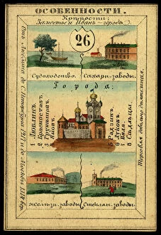
Background imageMaps Collection: Radomsko Province, 1856. Creator: Unknown

Radomsko Province, 1856. Creator: Unknown
Radomsko Province, 1856. This card is one of a souvenir set of 82 illustrated cards-one for each province of the Russian Empire as it existed in 1856

Background imageMaps Collection: Lublin Province, 1856. Creator: Unknown

Lublin Province, 1856. Creator: Unknown
Lublin Province, 1856. This card is one of a souvenir set of 82 illustrated cards-one for each province of the Russian Empire as it existed in 1856

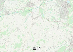
Background imageMaps Collection: Hampshire RG29 1 Map

Hampshire RG29 1 Map
Postcode Sector Map of Hampshire RG29 1

Background imageMaps Collection: The Partition of Europe under Treaties of Paris, June 1919, (c1920). Creator: Unknown

The Partition of Europe under Treaties of Paris, June 1919, (c1920). Creator: Unknown
The Partition of Europe under Treaties of Paris, June 1919, (c1920). Independent States coloured separately; Names of New States shown in Red capitals; Proposed League of Nations Territory; Projected

Background imageMaps Collection: Map Illustrating the Russian Retreat from Galicia in the Summer of 1915, 1916. Creator: Unknown

Map Illustrating the Russian Retreat from Galicia in the Summer of 1915, 1916. Creator: Unknown
Map Illustrating the Russian Retreat from Galicia in the Summer of 1915, 1916. Strategic withdrawal from the Galicia-Poland by the Imperial Russian Army during September 1915

Background imageMaps Collection: Poland and the Partitions of 1772, 1793 & 1795, (c1920). Creator: John Bartholomew & Son

Poland and the Partitions of 1772, 1793 & 1795, (c1920). Creator: John Bartholomew & Son
Poland and the Partitions of 1772, 1793 & 1795, (c1920). Map showing how territory in Europe was divided between the empires of Russia, Prussia and Austria in the 18th century

Background imageMaps Collection: Map of Central Europe, c1914. Creator: John Bartholomew & Son

Map of Central Europe, c1914. Creator: John Bartholomew & Son
Map of Central Europe, c1914. Europe as it looked at the beginning of the First World War. From " The Great World War - A History" Volume I, edited by Frank A Mumby
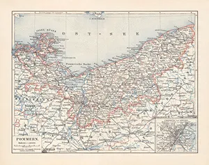
Background imageMaps Collection: Historical map of Pomerania, Germany and Poland, lithograph, published 1897

Historical map of Pomerania, Germany and Poland, lithograph, published 1897
Historical map of Pomerania, German Empire (now Germany and Poland). Lithograph, published in 1897

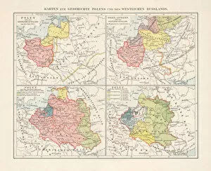
Background imageMaps Collection: Historical maps of Poland, Prussia, Lithuania and Western Russia

Historical maps of Poland, Prussia, Lithuania and Western Russia
Maps of the historical development of Poland, Prussia (Teutonic Order), Lithuania and Western Russia from the 10th to the 18th century. Lithograph, published in 1897

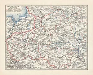
Background imageMaps Collection: Map of Poland and Western Russia (Belarus), lithograph, published 1897

Map of Poland and Western Russia (Belarus), lithograph, published 1897
Historical topographic map of Poland and Western Russia (Belarus). Lithograph, published in 1897

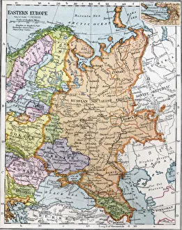
Background imageMaps Collection: Eastern Europe between the First and Second World Wars. From Bacons Excelsior Atlas of

Eastern Europe between the First and Second World Wars. From Bacons Excelsior Atlas of the World, published circa 1930

Background imageMaps Collection: The New Imperialism. American cartoon, 1951, by D. R. Fitzpatrick on the growing empire of Joseph

The New Imperialism. American cartoon, 1951, by D. R. Fitzpatrick on the growing empire of Joseph Stalins Soviet Union
RUSSIA: IMPERIALISM, 1951. The New Imperialism. American cartoon, 1951, by D.R. Fitzpatrick on the growing empire of Joseph Stalins Soviet Union

Background imageMaps Collection: Map showing the advance of the Russian Army in their effort to wipe out the enemy, August 1944

Map showing the advance of the Russian Army in their effort to wipe out the enemy, August 1944. From The War in Pictures, Fifth Year

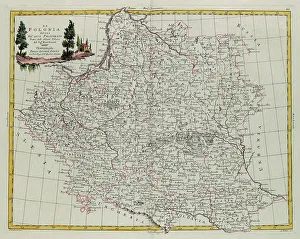
Background imageMaps Collection: Poland divided into its Palatinates, engraving by G. Zuliani taken from Tome III of the 'Newest

Poland divided into its Palatinates, engraving by G. Zuliani taken from Tome III of the "Newest Atlas" published in Venice in 1782 by Antonio Zatta

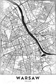
Background imageMaps Collection: Warsaw

Warsaw
StudioSix

Background imageMaps Collection: 13849201

13849201

Background imageMaps Collection: 13834573

13834573

Background imageMaps Collection: 13834549

13834549

Background imageMaps Collection: First Partition of Poland

First Partition of Poland
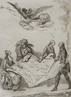
Partitions of Poland. The First Partition of Poland. It was decided on August 5, 1772. The agreement was signed in Vienna in February 1772

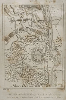
Background imageMaps Collection: Plan of the Battle of Vienna, 12 September 1683

Plan of the Battle of Vienna, 12 September 1683
Holy Roman Empire. Plan of the Battle of Vienna, 12 September 1683. It took place at Kahlenberg Mountain, near Vienna, ather the city had been besieged by the Ottoman Empire during two months

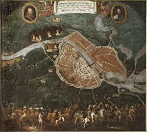
Background imageMaps Collection: La bataille de Novgorod (Rusie), guerre polono suedoise (1600-1611) - The battle of Novgorod

La bataille de Novgorod (Rusie), guerre polono suedoise (1600-1611) - The battle of Novgorod, 1611, by Hammer (Hammar)
FIA5408597 La bataille de Novgorod (Rusie), guerre polono suedoise (1600-1611) - The battle of Novgorod, 1611, by Hammer (Hammar), Johan (1640-1698). Oil on canvas, 1698. Dimension : 139x152 cm

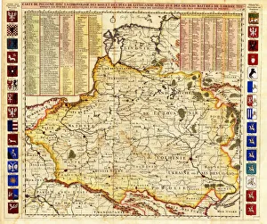
Background imageMaps Collection: Map of Poland includes portions of Livonia and Grand Duchy of Moscow par Chatelain

Map of Poland includes portions of Livonia and Grand Duchy of Moscow par Chatelain, Henri Abraham (1684-1743)
FIA5405768 Map of Poland includes portions of Livonia and Grand Duchy of Moscow par Chatelain, Henri Abraham (1684-1743). Etching, watercolour, 1714, Private Collection by Chatelain

Background imageMaps Collection: The tea rose. 1905 (Oil on canvas)

The tea rose. 1905 (Oil on canvas)
FIA5345218 The tea rose. 1905 (Oil on canvas) by Cloginsky, Jan Franzevich (1858-1912); 80x67, 5 cm; Kharkov Art Museum, Kharkov, Russia; (add.info.: The rose (The tea rose)

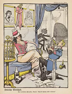
Background imageMaps Collection: The Prussian in love: Poland is not yet lost (colour litho)

The Prussian in love: Poland is not yet lost (colour litho)
7201307 The Prussian in love: Poland is not yet lost (colour litho) by Wellner, Wilhelm Anton (1859-1939); Private Collection; (add.info.: The Prussian in love: Poland is not yet lost)

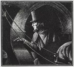
Background imageMaps Collection: Frederic Chopin leaving his last concert, London, 1848 (litho)

Frederic Chopin leaving his last concert, London, 1848 (litho)
7149729 Frederic Chopin leaving his last concert, London, 1848 (litho) by Barrett, Oswald Charles (BATT) (1892-1945); Private Collection; (add.info)

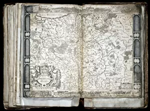
Background imageMaps Collection: Carte de la Pologne, 17eme siecle - Nova Poloniae delineation - (Map of Poland)

Carte de la Pologne, 17eme siecle - Nova Poloniae delineation - (Map of Poland)
FIA5391203 Carte de la Pologne, 17eme siecle - Nova Poloniae delineation - (Map of Poland) - Oeuvre de Jocodus Hondius l Ancien (Josse de Hond) (1563-1612), gravure (33, 7x47, 9 cm)

Background imageMaps Collection: Ignacy Jan Paderewski, Polish Prime Minister (photogravure)

Ignacy Jan Paderewski, Polish Prime Minister (photogravure)
7150706 Ignacy Jan Paderewski, Polish Prime Minister (photogravure) by Hollyer, Frederick (1837-1933) (after); Private Collection; (add.info.: Bronze bust of Ignacy Jan Paderewski (1860-1941)

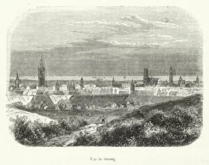
Background imageMaps Collection: Vue de Dantzig (engraving)

Vue de Dantzig (engraving)
7179210 Vue de Dantzig (engraving) by French School, (19th century); Private Collection; (add.info.: Vue de Dantzig. Illustration for Dictionnaire Populaire Illustre by Decembre-Alonnier (c 1880)

Background imageMaps Collection: Stanislaw August Poniatowski, King of Poland (engraving)

Stanislaw August Poniatowski, King of Poland (engraving)
7173343 Stanislaw August Poniatowski, King of Poland (engraving) by German School, (19th century); Private Collection; (add.info.: Stanislaw August Poniatowski (1732-1798), King of Poland

Background imageMaps Collection: The 'Thieves Market'for old goods in Warsaw (litho)

The "Thieves Market"for old goods in Warsaw (litho)
7171080 The " Thieves Market" for old goods in Warsaw (litho) by American School, (20th century); Private Collection; (add.info.: The " Thieves Market" for old goods in Warsaw)

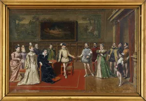
Background imageMaps Collection: Catherine de Medici meets her sons Charles IX and Henry III

Catherine de Medici meets her sons Charles IX and Henry III
FIA5395337 Catherine de Medici meets her sons Charles IX and Henry III by Bakalowicz, Wladyslaw (1833-1907); Private Collection; (add.info)

Background imageMaps Collection: Jean III Sobieski (1629-1696) send a message of victory to the Pope Innocent XI after the Vienna

Jean III Sobieski (1629-1696) send a message of victory to the Pope Innocent XI after the Vienna battle
FIA5410110 Jean III Sobieski (1629-1696) send a message of victory to the Pope Innocent XI after the Vienna battle, 1883 (oil on canvas) by Matejko

Background imageMaps Collection: La reddition prussienne a Breslau (ou Wroclaw, en Pologne), le 25 novembre 1757

La reddition prussienne a Breslau (ou Wroclaw, en Pologne), le 25 novembre 1757
FIA5372207 La reddition prussienne a Breslau (ou Wroclaw, en Pologne), le 25 novembre 1757. (The Prussian Surrender At Breslau On November 20, 1757). Episode de la guerre de sept ans (1756-1763)

Background imageMaps Collection: The Monastery of Czestochowa, Polands most holy shrine (litho)

The Monastery of Czestochowa, Polands most holy shrine (litho)
7171085 The Monastery of Czestochowa, Polands most holy shrine (litho) by American School, (20th century); Private Collection; (add.info.: The Monastery of Czestochowa, Polands most holy shrine)

Background imageMaps Collection: The town-house of Thorn (litho)

The town-house of Thorn (litho)
7171081 The town-house of Thorn (litho) by American School, (20th century); Private Collection; (add.info.: The town-house of Thorn)

Background imageMaps Collection: Catherine I of Russia telling Peter the Great: 'Write, it will be your salvation'(litho)

Catherine I of Russia telling Peter the Great: "Write, it will be your salvation"(litho)
7184925 Catherine I of Russia telling Peter the Great: " Write, it will be your salvation" (litho) by European School

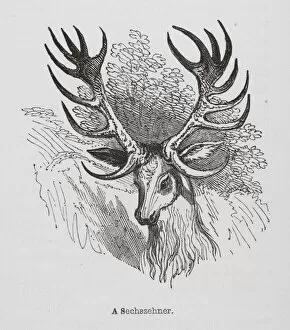
Background imageMaps Collection: A Sechszehner (engraving)

A Sechszehner (engraving)
7178000 A Sechszehner (engraving) by English School, (19th century); Private Collection; (add.info.: A Sechszehner. Illustration for The Comic Annual by Thomas Hood)

Background imageMaps Collection: Taken prisoner in Marienburg, the future Catherine I of Russia is ceded to Princess Menshikov

Taken prisoner in Marienburg, the future Catherine I of Russia is ceded to Princess Menshikov (litho)
7184928 Taken prisoner in Marienburg, the future Catherine I of Russia is ceded to Princess Menshikov (litho) by European School

Background imageMaps Collection: The Battle of Vienna on 12 September 1683, ca 1683-84 (oil on canvas)

The Battle of Vienna on 12 September 1683, ca 1683-84 (oil on canvas)
FIA5399361 The Battle of Vienna on 12 September 1683, ca 1683-84 (oil on canvas) by Casteels, Pauwel (fl.1656-84); 156.5x184 cm; Wilanow Palace, Warsaw

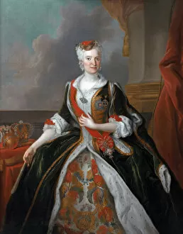
Background imageMaps Collection: Marie Josephe de Habsbourg, archiduchesse d Autriche (Maria Josepha)

Marie Josephe de Habsbourg, archiduchesse d Autriche (Maria Josepha, epouse d Auguste III de Pologne)
FIA5399348 Marie Josephe de Habsbourg, archiduchesse d Autriche (Maria Josepha, epouse d Auguste III de Pologne) - Portrait of Maria Josepha of Austria (1699-1757) - Silvestre

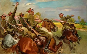
Background imageMaps Collection: Polish Cavalry Charging (oil on canvas)

Polish Cavalry Charging (oil on canvas)
6619442 Polish Cavalry Charging (oil on canvas) by Kossak, Wojciech (1857-1942); Private Collection

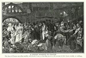
Background imageMaps Collection: A Jewish wedding in Cracow (litho)

A Jewish wedding in Cracow (litho)
7171086 A Jewish wedding in Cracow (litho) by American School, (20th century); Private Collection; (add.info.: A Jewish wedding in Cracow)

Background imageMaps Collection: The island theatre of the Lazienki Park in Warsaw (litho)

The island theatre of the Lazienki Park in Warsaw (litho)
7171083 The island theatre of the Lazienki Park in Warsaw (litho) by American School, (20th century); Private Collection; (add.info.: The island theatre of the Lazienki Park in Warsaw)

Background imageMaps Collection: Polish Jews at prayer in their synagogue (engraving)

Polish Jews at prayer in their synagogue (engraving)
7161010 Polish Jews at prayer in their synagogue (engraving) by English School, (19th century); Private Collection; (add.info.: Polish Jews at prayer in their synagogue)

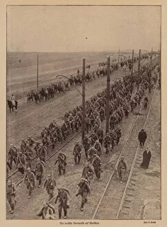
Background imageMaps Collection: German advance on Warsaw, World War I, 1915 (b / w photo)

German advance on Warsaw, World War I, 1915 (b / w photo)
7185945 German advance on Warsaw, World War I, 1915 (b/w photo) by Cooper, Alfred Heaton (1864-1929); Private Collection; (add.info.: German advance on Warsaw, World War I, 1915)

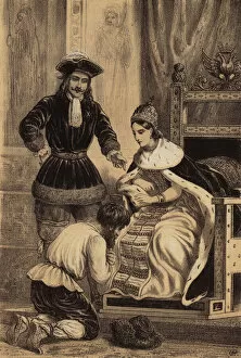
Background imageMaps Collection: Peter the Great of Russia ordering Karol Skowronski to kiss the hem of the skirt of his sister

Peter the Great of Russia ordering Karol Skowronski to kiss the hem of the skirt of his sister
7184929 Peter the Great of Russia ordering Karol Skowronski to kiss the hem of the skirt of his sister, Empress Catherine I (litho) by European School

Background imageMaps Collection: Koserkinsyko a la tete des paysans polonais (engraving)

Koserkinsyko a la tete des paysans polonais (engraving)
7179416 Koserkinsyko a la tete des paysans polonais (engraving) by French School, (19th century); Private Collection; (add.info.: Koserkinsyko a la tete des paysans polonais)

Background imageMaps Collection: In Polands woodlands (litho)

In Polands woodlands (litho)
7171084 In Polands woodlands (litho) by American School, (20th century); Private Collection; (add.info.: In Polands woodlands)


All Professionally Made to Order for Quick Shipping


-

Maps Collection

Poland is a country located in Central Europe, bordered by Germany to the west, the Czech Republic and Slovakia to the south, Ukraine and Belarus to the east, and Lithuania and Russia's Kaliningrad Oblast region to the north. Poland has a long history of being one of Europe's most important countries. Maps of Poland have been used for centuries for navigation, exploration, trade routes, military campaigns and more. Today there are many different types available that show Poland’s geography in detail. These include physical maps showing its terrain features such as mountains and rivers; political maps showing its administrative divisions; road maps showing its major highways; satellite images providing an aerial view; topographic maps illustrating elevation changes; population density maps highlighting urban areas; climate charts displaying temperature ranges throughout the year; historical maps depicting past events or boundaries over time. All these types of map provide valuable insights into this fascinating country’s geography.
+

Our beautiful Wall Art and Photo Gifts include Framed Prints, Photo Prints, Poster Prints, Canvas Prints, Jigsaw Puzzles, Metal Prints and so much more

Media Storehouse offers a stunning collection of Maps of Poland Europe wall art and framed prints for those who love to explore the rich history and culture of this beautiful country. Our collection features an extensive range of maps, including antique, vintage, and contemporary designs that showcase the evolution of Poland's geography over time. These maps are perfect for decorating homes or offices with a touch of sophistication and elegance. The Maps of Poland Europe collection is curated by expert designers who have carefully selected each piece to ensure its quality and authenticity. From detailed city plans to regional maps, our collection has something for everyone interested in Polish history or geography. Whether you're looking for a unique gift or want to add some character to your living space, these prints are sure to impress. Our Maps of Poland Europe collection is an excellent choice for anyone seeking high-quality wall art that celebrates the beauty and complexity of one of Europe's most fascinating countries.
+

What are Maps of Poland Europe art prints?

Maps of Poland Europe art prints are high-quality reproductions of maps that depict the geography, topography, and political boundaries of Poland and its surrounding regions. These prints are created using advanced printing techniques that ensure accurate reproduction of every detail on the original map. These maps can be used for a variety of purposes, including educational or decorative use in homes, offices, schools, or libraries. They provide an excellent way to learn about the history and culture of Poland as well as its geographical features. Maps of Poland Europe art prints come in various sizes and styles to suit different preferences. Some are printed on canvas while others are printed on paper or framed with wood or metal frames. Regardless of their style or size, these prints offer a unique way to appreciate the beauty and complexity of cartography while also learning more about this fascinating region.
+

What Maps of Poland Europe art prints can I buy from Media Storehouse?

We offer a wide range of Maps of Poland Europe art prints that are perfect for anyone who loves history, geography or simply wants to decorate their home with beautiful and unique artwork. These maps come in various sizes and styles, including antique maps from the 16th century, modern political maps, topographical maps and more. Some popular options include detailed city plans of Warsaw or Krakow, vintage railway maps showing the extensive network across Poland during the early 20th century, as well as colourful satellite images highlighting the country's natural features such as mountains and lakes. All Media Storehouse Maps of Poland Europe art prints are printed on high-quality paper using state-of-the-art printing technology to ensure that they look stunning when displayed on your wall. Whether you're looking for a gift for someone special or want to add some character to your own living space, there is sure to be a map print that suits your taste at Media Storehouse.
+

How do I buy Maps of Poland Europe art prints?

To buy Maps of Poland Europe art prints, you can visit our online gallery. We offer a wide range of high-quality art prints that are perfect for decorating your home or office space. You can browse through our collection and choose the map print that suits your taste and style. Once you have selected the print, you can add it to your cart and proceed to checkout. At this stage, you will be asked to provide your shipping details and payment information. We accept various payment methods such as credit cards, PayPal, and Apple Pay. After completing the purchase process, your order will be processed by their team of experts who will ensure that it is printed on high-quality paper using state-of-the-art printing technology. The finished product will then be carefully packaged and shipped directly to your doorstep. Buying Maps of Poland Europe art prints from Media Storehouse is a simple and hassle-free process that allows you to enjoy beautiful artwork in the comfort of your own home or office space.
+

How much do Maps of Poland Europe art prints cost?

We offer a wide range of Maps of Poland Europe art prints at varying prices. Our collection includes vintage maps, modern maps and artistic interpretations of the region. The cost of each print depends on factors such as size, framing options and printing materials. We strive to provide our customers with high-quality prints that are affordable and accessible to all. Our pricing is competitive in the market and reflects the value we place on providing excellent customer service. Whether you're looking for a detailed map for educational purposes or an eye-catching piece to decorate your home or office space, we have something for everyone. We take pride in offering unique and diverse artwork that celebrates the beauty and history of Poland and Europe. If you're interested in purchasing one of our Maps of Poland Europe art prints, please visit our website or contact us directly for more information.
+

How will my Maps of Poland Europe art prints be delivered to me?

We take great care in ensuring that your Maps of Poland Europe art prints are delivered to you safely and securely. We use high-quality packaging materials to protect your artwork during transit, so it arrives at your doorstep in pristine condition. We offer a range of delivery options to suit your needs, including standard and express shipping services. Our standard delivery service typically takes between 3-5 working days for UK orders and up to 14 working days for international orders. Once your order has been dispatched, you will receive an email confirmation with tracking information so you can keep track of its progress. If there are any issues with the delivery or if you have any questions about your order, our customer service team is always on hand to assist you. We strive to provide a seamless and hassle-free experience when it comes to delivering your Maps of Poland Europe art prints straight to your door.