
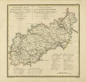
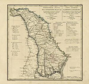
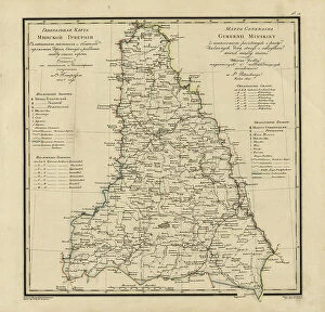
Maps Collection
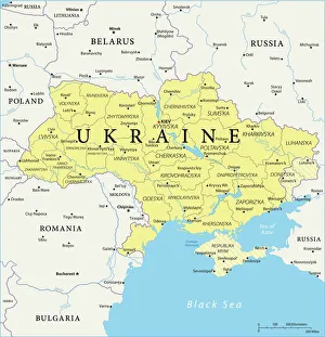
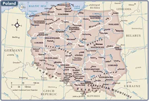
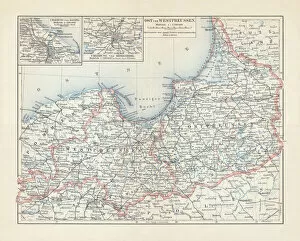
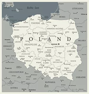
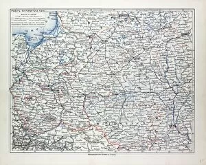
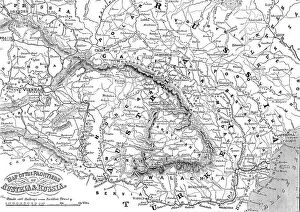
Poland is a country located in Central Europe, bordered by Germany to the west, the Czech Republic and Slovakia to the south, Ukraine and Belarus to the east
Choose a picture from our Maps Collection for your Wall Art and Photo Gifts
303 items


All Professionally Made to Order for Quick Shipping
-
Maps Collection
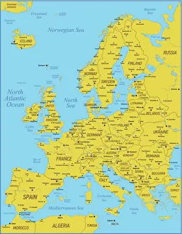
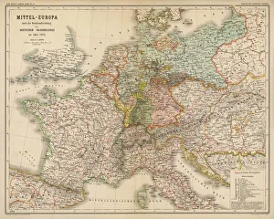
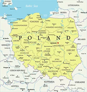
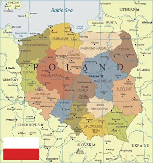
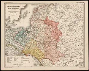
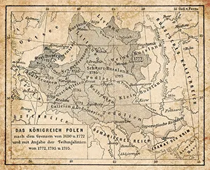
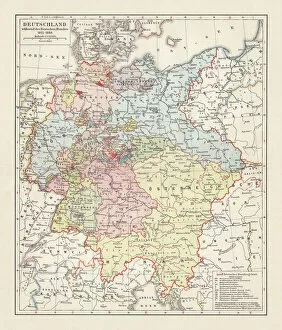
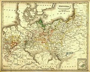
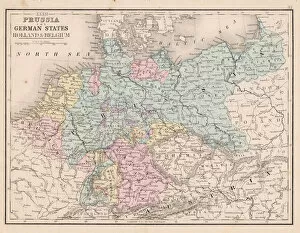
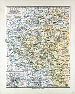
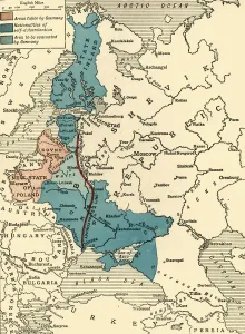
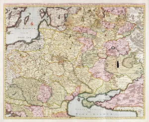
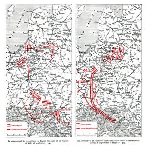
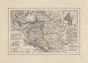
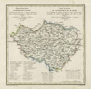
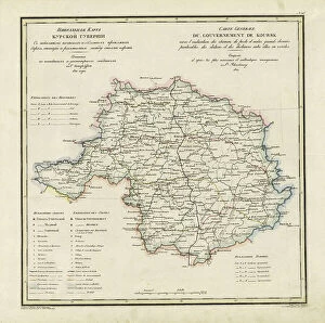
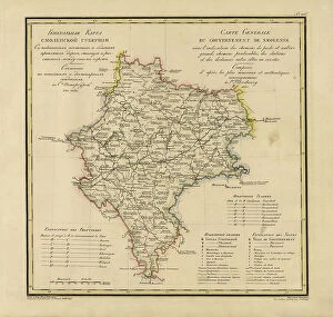
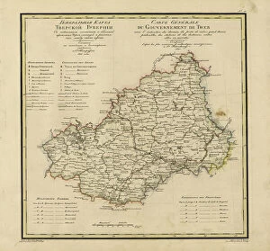
Poland is a country located in Central Europe, bordered by Germany to the west, the Czech Republic and Slovakia to the south, Ukraine and Belarus to the east, and Lithuania and Russia's Kaliningrad Oblast region to the north. Poland has a long history of being one of Europe's most important countries. Maps of Poland have been used for centuries for navigation, exploration, trade routes, military campaigns and more. Today there are many different types available that show Poland’s geography in detail. These include physical maps showing its terrain features such as mountains and rivers; political maps showing its administrative divisions; road maps showing its major highways; satellite images providing an aerial view; topographic maps illustrating elevation changes; population density maps highlighting urban areas; climate charts displaying temperature ranges throughout the year; historical maps depicting past events or boundaries over time. All these types of map provide valuable insights into this fascinating country’s geography.
+
Our beautiful pictures are available as Framed Prints, Photos, Wall Art and Photo Gifts
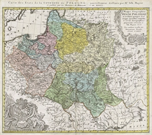
Media Storehouse offers a stunning collection of Maps of Poland Europe wall art and framed prints for those who love to explore the rich history and culture of this beautiful country. Our collection features an extensive range of maps, including antique, vintage, and contemporary designs that showcase the evolution of Poland's geography over time. These maps are perfect for decorating homes or offices with a touch of sophistication and elegance. The Maps of Poland Europe collection is curated by expert designers who have carefully selected each piece to ensure its quality and authenticity. From detailed city plans to regional maps, our collection has something for everyone interested in Polish history or geography. Whether you're looking for a unique gift or want to add some character to your living space, these prints are sure to impress. Our Maps of Poland Europe collection is an excellent choice for anyone seeking high-quality wall art that celebrates the beauty and complexity of one of Europe's most fascinating countries.
+
What are Maps of Poland Europe art prints?
Maps of Poland Europe art prints are high-quality reproductions of maps that depict the geography, topography, and political boundaries of Poland and its surrounding regions. These prints are created using advanced printing techniques that ensure accurate reproduction of every detail on the original map. These maps can be used for a variety of purposes, including educational or decorative use in homes, offices, schools, or libraries. They provide an excellent way to learn about the history and culture of Poland as well as its geographical features. Maps of Poland Europe art prints come in various sizes and styles to suit different preferences. Some are printed on canvas while others are printed on paper or framed with wood or metal frames. Regardless of their style or size, these prints offer a unique way to appreciate the beauty and complexity of cartography while also learning more about this fascinating region.
+
What Maps of Poland Europe art prints can I buy from Media Storehouse?
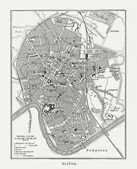
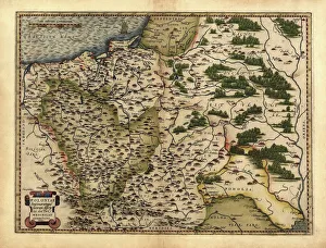
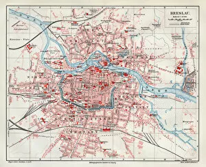
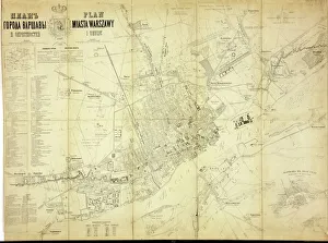
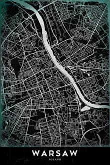
We offer a wide range of Maps of Poland Europe art prints that are perfect for anyone who loves history, geography or simply wants to decorate their home with beautiful and unique artwork. These maps come in various sizes and styles, including antique maps from the 16th century, modern political maps, topographical maps and more. Some popular options include detailed city plans of Warsaw or Krakow, vintage railway maps showing the extensive network across Poland during the early 20th century, as well as colourful satellite images highlighting the country's natural features such as mountains and lakes. All Media Storehouse Maps of Poland Europe art prints are printed on high-quality paper using state-of-the-art printing technology to ensure that they look stunning when displayed on your wall. Whether you're looking for a gift for someone special or want to add some character to your own living space, there is sure to be a map print that suits your taste at Media Storehouse.
+
How do I buy Maps of Poland Europe art prints?
To buy Maps of Poland Europe art prints, you can visit our online gallery. We offer a wide range of high-quality art prints that are perfect for decorating your home or office space. You can browse through our collection and choose the map print that suits your taste and style. Once you have selected the print, you can add it to your cart and proceed to checkout. At this stage, you will be asked to provide your shipping details and payment information. We accept various payment methods such as credit cards, PayPal, and Apple Pay. After completing the purchase process, your order will be processed by their team of experts who will ensure that it is printed on high-quality paper using state-of-the-art printing technology. The finished product will then be carefully packaged and shipped directly to your doorstep. Buying Maps of Poland Europe art prints from Media Storehouse is a simple and hassle-free process that allows you to enjoy beautiful artwork in the comfort of your own home or office space.
+
How much do Maps of Poland Europe art prints cost?
We offer a wide range of Maps of Poland Europe art prints at varying prices. Our collection includes vintage maps, modern maps and artistic interpretations of the region. The cost of each print depends on factors such as size, framing options and printing materials. We strive to provide our customers with high-quality prints that are affordable and accessible to all. Our pricing is competitive in the market and reflects the value we place on providing excellent customer service. Whether you're looking for a detailed map for educational purposes or an eye-catching piece to decorate your home or office space, we have something for everyone. We take pride in offering unique and diverse artwork that celebrates the beauty and history of Poland and Europe. If you're interested in purchasing one of our Maps of Poland Europe art prints, please visit our website or contact us directly for more information.
+
How will my Maps of Poland Europe art prints be delivered to me?
We take great care in ensuring that your Maps of Poland Europe art prints are delivered to you safely and securely. We use high-quality packaging materials to protect your artwork during transit, so it arrives at your doorstep in pristine condition. We offer a range of delivery options to suit your needs, including standard and express shipping services. Our standard delivery service typically takes between 3-5 working days for UK orders and up to 14 working days for international orders. Once your order has been dispatched, you will receive an email confirmation with tracking information so you can keep track of its progress. If there are any issues with the delivery or if you have any questions about your order, our customer service team is always on hand to assist you. We strive to provide a seamless and hassle-free experience when it comes to delivering your Maps of Poland Europe art prints straight to your door.