Fraud Blocker Skip to main content

Home > Europe > France > Paris > Maps

Maps Collection (page 6)

Maps of Paris, France, Europe are invaluable resources for anyone visiting or living in the city

2,147 items

Background imageMaps Collection: 1867 Ledot Pocket Map Of Paris France Topography

1867 Ledot Pocket Map Of Paris France Topography
1867, Ledot Pocket Map of Paris, France

Background imageMaps Collection: 1865 Galignani's Plan Of Paris And Environs France

1865 Galignani's Plan Of Paris And Environs France
1865, Galignani's Plan of Paris and Environs, France

Background imageMaps Collection: 1863 Henriot Pocket Map Of Paris France Topography

1863 Henriot Pocket Map Of Paris France Topography
1863, Henriot Pocket Map of Paris, France

Background imageMaps Collection: 1860 Andriveau Goujon Case Map Of Paris France

1860 Andriveau Goujon Case Map Of Paris France
1860, Andriveau Goujon Case Map of Paris, France

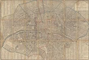
Background imageMaps Collection: 1860 Andriveau Goujon Folding Wall Map Of Paris

1860 Andriveau Goujon Folding Wall Map Of Paris
1860, Andriveau Goujon Folding Wall Map of Paris, France

Background imageMaps Collection: 1857 Colton Map Of Paris France Topography Cartography

1857 Colton Map Of Paris France Topography Cartography
1857, Colton Map of Paris, France

Background imageMaps Collection: 1855 Colton Map Or City Plan Of Paris France

1855 Colton Map Or City Plan Of Paris France
1855, Colton Map or City Plan of Paris, France

Background imageMaps Collection: 1852 Levasseur Map Of The Department De La Seine

1852 Levasseur Map Of The Department De La Seine
1852, Levasseur Map of the Department de la Seine, Paris

Background imageMaps Collection: 1852 Levasseur Map Of Seine-et-Oise Paris Topography

1852 Levasseur Map Of Seine-et-Oise Paris Topography
1852, Levasseur Map of Seine-et-Oise, Paris

Background imageMaps Collection: 1852 Depot De Guerre Map Of Paris And Its Environs

1852 Depot De Guerre Map Of Paris And Its Environs
1852, Depot de Guerre Map of Paris and its Environs, France

Background imageMaps Collection: 1852 Andriveau Goujon Map Of Paris And Environs

1852 Andriveau Goujon Map Of Paris And Environs
1852, Andriveau Goujon Map of Paris and Environs, France

Background imageMaps Collection: 1802 Chez Jean Map Of Paris In 12 Municipalities

1802 Chez Jean Map Of Paris In 12 Municipalities
1802, Chez Jean Map of Paris in 12 Municipalities, France

Background imageMaps Collection: 1797 Jean Map Of Paris And The Faubourgs France

1797 Jean Map Of Paris And The Faubourgs France
1797, Jean Map of Paris and the Faubourgs, France

Background imageMaps Collection: 1780 Bonne Map Of The Environs Of Paris France

1780 Bonne Map Of The Environs Of Paris France
1780, Bonne Map of the Environs of Paris, France, Rigobert Bonne 1727 - 1794, one of the most important cartographers of the late 18th century

Background imageMaps Collection: 1780 Bonne Map Of The Environs Of Paris France

1780 Bonne Map Of The Environs Of Paris France
1780, Bonne Map of the Environs of Paris, France, Rigobert Bonne 1727 - 1794, one of the most important cartographers of the late 18th century

Background imageMaps Collection: 1775 Esnauts And Rapilly Case Or Pocket Map Of Paris

1775 Esnauts And Rapilly Case Or Pocket Map Of Paris
1775, Esnauts and Rapilly Case or Pocket Map of Paris, France and environs

Background imageMaps Collection: 1771 Bonne Map Of Isle De France Vicinity Of Paris

1771 Bonne Map Of Isle De France Vicinity Of Paris
1771, Bonne Map of Isle de France, vicinity of Paris, France, Rigobert Bonne 1727 - 1794, one of the most important cartographers of the late 18th century

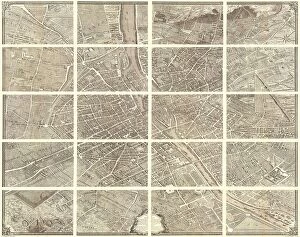
Background imageMaps Collection: 1739 Bretez Turgot View And Map Of Paris France

1739 Bretez Turgot View And Map Of Paris France
1739, Bretez, Turgot View and Map of Paris, France

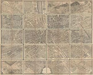
Background imageMaps Collection: 1739 Bretez Turgot View And Map Of Paris France

1739 Bretez Turgot View And Map Of Paris France
1739, Bretez, Turgot View and Map of Paris, France, c. 1900

Background imageMaps Collection: 1739 Bretez Turgot View And Map Of Paris France

1739 Bretez Turgot View And Map Of Paris France
1739, Bretez, Turgot View and Map of Paris, France, c. 1900

Background imageMaps Collection: 1652 Gomboust Map Of Paris France C. 1900 Taride Reissue

1652 Gomboust Map Of Paris France C. 1900 Taride Reissue
1652, Gomboust Map of Paris, France, c. 1900 Taride reissue

Background imageMaps Collection: 1652 Gomboust 9 Panel Map Of Paris France C. 1900 Taride Reissue

1652 Gomboust 9 Panel Map Of Paris France C. 1900 Taride Reissue
1652, Gomboust 9 Panel Map of Paris, France, c. 1900 Taride reissue

Background imageMaps Collection: Trait De L'horlogerie Mchanique Et Pratique

Trait De L'horlogerie Mchanique Et Pratique
Trait de l'horlogerie, mchanique et pratique, approuv par l'Academie royale des sciences, 1741, Paris, 2 volumes, 26, 400 pages, 50, 41 folded leaves, plates, illustrations, Height, 10 1/4, 26 cm

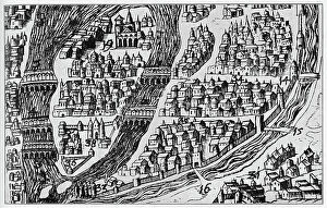
Background imageMaps Collection: Map of Paris in 16th century (engraving)

Map of Paris in 16th century (engraving)
3793834 Map of Paris in 16th century (engraving); (add.info.: Map of Paris in the 16th century. Engraving including the University quarter above no. 34)

Background imageMaps Collection: Portrait of a group of scholars, in Paris

Portrait of a group of scholars, in Paris France Paris. Date of Photograph:1880 ca

Background imageMaps Collection: The Kings Cake being Cut at the Congress of Vienna (November 1814-June 1815)

The Kings Cake being Cut at the Congress of Vienna (November 1814-June 1815), c.1815 (colour engraving)
7425492 The Kings Cake being Cut at the Congress of Vienna (November 1814-June 1815), c.1815 (colour engraving) by French School, (19th century); Musee de la Ville de Paris, Musee Carnavalet, Paris

Background imageMaps Collection: Map of Europe, from a facsimile of the Miller Atlas by Pedro and Jorge Reinel, and Lopo Homem

Map of Europe, from a facsimile of the Miller Atlas by Pedro and Jorge Reinel, and Lopo Homem, made in 1519
XOT366585 Map of Europe, from a facsimile of the Miller Atlas by Pedro and Jorge Reinel, and Lopo Homem, made in 1519; Bibliotheque Nationale, Paris

Background imageMaps Collection: Paris

Paris
StudioSix

Background imageMaps Collection: Paris White

Paris White
StudioSix

Background imageMaps Collection: Map of the northern Mexican archipelago and the West Indies, 1688 (engraving)

Map of the northern Mexican archipelago and the West Indies, 1688 (engraving)
VNK284160 Map of the northern Mexican archipelago and the West Indies, 1688 (engraving) by Coronelli, Vincenzo Maria (1650-1718); Vorontsov Palace, Crimea

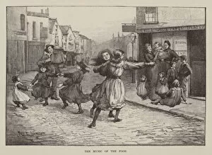
Background imageMaps Collection: The music of the poor (engraving)

The music of the poor (engraving)
7185818 The music of the poor (engraving) by Luxmoore, Myra E. (1851-1919); Private Collection; (add.info.: The music of the poor)

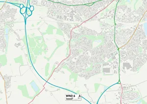
Background imageMaps Collection: Wigan WN3 6 Map

Wigan WN3 6 Map
Postcode Sector Map of Wigan WN3 6

Background imageMaps Collection: Staffordshire ST1 3 Map

Staffordshire ST1 3 Map
Postcode Sector Map of Staffordshire ST1 3

Background imageMaps Collection: Salford M5 3 Map

Salford M5 3 Map
Postcode Sector Map of Salford M5 3

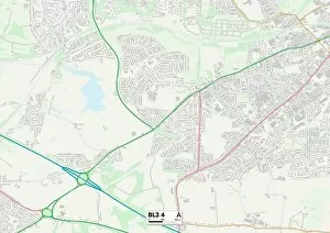
Background imageMaps Collection: Bolton BL3 4 Map

Bolton BL3 4 Map
Postcode Sector Map of Bolton BL3 4

Background imageMaps Collection: Paris City Centre Street Map

Paris City Centre Street Map
A detailed street level map of central Paris. Covers from La Chapelle in the north to Montparnasse Cemetery in the south and to Parc des Buttes-Chamont in the east to Pont de Grenelle in the west

Background imageMaps Collection: Europe Political map 1887

Europe Political map 1887
Map from La Premiere Annee de Geographie par P. Foncin - Paris 1887

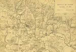
Background imageMaps Collection: Map of the Battle of Sedan, 1 September 1870, (c1872). Creator: R. Walker

Map of the Battle of Sedan, 1 September 1870, (c1872). Creator: R. Walker
Map of the Battle of Sedan, 1 September 1870, (c1872). Map: Drawn under the Superintendance of Captain Hozier, showing the enemy positions

Background imageMaps Collection: The Partition of Europe under Treaties of Paris, June 1919, (c1920). Creator: Unknown

The Partition of Europe under Treaties of Paris, June 1919, (c1920). Creator: Unknown
The Partition of Europe under Treaties of Paris, June 1919, (c1920). Independent States coloured separately; Names of New States shown in Red capitals; Proposed League of Nations Territory; Projected

Background imageMaps Collection: Map of Belgium and Northern France, c1914, (c1920). Creator: John Bartholomew & Son

Map of Belgium and Northern France, c1914, (c1920). Creator: John Bartholomew & Son
Map of Belgium and Northern France, c1914, (c1920). How the area looked at the start of the First World War. From " The Great World War - A History" Volume I, edited by Frank A Mumby

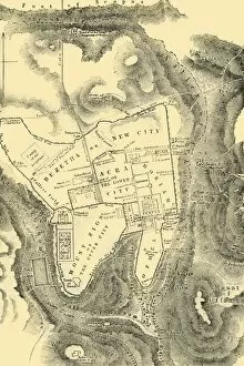
Background imageMaps Collection: Plan of Jerusalem in the First Christian Century, 1890. Creator: Unknown

Plan of Jerusalem in the First Christian Century, 1890. Creator: Unknown
Plan of Jerusalem in the First Christian Century, 1890. From " Cassells Illustrated Universal History Vol. II - Rome", by Edmund Ollier

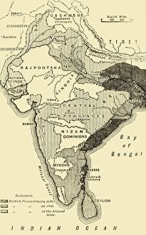
Background imageMaps Collection: Map of India, Showing the British Possessions in 1780, 1800, and at the Present Time, 1890

Map of India, Showing the British Possessions in 1780, 1800, and at the Present Time, 1890. From " Cassells Illustrated Universal History, Vol. IV - Modern History", by Edmund Ollier

Background imageMaps Collection: Map of England, Showing Anglo-Saxon Kingdoms and Danish Districts, (c9th century)

Map of England, Showing Anglo-Saxon Kingdoms and Danish Districts, (c9th century)
Map of England, Showing the Anglo-Saxon Kingdoms and the Danish Districts (The Latter Shaded), (c9th century), 1890. The Heptarchy is a collective name applied to the seven kingdoms of Anglo-Saxon

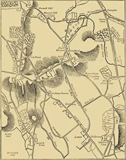
Background imageMaps Collection: Map of Hornsey and Neighbourhood in 1819, (c1876). Creator: Unknown

Map of Hornsey and Neighbourhood in 1819, (c1876). Creator: Unknown
Map of Hornsey and Neighbourhood in 1819, (c1876).. The village grew dramatically after c1860. From " Old and New London: A Narrative of Its History, Its People, and Its Places

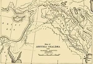
Background imageMaps Collection: Map of Assyria, Chaldea and Adjacent Countries, 1890. Creator: Unknown

Map of Assyria, Chaldea and Adjacent Countries, 1890. Creator: Unknown
Map of Assyria, Chaldea and Adjacent Countries, 1890. Assyria was a Mesopotamian kingdom from 25th century BC to 612 BC- 609 BC

Background imageMaps Collection: Detail from the Catalan Atlas, 1375 (vellum)

Detail from the Catalan Atlas, 1375 (vellum)
XZL151844 Detail from the Catalan Atlas, 1375 (vellum) by Cresques, Abraham (1325-87); Bibliotheque Nationale, Paris, France; Spanish, out of copyright

Background imageMaps Collection: 2685803

2685803

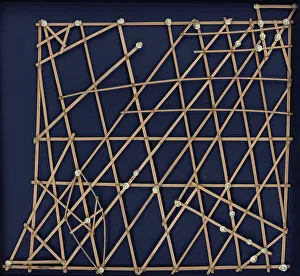
Background imageMaps Collection: Marshall Islands stick chart. Micronesia, c. 1920

Marshall Islands stick chart. Micronesia, c. 1920. Found in the Collection of Muse e du Quai Branly, Paris


All Professionally Made to Order for Quick Shipping


-

Maps Collection

Maps of Paris, France, Europe are invaluable resources for anyone visiting or living in the city. They provide an overview of the city's layout, including its streets and landmarks. They also show public transportation routes and stations, as well as points of interest such as parks and museums. Many it also include information about nearby cities and towns, allowing visitors to plan day trips outside the city limits. Additionally they can help visitors find their way around Paris more easily by providing detailed directions from one point to another. With a map in hand, travelers can explore all that Paris has to offer with confidence.
+

Our beautiful Wall Art and Photo Gifts include Framed Prints, Photo Prints, Poster Prints, Canvas Prints, Jigsaw Puzzles, Metal Prints and so much more

The Maps of Paris France Europe collection from Media Storehouse is a stunning assortment of wall art, framed prints, photo prints, canvas prints, jigsaw puzzles and greeting cards that capture the beauty and history of Paris. Our collection features a wide range of maps depicting different eras in the city's rich cultural heritage. From antique maps dating back to the 18th century to modern-day street maps highlighting popular landmarks such as the Eiffel Tower and Notre-Dame Cathedral, our collection offers something for everyone. Each piece in our collection is carefully crafted using high-quality materials to ensure long-lasting durability and vibrant colors that will stand out on any wall. Whether you're looking for a unique gift or want to add some French charm to your home or office decor, these beautiful pieces are sure to impress. With so many options available at affordable prices, it's easy to find exactly what you need from this impressive selection of artwork.
+

What are Maps of Paris France Europe art prints?

Maps of Paris France Europe art prints are beautiful and detailed depictions of the city of Paris, France, and its surrounding regions. These maps showcase the intricate layout of streets, landmarks, and buildings throughout the area. They are often created using a combination of traditional cartography techniques and modern design elements to produce an aesthetically pleasing representation. These art prints serve as both decorative pieces for your home or office space as well as educational tools for those interested in geography or history. They can be used to plan trips to Paris or simply admired for their artistic value. Maps of Paris France Europe art prints come in various sizes and styles, ranging from vintage designs that capture the essence of old-world charm to contemporary interpretations that reflect modern-day trends. Regardless of your personal style preferences, there is sure to be a map print that will suit your tastes perfectly.
+

What Maps of Paris France Europe art prints can I buy from Media Storehouse?

We offer a wide range of Maps of Paris, France and Europe art prints that are perfect for home decor or as gifts. These maps come in various sizes and styles to suit your preferences. You can choose from vintage-style maps that showcase the intricate details of the city's streets, landmarks, and neighborhoods, or modern designs that highlight its vibrant culture and history. Some popular options include detailed street maps of Paris with iconic landmarks such as the Eiffel Tower, Notre Dame Cathedral, and Arc de Triomphe highlighted. There are also antique-style world maps featuring Europe prominently along with other continents. Media Storehouse also offers panoramic views of Paris' skyline at different times of day including sunrise or sunset which make great wall art pieces for any room in your home. Whether you're looking for something classic or contemporary, we have a vast collection of Maps of Paris France Europe art prints to choose from.
+

How do I buy Maps of Paris France Europe art prints?

To buy Maps of Paris France Europe art prints from Media Storehouse, you can browse our extensive collection of maps and select the one that best suits your preferences. Once you have found the map you want to purchase, simply add it to your cart and proceed to checkout. You will be prompted to enter your shipping information and payment details before finalizing your order. We offer a variety of sizes for their art prints, so make sure to choose the size that fits your needs. We also offer different framing options if you prefer a framed print. If you have any questions or concerns about purchasing Maps of Paris France Europe art prints from Media Storehouse, they have a customer service team available to assist you. Simply reach out via email or phone and they will be happy to help guide you through the process.
+

How much do Maps of Paris France Europe art prints cost?

We offer a wide range of Maps of Paris France Europe art prints, which vary in price depending on the size and type of print. The cost for these prints can be affected by factors such as the quality of paper or canvas used, the printing method employed, and any additional features that may be included with the print. However, it is important to note that Media Storehouse strives to offer affordable prices for all their products while maintaining high-quality standards. You can expect reasonable pricing options for Maps of Paris France Europe art prints without compromising on quality. Whether you are looking for vintage maps or contemporary designs, we have something to suit every taste and budget. With a vast collection available online, you can easily browse through different options before making their purchase decision.
+

How will my Maps of Paris France Europe art prints be delivered to me?

We take great care in ensuring that your Maps of Paris France Europe art prints are delivered to you safely and securely. We use high-quality packaging materials to protect your print during transit, so it arrives at your doorstep in pristine condition. Your print will be carefully rolled and placed inside a protective tube before being shipped out to you. This ensures that the print is not damaged or creased during shipping. Additionally, we work with trusted courier services to ensure timely delivery of your order. Once your package has been dispatched, you will receive a tracking number via email which allows you to track the progress of your shipment online. If for any reason there are issues with the delivery of your order, our customer service team is always available to assist you. We hope that receiving your Maps of Paris France Europe art prints brings joy and inspiration into your home or office space.