Fraud Blocker Skip to main content

Home > Asia > India > Maps

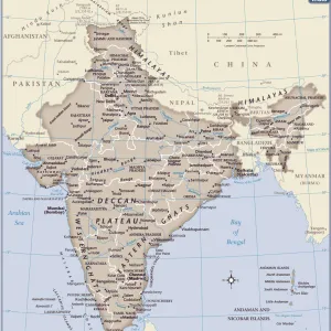
Sketch Map Illustrating Vasco Da Gamas Voyages. The Dotted Line Indicates The First Voyage To India In 1497. From The Great Explorers Columbus And Vasco Da Gama

Sketch Map Illustrating Vasco Da Gamas Voyages. The Dotted Line Indicates The First Voyage To India In 1497. From The Great Explorers Columbus And Vasco Da Gama
In Stock
We accept all major credit cards
Framed Photos
Buy from $79.99
Photo Prints
Buy from $9.99
Jigsaw Puzzles
Buy from $39.99
Poster Prints
Buy from $24.99
Canvas Prints
Buy from $99.99
Fine Art Prints
Buy from $60.90
Metal Prints
Buy from $169.99
Home Decor
Buy from $16.99

Design Pics Photo Prints and Wall Art

Sketch Map Illustrating Vasco Da Gamas Voyages. The Dotted Line Indicates The First Voyage To India In 1497. From The Great Explorers Columbus And Vasco Da Gama

Sketch Map Illustrating Vasco Da Gamas Voyages. The Dotted Line Indicates The First Voyage To India In 1497. From The Great Explorers Columbus And Vasco Da Gama. Design Pics offers Distinctively Different Imagery representing over 1,500 contributors. © Ken Welsh / Design Pics

Media ID 18192823

15th Chart Discoverer Discovery Exploration Explorer Fifteenth India Sketch Vasco Voyage Voyages Gama

FEATURES IN THESE COLLECTIONS

> Asia > India > Maps

> Asia > India > Related Images

> Design Pics > Historical

> Design Pics > Vintage Maps

> Maps and Charts > India

SECURE PAYMENTS
We happily accept a wide range of payment options so you can pay for the things you need in the way that is most convenient for you

MADE IN THE USA
Safe Shipping with 30 Day Money Back Guarantee

FREE PERSONALISATION
We are proud to offer a range of customisation including Cropping, Captions, and Filters. Zoom Cropping can be adjusted in the Basket.


EDITORS COMMENTS

This print showcases a sketch map illustrating the remarkable voyages of Vasco Da Gama, one of history's greatest explorers. The intricate lines and markings on the map depict his significant journeys, with a dotted line specifically indicating his groundbreaking first voyage to India in 1497. The image is part of the collection "Great Explorers Columbus and Vasco Da Gama" by Ken Welsh, which pays homage to these intrepid adventurers who shaped our understanding of the world during the 15th century. Through this visual representation, viewers are transported back in time to witness the audacity and determination that characterized Da Gama's exploration efforts. As they trace his routes on this meticulously drawn chart, they can appreciate the immense challenges he faced while navigating uncharted waters. This print serves as a reminder of humanity's insatiable thirst for discovery and its relentless pursuit of knowledge beyond familiar horizons. It captures both the excitement and trepidation that accompanied these expeditions into unknown territories. Whether you are an avid history enthusiast or simply fascinated by tales of exploration, this artwork invites you to delve into Vasco Da Gama's extraordinary accomplishments and ponder upon their enduring impact on our modern world.


Framed Prints

Discover the rich history of exploration with our stunning Framed Print of "Sketch Map Illustrating Vasco Da Gama's Voyages" by Ken Welsh from Design Pics. This captivating illustration depicts the first voyage to India by Vasco Da Gama in 1497, marked by the dotted line. Joining Columbus as one of history's greatest explorers, Vasco Da Gama's journey opened up a new trade route from Europe to India. Bring this intriguing piece of history into your home or office with our high-quality Framed Print, perfect for any room or decor style. Immerse yourself in the adventure and wonder of the past.


Photo Prints

Step back in time with our captivating vintage sketch map print, "Sketch Map Illustrating Vasco Da Gama's Voyages" by Ken Welsh from Design Pics. This exquisite illustration takes you on a journey back to 1497, marking the first recorded European voyage to India by the great explorer Vasco Da Gama. The intricate dotted line on the map signifies this historic journey, accompanied by the notable voyages of Columbus. Ideal for history enthusiasts, world travelers, or anyone who appreciates the beauty of exploration and discovery, this unique photographic print adds an elegant touch to any space.


Poster Prints

Discover history with our captivating Sketch Map Print by Ken Welsh from Design Pics. This vintage-inspired poster brings to life the epic journey of Vasco Da Gama's first voyage to India in 1497, marked by the distinctive dotted line. Travel back in time and explore the incredible story of this great explorer, alongside the legendary Columbus, as you adorn your walls with this exquisite piece of art. Perfect for history enthusiasts, classrooms, or any room in need of a thought-provoking addition. Bring the past to life with Media Storehouse's Sketch Map Print.


Jigsaw Puzzles

Discover the rich history of exploration with our captivating jigsaw puzzle from Media Storehouse. Featuring an intricately detailed sketch map illustrating Vasco Da Gama's historic voyage to India in 1497, as depicted by renowned artist Ken Welsh. This beautiful puzzle brings to life the dotted line that marked the first direct maritime route from Europe to India, connecting two continents and opening up a new world of possibilities. Immerse yourself in the journey of one of history's greatest explorers and enjoy the satisfaction of piecing together this stunning puzzle.

diamond
Made With High Grade Materials
thumb_up
Professional Quality Finish
package_2
Carefully Packed To Aid Safe Arrival

You May Also Like


Unification of Italy: Garibaldi asking Victor Emmanuel IIUnification of Italy: Garibaldi asking Victor Emmanuel II
Add to Basket
A grotesque man kneeling, holding a tall beer glass at its base, 1529-62 (pen and dark brown ink on paper)A grotesque man kneeling, holding a tall beer glass at its base, 1529-62 (pen and dark brown ink on paper)
Add to Basket
Kaiser Wilhelm II in military uniformKaiser Wilhelm II in military uniform
Add to Basket
Head of Christ on the cross by Peter Paul Rubens (drawing)Head of Christ on the cross by Peter Paul Rubens (drawing)
Add to Basket
Death and Three Nude Women, c. 1546-50 (copperplate engraving)Death and Three Nude Women, c. 1546-50 (copperplate engraving)
Add to Basket
Naughty boy smoking a cigarette, circa 1950Naughty boy smoking a cigarette, circa 1950
Add to Basket
Church of Our Lady of the Rocks, Gospa od Skrpjela islet, Bay of Kotor, Perast, MontenegroChurch of Our Lady of the Rocks, Gospa od Skrpjela islet, Bay of Kotor, Perast, Montenegro
Add to Basket
King Arthur, mosaic in the Cathedral of Otranto, ItalyKing Arthur, mosaic in the Cathedral of Otranto, Italy
Add to Basket
The Adoration of the Magi. Detail: Self-portraitThe Adoration of the Magi. Detail: Self-portrait
Add to Basket
John D RockefellerJohn D Rockefeller
Add to Basket
Illustration of rhythmic gymnast competing with hoopIllustration of rhythmic gymnast competing with hoop
Add to Basket
Communist Food 1919Communist Food 1919
Add to Basket

Gallery Wall Inspiration

Map Of The Battle Of Omdurman, Khartoum, Sudan, 1898, Showing The 1st Attack At 6. 45 A. m. And The Khalifas Attack At 9. 40 A. m. From Field Marshal Lord Kitchener, His Life And Work For The Empire, Published 1916
Map Of Britain In The Midst Of The English Conquest From A Short History Of The English People By John Richard Green Published By Macmillan And Co 1911
Map Of The World Showing In Red The Extent Of The British Empire In 1901
Countries Travelled By The Apostles And Showing The Journeys Of St Paul Between Asia And Europe. From The Holy Bible Published By William Collins, Sons, & Company In 1869
Map Showing The Ypres Salient Before And After The Second Battle Of Ypres April And May 13 1915. From The Great World War A History Volume Iii, Published 1916
Map Of Germany, Bohemia And Hungary, Circa. 1760. From "Atlas De Toutes Les Parties Connues Du Globe Terrestre "By Cartographer Rigobert Bonne. Published Geneva Circa. 1760
Map showing the main centres of fighting between the Japanese and Allied forces in Papua New Guinea, 27 - 30 August, 1942. From The War in Pictures Third Year
Map showing the territory (shaded dark) recaptured during the Russian winter offensive, December 1941 - May 1942 during WWII. From The War in Pictures Third Year
EDITORIAL Map showing details of the fall of Singapore, 15 February, 1942. From The War in Pictures Third Year
EDITORIAL Retreat to Singapore. Map showing the stages of the Japanese advance, with insets of Malaya in relation to surrounding territory and Singapore Island, 30-31 January, 1942. From The War in Pictures Third Year
EDITORIAL Map showing stages of the German advances on the Eastern Front from 17 August to 6 December 1941, when the offensive was brought to a standstill. From The War in Pictures Third Year
EDITORIAL ONLY Map showing the advance of the Eighth Army over the Mareth Line, 28 March, 1943. From The War in Pictures, Fourth Year
EDITORIAL ONLY Map of Stalingrad showing the farthest enemy advance into the city before the Red Army's smashing counter attack, 19 November, 1942. From The War in Pictures, Fourth Year
EDITORIAL ONLY Eighth Army hits back. Map showing the main phases of the Second Battle of El Alamein, 23 October - 3 November 1942. From The War in Pictures, Fourth Year
19th century map showing the Dominions of David and Solomon and places remote. Published for the Society for Promoting Christian Knowledge by Messrs. Rivington's, St.Paul's Church Yard, London, September 1814
Map showing the ancient site of Carthage, Utica, and the Gulf of Carthage, plus the horizontal section of the lesser set of cisterns in the ruins of the ancient city of Carthage
18th century map by Herman Moll showing, The West Part of Barbary Containing Fez, Marocco Algiers and Tunis - The East Part of Barbary containing Tripoli, Barca and the North Part of Egypt
19th century map showing The World as peopled by The Descendants of Noah
19th century map showing the Kngdoms of Judah and israel, illustrative of the Books of Kings and Chronicles
19th century map showing the Journeyings of The Children of Israel from Egypt to the Land of Canaan
Map showing the Allied advance eastwards across France, Belgium and Holland to the Rhine from 3 September 1945 during WWII. From The War in Pictures, Sixth Year
Map showing the advance of the Russian Army in their effort to wipe out the enemy, August 1944. From The War in Pictures, Fifth Year
Map showing the speed of the Russian army's drive into the heart of Reich territory, January 1945, during WWII. From The War in Pictures, Sixth Year
Map showing the Russian advance in October 1943, the Red Army launched an offensive of a 1, 000 mile front from Vitebsk to the Taman Peninsula, Russia, wiping out German bridgeheads on the way. From The War in Pictures, Fifth Year
Map showing the occupation, and demilitarization of France by Germany during WWII. From The War in Pictures, First Year
Map illustrating the Far East bombing offensive by American "Super-Fortresses", November 1944. It shows the area occupied by the Allies, and the Japanese, air raids and naval bases. From The War in Pictures, Sixth Year
Map showing the movement of the Anglo-American troops towards the centre of the Reich and the Czechoslovak border and the British advance to cut off Holland, April 1945 during WWII. From The War in Pictures, Sixth Year

Discover Our Collections


Vintage MapsVintage Maps
View Collection
India Related ImagesIndia Related Images
View Collection
MapsMaps
View Collection
IndiaIndia
View Collection
HistoricalHistorical
View Collection


© Copyright Media Storehouse, All Rights Reserved 2003 - 2024
Facebook     Pinterest     Card Payments     Reviews IO