Canvas Print > Europe > Germany > Maps
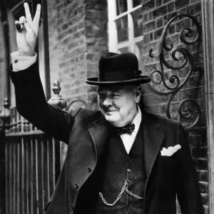
Canvas Print : Map of Germany showing Changes made in 1866 (engraving)
")
")

![]()
Canvas Prints From Fine Art Finder
Map of Germany showing Changes made in 1866 (engraving)
8649921 Map of Germany showing Changes made in 1866 (engraving) by European School, (19th century); Private Collection; (add.info.: Map of Germany showing Changes made in 1866. Illustration for Bismarck and the Foundation of the German Empire by James Wycliffe Headlam (G P Putnam, 1889).); © Look and Learn
Media ID 38393484
© © Look and Learn / Bridgeman Images
Count Of Bismarck Schonhausen Homme Politique Politician Imperials Otto Eduard Leopold Von Bismarck Otto Von Bismarck Prince Of Bismarck
20"x16" (51x41cm) Canvas Print
Explore our collection of historical canvas prints, like this detailed map of Germany showing changes made in 1866. Perfect for adding a touch of vintage charm to any space.
Delivered stretched and ready to hang our premium quality canvas prints are made from a polyester/cotton blend canvas and stretched over a 1.25" (32mm) kiln dried knot free wood stretcher bar. Packaged in a plastic bag and secured to a cardboard insert for safe transit.
Canvas Prints add colour, depth and texture to any space. Professionally Stretched Canvas over a hidden Wooden Box Frame and Ready to Hang
Estimated Product Size is 50.8cm x 40.6cm (20" x 16")
These are individually made so all sizes are approximate
Artwork printed orientated as per the preview above, with landscape (horizontal) orientation to match the source image.
FEATURES IN THESE COLLECTIONS
> Maps and Charts
> Early Maps
> Maps and Charts
> Related Images
> People
> Politicians
> Fine Art Finder
> Artists
> English School
> Fine Art Finder
> Artists
> European School
EDITORS COMMENTS
This engraving of a Map of Germany showing Changes made in 1866 offers a glimpse into the intricate political landscape of 19th century Europe. The detailed illustration, created by the European School, showcases the territorial adjustments that took place during this pivotal period in German history.
As we study this historical map, we are reminded of the significant role played by Otto von Bismarck in shaping the foundation of the German Empire. Known for his strategic prowess and statesmanship, Bismarck orchestrated various alliances and military campaigns that ultimately led to the unification of Germany under Prussian leadership.
The black and white aesthetic of this engraving adds a sense of gravitas to the depiction, emphasizing the gravity of these geopolitical changes. Each line and border on the map tells a story of shifting allegiances, power struggles, and aspirations for national unity.
Through this visual representation, we gain insight into not only the physical geography but also the socio-political dynamics that defined Germany during this era. It serves as a tangible reminder of how history is shaped by individuals like Bismarck who leave an indelible mark on their nation's destiny.
MADE IN THE USA
Safe Shipping with 30 Day Money Back Guarantee
FREE PERSONALISATION*
We are proud to offer a range of customisation features including Personalised Captions, Color Filters and Picture Zoom Tools
SECURE PAYMENTS
We happily accept a wide range of payment options so you can pay for the things you need in the way that is most convenient for you
* Options may vary by product and licensing agreement. Zoomed Pictures can be adjusted in the Basket.