Fraud Blocker Skip to main content

Home > Asia > Israel > Maps

Maps Collection (#5)

Maps of Israel Asia are maps that depict the geographical region of Israel and its surrounding countries in Asia

228 Items

Background imageMaps Collection: Section map across Galilee Jordan Valley George Odom

Section map across Galilee Jordan Valley George Odom
Section map across Galilee & Jordan Valley, by George Odom Smith. 1934, Israel

Background imageMaps Collection: Madeba mosaic map Jerusalem 1898 Israel

Madeba mosaic map Jerusalem 1898 Israel
Madeba mosaic map of Jerusalem. 1898, Israel

Background imageMaps Collection: Relief map Jerusalem relief model Ernest Forrest

Relief map Jerusalem relief model Ernest Forrest
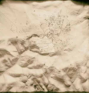
Relief map of Jerusalem. a relief model of Jerusalem made by Ernest Forrest Beaumont. 1920, Israel

Background imageMaps Collection: Relief map Relief model Jerusalem Ernest Forrest

Relief map Relief model Jerusalem Ernest Forrest
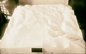
Relief map. Relief model of Jerusalem made by Ernest Forrest Beaumont. 1930, Israel

Background imageMaps Collection: Schick map Jerusalem 1898 Israel

Schick map Jerusalem 1898 Israel
Schick map of Jerusalem 1898, Israel

Background imageMaps Collection: Map Jerash Church St. Theodore 1898 Middle East

Map Jerash Church St. Theodore 1898 Middle East
Map, Jerash, Church of St. Theodore. 1898, Middle East, Israel and/or Palestine

Background imageMaps Collection: Schick map 1898 Middle East Israel Palestine

Schick map 1898 Middle East Israel Palestine
Schick map. 1898, Middle East, Israel and/or Palestine

Background imageMaps Collection: Air mosaic plan map Jerusalem surroundings 1940

Air mosaic plan map Jerusalem surroundings 1940
Air mosaic plan or map of Jerusalem & surroundings. 1940, Israel

Background imageMaps Collection: Copy relief map original topography Jerusalem

Copy relief map original topography Jerusalem
Copy of relief map showing original topography of Jerusalem with removed section from Ophel showing course of Siloam tunnel Relief model of Jerusalem made by Ernest Forrest Beaumont. 1934, Israel

Background imageMaps Collection: Location map Lydda aerodrome 1934 Israel Lod

Location map Lydda aerodrome 1934 Israel Lod
Location map of Lydda aerodrome. 1934, Israel, Lod

Background imageMaps Collection: Map Extent Jewish landholdings issued Jewish National

Map Extent Jewish landholdings issued Jewish National
Map. Extent of Jewish landholdings, issued by Jewish National Foundation, Jerusalem; Another view of map of Jewish landholdings 1934, Israel

Background imageMaps Collection: Around Dead Sea Map 1900 Israel

Around Dead Sea Map 1900 Israel
Around the Dead Sea Map of the Dead Sea 1900, Israel

Background imageMaps Collection: Raised map Jerusalem environs 1900 Israel

Raised map Jerusalem environs 1900 Israel
Raised map of Jerusalem and environs 1900, Israel

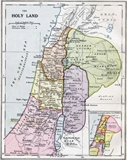
Background imageMaps Collection: The Holy Land In Biblical Times. From Bacons Excelsior Atlas Of The World, Published Circa 1930

The Holy Land In Biblical Times. From Bacons Excelsior Atlas Of The World, Published Circa 1930

Background imageMaps Collection: Map of Christian world with Jerusalem placed at its center

Map of Christian world with Jerusalem placed at its center
Cartography, 14th century. Map of the Christian world with Jerusalem placed at its center

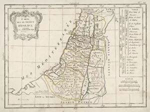
Background imageMaps Collection: Map of Canaan divided into the twelve tribes of Israel, c1830

Map of Canaan divided into the twelve tribes of Israel, c1830
Map of Canaan divided into the twelve tribes of Israel, 1830. Map of Canaan divided into the territories of the Twelve Tribes of Israel as described in the Bible, Numbers 23:54. Engraving c1830

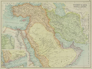
Background imageMaps Collection: arabia, archival, asia, border, cartography, caspian sea, coordinates, document, geography

arabia, archival, asia, border, cartography, caspian sea, coordinates, document, geography, historic, historical, insets, iran, iraq, israel, jordan, latitude, legend, longitude, map, mediterranean

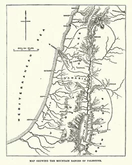
Background imageMaps Collection: Map showing the mountain ranges of Palestine

Map showing the mountain ranges of Palestine
Vintage engraving of Map showing the mountain ranges of Palestine, 19th Century

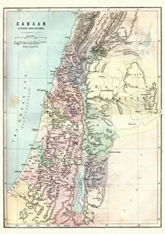
Background imageMaps Collection: Map of Canaan as divided amoung the tribes

Map of Canaan as divided amoung the tribes
Vintage engraving of a Map of Canaan as divided amoung the tribes

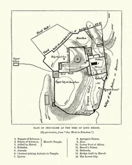
Background imageMaps Collection: Plan of Jerusalem at the Tine of King Herod

Plan of Jerusalem at the Tine of King Herod
Vintage engraving of a Plan of Jerusalem at the Tine of King Herod

Background imageMaps Collection: Antique map of Middle East with Arabia, Egypt, Nubia, and Abyssinia

Antique map of Middle East with Arabia, Egypt, Nubia, and Abyssinia

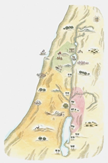
Background imageMaps Collection: Illustration of map of Judea, the area in which Jerusalem was situated

Illustration of map of Judea, the area in which Jerusalem was situated, as it would have been at the time of Jesus

Background imageMaps Collection: 12 Tribes of Israel

12 Tribes of Israel
The distribution of the twelve Tribes of Israel; note also a small strip of coastline occupied by the Philistines

Background imageMaps Collection: Schick map Jerusalem 1898 Israel

Schick map Jerusalem 1898 Israel
Schick map of Jerusalem 1898, Israel

Background imageMaps Collection: Copy relief map original topography Jerusalem

Copy relief map original topography Jerusalem
Copy of relief map showing original topography of Jerusalem. Relief model of Jerusalem made by Ernest Forrest Beaumont. 1934, Israel

Background imageMaps Collection: Copy relief map original topography Jerusalem

Copy relief map original topography Jerusalem
Copy of relief map showing original topography of Jerusalem with Ophel & removal to show tunnel. 1934, Israel

Background imageMaps Collection: Map of Israel

Map of Israel

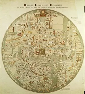
Background imageMaps Collection: Map of the world with Jerusalem placed at its center

Map of the world with Jerusalem placed at its center
Cartography, 13th century. Map of the world with Jerusalem placed at its center

Background imageMaps Collection: The Jerusalem Map (From: Civitates Orbis Terrarum), 1572

The Jerusalem Map (From: Civitates Orbis Terrarum), 1572. Private Collection

Background imageMaps Collection: Plan of Jerusalem. Psalter fragment, ca 1200. Artist: Anonymous

Plan of Jerusalem. Psalter fragment, ca 1200. Artist: Anonymous
Plan of Jerusalem. Psalter fragment, ca 1200. Found in the collection of the Koninklijke Bibliotheek, The Hague

Background imageMaps Collection: Plan of the town of Acre, Palestine, 14th century

Plan of the town of Acre, Palestine, 14th century. From a drawing by Martino Sanuto in the 21st volume of the Archaeology

Background imageMaps Collection: The lake and city of Tiberias, Israel, 1895

The lake and city of Tiberias, Israel, 1895. Tiberias is a town on the western shore of the Sea of Galilee. It was named in honour of the emperor Tiberius

Background imageMaps Collection: The Jerusalem Map (From: Jansson, Jan. Illustriorum Hispaniae urbium tabulae, Amsterdam, 1657), 1657

The Jerusalem Map (From: Jansson, Jan. Illustriorum Hispaniae urbium tabulae, Amsterdam, 1657), 1657. From a private collection

Background imageMaps Collection: The Jerusalem Map (Vue generale de Jerusalem historique et moderne), ca 1862

The Jerusalem Map (Vue generale de Jerusalem historique et moderne), ca 1862. Artist: Eltzner, Adolf (1816-1891)
The Jerusalem Map (Vue generale de Jerusalem historique et moderne), ca 1862. From a private collection

Background imageMaps Collection: The Jerusalem Map (Ville Capitale de la Palestine sous David et Salomon... ), 1770

The Jerusalem Map (Ville Capitale de la Palestine sous David et Salomon... ), 1770
The Jerusalem Map (Ville Capitale de la Palestine sous David et Salomon...), 1770. From a private collection

Background imageMaps Collection: Map of Palestine based on ancient authors, c1830

Map of Palestine based on ancient authors, c1830
Map of Palestine showing distances in Roman miles, based on various ancient authors and the Jerusalem Itinerary. Engraving c1830


All Professionally Made to Order for Quick Shipping


-

Maps Collection

Maps of Israel Asia are maps that depict the geographical region of Israel and its surrounding countries in Asia. These maps provide an accurate representation of the region, including its physical features such as mountains, rivers, and deserts. They also show political boundaries between countries and their respective capitals. Additionally, these maps often include information about major cities, roads, airports, and other points of interest in the area. Maps of Israel Asia can be used to plan trips or to gain a better understanding of the region’s geography and are useful for studying history or conducting research on this part of the world.
+

Our beautiful Wall Art and Photo Gifts include Framed Prints, Photo Prints, Poster Prints, Canvas Prints, Jigsaw Puzzles, Metal Prints and so much more

The Maps of Israel Asia collection from Media Storehouse is a stunning compilation of vintage and contemporary maps that showcase the intricate geography and history of Israel and its surrounding regions. Our collection features a diverse range of maps, including ancient biblical maps, Ottoman Empire maps, modern political boundary maps, and topographical relief maps. Each map is carefully curated to provide a unique perspective on the region's rich cultural heritage. These high-quality wall art prints are perfect for anyone interested in exploring the fascinating history and geography of Israel or looking to add an artistic touch to their home or office decor. The Maps of Israel Asia collection offers a wide variety of sizes and framing options to suit any taste or budget. Whether you're an avid collector or simply looking for a beautiful piece of artwork to adorn your walls, our collection has something for everyone. With its stunning visuals and historical significance, the Maps of Israel Asia collection is sure to be a conversation starter in any room it graces.
+

What are Maps of Israel Asia art prints?

Maps of Israel Asia art prints are high-quality reproductions of maps that depict the geography and topography of Israel and its surrounding regions in Asia. These prints showcase the intricate details, landmarks, cities, borders, and other important features that make up this part of the world. They are created using state-of-the-art printing technology to ensure that every detail is captured accurately. These art prints are perfect for anyone who has an interest in history or geography, as they provide a fascinating glimpse into the past and present of this region. They can be used to decorate homes, offices, schools or any other space where you want to add a touch of sophistication and elegance. Whether you're looking for a vintage map from centuries ago or a modern-day representation with all the latest updates included, Maps of Israel Asia art prints offer something for everyone. With their stunning visual appeal and educational value, these prints are sure to become treasured additions to your collection.
+

What Maps of Israel Asia art prints can I buy from Media Storehouse?

We offer a wide range of Maps of Israel Asia art prints that are perfect for those who love to explore and learn about the region. These prints showcase different maps from various periods in history, including antique maps, vintage maps, and modern-day cartography. Some of the popular Maps of Israel Asia art prints available at Media Storehouse include detailed topographical maps that highlight the natural features and landmarks of the area. Other options include political maps that show borders between countries and regions, as well as historical maps that depict ancient empires and civilizations. Whether you're looking for a unique piece to decorate your home or office or want to gift someone with an interest in geography or history, we have plenty of options to choose from. With high-quality printing techniques used on premium materials, these Maps of Israel Asia art prints are sure to impress any viewer.
+

How do I buy Maps of Israel Asia art prints?

To purchase Maps of Israel Asia art prints from Media Storehouse, you can browse our extensive collection of artwork online. Once you have found the print that you would like to purchase, simply add it to your cart and proceed to checkout. You will be prompted to enter your shipping and payment information before finalizing your order. We offer a variety of sizes for their prints, so be sure to select the size that best fits your needs. We also offer framing options for an additional fee if you prefer a ready-to-hang piece. If you have any questions about the ordering process or need assistance with selecting a print, we have customer service representatives available via phone or email who are happy to help. With our easy-to-use website and high-quality artwork selection, purchasing Maps of Israel Asia art prints from Media Storehouse is simple and convenient.
+

How much do Maps of Israel Asia art prints cost?

We offer a wide range of Maps of Israel Asia art prints at varying prices. Our collection includes high-quality reproductions of antique maps, contemporary designs, and everything in between. The cost of each print depends on several factors such as the size, material used for printing, and the complexity of the design. We understand that our customers have different preferences and budgets when it comes to purchasing art prints. Therefore, we strive to provide options that cater to everyone's needs without compromising on quality. Whether you're looking for a small poster or a large canvas print, we've got you covered. Our Maps of Israel Asia art prints are perfect for adding character and style to any room in your home or office. They also make great gifts for history buffs or anyone who loves exploring new cultures and places around the world.
+

How will my Maps of Israel Asia art prints be delivered to me?

Your Maps of Israel Asia art prints will be delivered to you through a reliable and secure shipping service. We take great care in ensuring that your artwork arrives at your doorstep in pristine condition, ready for display or framing. Our team works with trusted delivery partners who specialize in handling delicate items such as art prints. We use high-quality packaging materials to protect your artwork during transit, including sturdy cardboard tubes and protective sleeves. Your order will be dispatched promptly once it has been printed and quality checked by our team. We understand the importance of delivering your order on time and without any damage. That's why we work hard to ensure that every step of the delivery process is carefully managed and monitored. Once you receive your Maps of Israel Asia art prints, we hope they bring joy and inspiration into your home or office space for years to come.