Fraud Blocker Skip to main content

Home > Asia > Israel > Maps

Maps Collection (page 3)

Maps of Israel Asia are maps that depict the geographical region of Israel and its surrounding countries in Asia

260 items

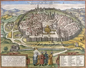
Background imageMaps Collection: View of Jerusalem, from the Atlas Le Theatre des Cites du Monde by Georg Braun

View of Jerusalem, from the Atlas Le Theatre des Cites du Monde by Georg Braun
CHT207412 View of Jerusalem, from the Atlas Le Theatre des Cites du Monde by Georg Braun, published Cologne, 1599 (colour engraving) by Hogenberg, Franz (1540-c.1590); Bibliotheque Nationale, Paris

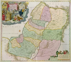
Background imageMaps Collection: Map of the Holy Land (coloured engraving)

Map of the Holy Land (coloured engraving)
VNK249240 Map of the Holy Land (coloured engraving) by Danckerts, Theodorus (1663-1727); Vorontsov Palace, Crimea, Ukraine; (add.info.: carte de la Judee)

Background imageMaps Collection: Ms 25517 / 1 fol. 88 Map of the village of Belchamp St. Paul

Ms 25517 / 1 fol. 88 Map of the village of Belchamp St. Paul
SPC210579 Ms 25517/1 fol.88 Map of the village of Belchamp St. Paul, 1576 (pen & ink and w/c on paper) by Amyce, Israel (fl.1576); St. Pauls Cathedral Library, London, UK; eSt

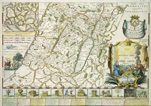
Background imageMaps Collection: Map of the Holy land in Old Testament times by Mons l Abbe de la Grive

Map of the Holy land in Old Testament times by Mons l Abbe de la Grive
STC255316 Map of the Holy land in Old Testament times by Mons l Abbe de la Grive, 1772 (coloured engraving) by French School, (18th century); Private Collection; The Stapleton Collection; French

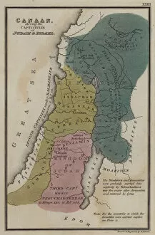
Background imageMaps Collection: Canaan, shewing the Captivities of Judah and Israel (coloured engraving)

Canaan, shewing the Captivities of Judah and Israel (coloured engraving)
3640673 Canaan, shewing the Captivities of Judah and Israel (coloured engraving) by English School, (19th century); Private Collection; (add.info.: Canaan)

Background imageMaps Collection: The Fountaine Collection, Articles purchased by the Syndicate (engraving)

The Fountaine Collection, Articles purchased by the Syndicate (engraving)
1622606 The Fountaine Collection, Articles purchased by the Syndicate (engraving) by English School, (19th century); Private Collection; (add.info.: The Fountaine Collection)

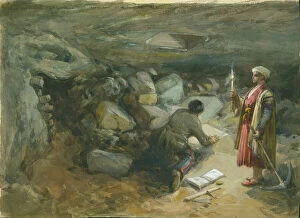
Background imageMaps Collection: Rock-Cut Cistern under Robinsons Arch, Jerusalem, 1871 (w / c & pencil on paper)

Rock-Cut Cistern under Robinsons Arch, Jerusalem, 1871 (w / c & pencil on paper)
PEF316703 Rock-Cut Cistern under Robinsons Arch, Jerusalem, 1871 (w/c & pencil on paper) by Simpson, William Crimea (1823-99); Palestine Exploration Fund, London

Background imageMaps Collection: Ms. 25517 / 1 Estate map of Belchamp St. Paul, 1576 (pen & ink and w / c on paper) (detail)

Ms. 25517 / 1 Estate map of Belchamp St. Paul, 1576 (pen & ink and w / c on paper) (detail)
SPC209100 Ms.25517/1 Estate map of Belchamp St. Paul, 1576 (pen & ink and w/c on paper) (detail) by Amyce, Israel (fl.1576); St. Pauls Cathedral Library, London, UK; eSt

Background imageMaps Collection: Map of Canaan, or the Holy Land (engraving)

Map of Canaan, or the Holy Land (engraving)
6002060 Map of Canaan, or the Holy Land (engraving) by English School, (18th century); Private Collection; (add.info.: Map of Canaan, or the Holy Land)

Background imageMaps Collection: View of Jerusalem (Jerusalem), Israel (etching, 1572-1617)

View of Jerusalem (Jerusalem), Israel (etching, 1572-1617)
LRI4707561 View of Jerusalem (Jerusalem), Israel (etching, 1572-1617) by Hogenberg, Franz (1540-c.1590); Private Collection; (add.info.: View of Jerusalem (Jerusalem)

Background imageMaps Collection: Birds eye view of the Holy Land (coloured engraving)

Birds eye view of the Holy Land (coloured engraving)
6014069 Birds eye view of the Holy Land (coloured engraving) by English School, (19th century); Private Collection; (add.info.: Birds eye view of the Holy Land)

Background imageMaps Collection: Map showing the forty year journey of the Children of Israel out of Egypt to the Promised Land

Map showing the forty year journey of the Children of Israel out of Egypt to the Promised Land (engraving)
6002057 Map showing the forty year journey of the Children of Israel out of Egypt to the Promised Land (engraving) by English School

Background imageMaps Collection: East Latin States before 1144 - Kingdom of Jerusalem - Principaut of Antioch - Count of

East Latin States before 1144 - Kingdom of Jerusalem - Principaut of Antioch - Count of
XEE4147538 East Latin States before 1144 - Kingdom of Jerusalem - Principaut of Antioch - Count of Edessa - Map prepared by M J-H Schnitzler, Historical and Picturesque Atlas 1858 by Unknown Artist

Background imageMaps Collection: Judah and Israel, illustrating the Books of Kings (coloured engraving)

Judah and Israel, illustrating the Books of Kings (coloured engraving)
3640671 Judah and Israel, illustrating the Books of Kings (coloured engraving) by English School, (19th century); Private Collection; (add.info.: Judah and Israel, illustrating the Books of Kings)

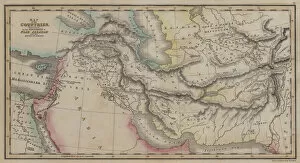
Background imageMaps Collection: Map of Countries, mentioned in the Histories of Noah, Abraham and the Kings of Israel

Map of Countries, mentioned in the Histories of Noah, Abraham and the Kings of Israel (coloured engraving)
3640650 Map of Countries, mentioned in the Histories of Noah, Abraham and the Kings of Israel (coloured engraving) by English School, (19th century); Private Collection; (add.info.: Map of Countries)

Background imageMaps Collection: Judah and Israel, illustrating the books of Kings (engraving)

Judah and Israel, illustrating the books of Kings (engraving)
2812888 Judah and Israel, illustrating the books of Kings (engraving) by English School, (19th century); Private Collection; (add.info.: Judah and Israel, illustrating the books of Kings)

Background imageMaps Collection: Jerusalem (leave 1), Israel (engraving, 1572-1617)

Jerusalem (leave 1), Israel (engraving, 1572-1617)
LRI4714736 Jerusalem (leave 1), Israel (engraving, 1572-1617) by Hogenberg, Franz (1540-c.1590); Private Collection; (add.info.: Jerusalem, leave)

Background imageMaps Collection: Holy Land and Palestina (engraving, 1596)

Holy Land and Palestina (engraving, 1596)
LRI4718686 Holy Land and Palestina (engraving, 1596) by Mercator, Gerardus (1512-94); Private Collection; (add.info.: Terra Sancta and Palestina)

Background imageMaps Collection: Map of Countries, mentioned in the Histories of Noah, Abraham and the Kings of Israel

Map of Countries, mentioned in the Histories of Noah, Abraham and the Kings of Israel (coloured engraving)
3640662 Map of Countries, mentioned in the Histories of Noah, Abraham and the Kings of Israel (coloured engraving) by English School, (19th century); Private Collection; (add.info.: Map of Countries)

Background imageMaps Collection: Foundation of South East Corner of Haram Wall, Jerusalem (w / c & pencil on paper)

Foundation of South East Corner of Haram Wall, Jerusalem (w / c & pencil on paper)
PEF316702 Foundation of South East Corner of Haram Wall, Jerusalem (w/c & pencil on paper) by Simpson, William Crimea (1823-99); Palestine Exploration Fund, London

Background imageMaps Collection: Map of the Holy Land, published in Amsterdam, 1629 (colour engraving)

Map of the Holy Land, published in Amsterdam, 1629 (colour engraving)
CHT221546 Map of the Holy Land, published in Amsterdam, 1629 (colour engraving) by Blaeu, Willem (1571-1638); Private Collection; (add.info.: carte de la Terre Sainte; ); eArchives Charmet; Dutch

Background imageMaps Collection: Map of Jerusalem and Palestine, Including the Sacred Sites and the Temple of Solomon

Map of Jerusalem and Palestine, Including the Sacred Sites and the Temple of Solomon
CHT207413 Map of Jerusalem and Palestine, Including the Sacred Sites and the Temple of Solomon (colour litho) by French School, (19th century); Musee des Arts Decoratifs, Paris

Background imageMaps Collection: Map of Jerusalem, from Civitates Orbis Terrarum

Map of Jerusalem, from Civitates Orbis Terrarum
STC121081 Map of Jerusalem, from Civitates Orbis Terrarum by Georg Braun (1541-1622) and Frans Hogenberg (1535-90), c.1572 (coloured engraving) by Hoefnagel

Background imageMaps Collection: Byzantine art: oldest map of Palestine. Detail representing the city of Jericho

Byzantine art: oldest map of Palestine. Detail representing the city of Jericho
LRI4671590 Byzantine art: oldest map of Palestine. Detail representing the city of Jericho (with the name in Greek). Mosaic of the 6th century. Madaba, Church of St

Background imageMaps Collection: Map of Jerusalem (Hierosolymorum), Israel (etching, 1572-1617)

Map of Jerusalem (Hierosolymorum), Israel (etching, 1572-1617)
LRI4708538 Map of Jerusalem (Hierosolymorum), Israel (etching, 1572-1617) by Hogenberg, Franz (1540-c.1590); Private Collection; (add.info.: Map of Jerusalem (Hierosolymorum)

Background imageMaps Collection: Map of the Middle East: Turkish Empire, Persia and Arabian Peninsula (etching, 1730)

Map of the Middle East: Turkish Empire, Persia and Arabian Peninsula (etching, 1730)
LRI4706712 Map of the Middle East: Turkish Empire, Persia and Arabian Peninsula (etching, 1730) by Delisle, Guillaume (1675-1726); Private Collection; (add.info.: Map of the Middle East)

Background imageMaps Collection: Suez Crisis 1956 The Israeli Ambassador Eliahu Elath at a press conference in

Suez Crisis 1956 The Israeli Ambassador Eliahu Elath at a press conference in the Embassy answering questions about Israels invasion of the Sinai Peninsula

Background imageMaps Collection: Ground-Plan of the Temple of Solomon, 1890. Creator: Unknown

Ground-Plan of the Temple of Solomon, 1890. Creator: Unknown
Ground-Plan of the Temple of Solomon, 1890. The First Temple of Solomon was destroyed by Nebuchadnezzar II after the Siege of Jerusalem, 587BC and replaced with the Second Temple in 6th century BC

Background imageMaps Collection: The Kingdoms of Judah and Israel, 1890. Creator: Unknown

The Kingdoms of Judah and Israel, 1890. Creator: Unknown
The Kingdoms of Judah and Israel, 1890. The Kingdom of Israel, an important local power by the 10th century BC with the Kingdom of Judah, emerging in the 8th or 9th century BC

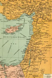
Background imageMaps Collection: Map To Illustrate The Campaign in Palestine, 1919. Creator: London Geographical Institute

Map To Illustrate The Campaign in Palestine, 1919. Creator: London Geographical Institute
Map To Illustrate The Campaign in Palestine, 1919. Map of the Eastern Mediterrean and the Middle East, showing Cyprus, Port Said in Egypt, parts of Turkey and what are now Syria, the Lebanon

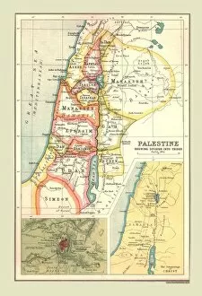
Background imageMaps Collection: Map of Palestine, Showing Division into Tribes, (1902). Creator: Unknown

Map of Palestine, Showing Division into Tribes, (1902). Creator: Unknown
Map of Palestine, Showing Division into Tribes, (1902). Map of the so-called Twelve Tribes of Israel, as referred to in the Hebrew Bible, with insets of Jerusalem and the Journeyings of Christ

Background imageMaps Collection: The Jerusalem Map (From: Civitates Orbis Terrarum), 1572

The Jerusalem Map (From: Civitates Orbis Terrarum), 1572. Private Collection

Background imageMaps Collection: Plan of Jerusalem. Psalter fragment, ca 1200. Artist: Anonymous

Plan of Jerusalem. Psalter fragment, ca 1200. Artist: Anonymous
Plan of Jerusalem. Psalter fragment, ca 1200. Found in the collection of the Koninklijke Bibliotheek, The Hague

Background imageMaps Collection: Plan of the town of Acre, Palestine, 14th century

Plan of the town of Acre, Palestine, 14th century. From a drawing by Martino Sanuto in the 21st volume of the Archaeology

Background imageMaps Collection: The lake and city of Tiberias, Israel, 1895

The lake and city of Tiberias, Israel, 1895. Tiberias is a town on the western shore of the Sea of Galilee. It was named in honour of the emperor Tiberius

Background imageMaps Collection: The Jerusalem Map (From: Jansson, Jan. Illustriorum Hispaniae urbium tabulae, Amsterdam, 1657), 1657

The Jerusalem Map (From: Jansson, Jan. Illustriorum Hispaniae urbium tabulae, Amsterdam, 1657), 1657. From a private collection

Background imageMaps Collection: The Jerusalem Map (Vue generale de Jerusalem historique et moderne), ca 1862

The Jerusalem Map (Vue generale de Jerusalem historique et moderne), ca 1862. Artist: Eltzner, Adolf (1816-1891)
The Jerusalem Map (Vue generale de Jerusalem historique et moderne), ca 1862. From a private collection

Background imageMaps Collection: The Jerusalem Map (Ville Capitale de la Palestine sous David et Salomon... ), 1770

The Jerusalem Map (Ville Capitale de la Palestine sous David et Salomon... ), 1770
The Jerusalem Map (Ville Capitale de la Palestine sous David et Salomon...), 1770. From a private collection

Background imageMaps Collection: Map of Palestine based on ancient authors, c1830

Map of Palestine based on ancient authors, c1830
Map of Palestine showing distances in Roman miles, based on various ancient authors and the Jerusalem Itinerary. Engraving c1830

Background imageMaps Collection: Palestinae Sive Totivs Terrae Promissionis Nova Descriptio A

Palestinae Sive Totivs Terrae Promissionis Nova Descriptio A
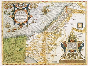
Map of the Judaica Holy Land 1575

Background imageMaps Collection: Judea seu Terra Sancta

Judea seu Terra Sancta
Map of Israels Twelve Tribes 1696

Background imageMaps Collection: Antique map of holy land with Egypt and Israel

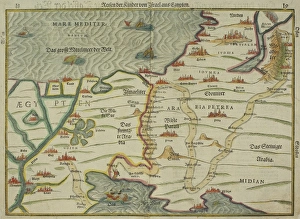
Antique map of holy land with Egypt and Israel

Background imageMaps Collection: Probable Settlement of the Descendants of Noah (steel engraving)

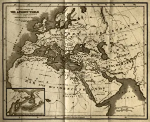
Probable Settlement of the Descendants of Noah (steel engraving)
A creased and stained steel engraving of a map which shows The Countries of the Ancient World Exhibiting the Probable Settlement of the Descendants of Noaha, from A System of Geography

Background imageMaps Collection: Stereoscopic view of North America

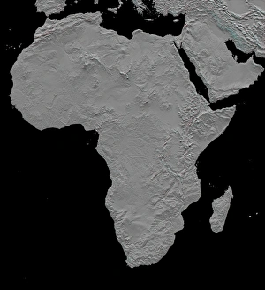
Stereoscopic view of North America
February 2000 - This stereoscopic shaded relief image shows Africas topography as measured by the Shuttle Radar Topography Mission (SRTM) in February 2000

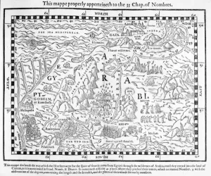
Background imageMaps Collection: A map showing the journey of the Israelites out of Egypt and into Canaan, facsimile

A map showing the journey of the Israelites out of Egypt and into Canaan, facsimile
XJF696551 A map showing the journey of the Israelites out of Egypt and into Canaan, facsimile of an image from the Geneva Bible of 1560 (engraving) by English School

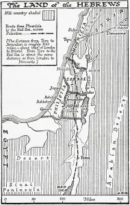
Background imageMaps Collection: Map showing the land of the Hebrews. From A Short History of the World, published c. 1936

Map showing the land of the Hebrews. From A Short History of the World, published c. 1936
Map showing the land of the Hebrews. From A Short History of the World, published c.1936

Background imageMaps Collection: Map of the kingdoms of Judah and Israel. From Cassells Universal History, published 1888

Map of the kingdoms of Judah and Israel. From Cassells Universal History, published 1888

Background imageMaps Collection: Canaan, or Palestine, as it was divided between the twelve tribes of Israel

Canaan, or Palestine, as it was divided between the twelve tribes of Israel. After a map published in 1750; Israel-Palestine


All Professionally Made to Order for Quick Shipping


-

Maps Collection

Maps of Israel Asia are maps that depict the geographical region of Israel and its surrounding countries in Asia. These maps provide an accurate representation of the region, including its physical features such as mountains, rivers, and deserts. They also show political boundaries between countries and their respective capitals. Additionally, these maps often include information about major cities, roads, airports, and other points of interest in the area. Maps of Israel Asia can be used to plan trips or to gain a better understanding of the region’s geography and are useful for studying history or conducting research on this part of the world.
+

Our beautiful pictures are available as Framed Prints, Photos, Wall Art and Photo Gifts

The Maps of Israel Asia collection from Media Storehouse is a stunning compilation of vintage and contemporary maps that showcase the intricate geography and history of Israel and its surrounding regions. Our collection features a diverse range of maps, including ancient biblical maps, Ottoman Empire maps, modern political boundary maps, and topographical relief maps. Each map is carefully curated to provide a unique perspective on the region's rich cultural heritage. These high-quality wall art prints are perfect for anyone interested in exploring the fascinating history and geography of Israel or looking to add an artistic touch to their home or office decor. The Maps of Israel Asia collection offers a wide variety of sizes and framing options to suit any taste or budget. Whether you're an avid collector or simply looking for a beautiful piece of artwork to adorn your walls, our collection has something for everyone. With its stunning visuals and historical significance, the Maps of Israel Asia collection is sure to be a conversation starter in any room it graces.
+

What are Maps of Israel Asia art prints?

Maps of Israel Asia art prints are high-quality reproductions of maps that depict the geography and topography of Israel and its surrounding regions in Asia. These prints showcase the intricate details, landmarks, cities, borders, and other important features that make up this part of the world. They are created using state-of-the-art printing technology to ensure that every detail is captured accurately. These art prints are perfect for anyone who has an interest in history or geography, as they provide a fascinating glimpse into the past and present of this region. They can be used to decorate homes, offices, schools or any other space where you want to add a touch of sophistication and elegance. Whether you're looking for a vintage map from centuries ago or a modern-day representation with all the latest updates included, Maps of Israel Asia art prints offer something for everyone. With their stunning visual appeal and educational value, these prints are sure to become treasured additions to your collection.
+

What Maps of Israel Asia art prints can I buy from Media Storehouse?

We offer a wide range of Maps of Israel Asia art prints that are perfect for those who love to explore and learn about the region. These prints showcase different maps from various periods in history, including antique maps, vintage maps, and modern-day cartography. Some of the popular Maps of Israel Asia art prints available at Media Storehouse include detailed topographical maps that highlight the natural features and landmarks of the area. Other options include political maps that show borders between countries and regions, as well as historical maps that depict ancient empires and civilizations. Whether you're looking for a unique piece to decorate your home or office or want to gift someone with an interest in geography or history, we have plenty of options to choose from. With high-quality printing techniques used on premium materials, these Maps of Israel Asia art prints are sure to impress any viewer.
+

How do I buy Maps of Israel Asia art prints?

To purchase Maps of Israel Asia art prints from Media Storehouse, you can browse our extensive collection of artwork online. Once you have found the print that you would like to purchase, simply add it to your cart and proceed to checkout. You will be prompted to enter your shipping and payment information before finalizing your order. We offer a variety of sizes for their prints, so be sure to select the size that best fits your needs. We also offer framing options for an additional fee if you prefer a ready-to-hang piece. If you have any questions about the ordering process or need assistance with selecting a print, we have customer service representatives available via phone or email who are happy to help. With our easy-to-use website and high-quality artwork selection, purchasing Maps of Israel Asia art prints from Media Storehouse is simple and convenient.
+

How much do Maps of Israel Asia art prints cost?

We offer a wide range of Maps of Israel Asia art prints at varying prices. Our collection includes high-quality reproductions of antique maps, contemporary designs, and everything in between. The cost of each print depends on several factors such as the size, material used for printing, and the complexity of the design. We understand that our customers have different preferences and budgets when it comes to purchasing art prints. Therefore, we strive to provide options that cater to everyone's needs without compromising on quality. Whether you're looking for a small poster or a large canvas print, we've got you covered. Our Maps of Israel Asia art prints are perfect for adding character and style to any room in your home or office. They also make great gifts for history buffs or anyone who loves exploring new cultures and places around the world.
+

How will my Maps of Israel Asia art prints be delivered to me?

Your Maps of Israel Asia art prints will be delivered to you through a reliable and secure shipping service. We take great care in ensuring that your artwork arrives at your doorstep in pristine condition, ready for display or framing. Our team works with trusted delivery partners who specialize in handling delicate items such as art prints. We use high-quality packaging materials to protect your artwork during transit, including sturdy cardboard tubes and protective sleeves. Your order will be dispatched promptly once it has been printed and quality checked by our team. We understand the importance of delivering your order on time and without any damage. That's why we work hard to ensure that every step of the delivery process is carefully managed and monitored. Once you receive your Maps of Israel Asia art prints, we hope they bring joy and inspiration into your home or office space for years to come.