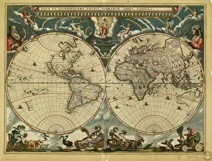
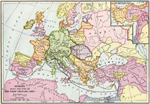
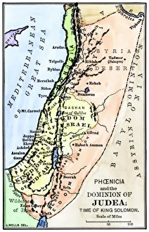
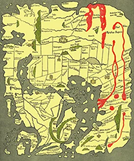
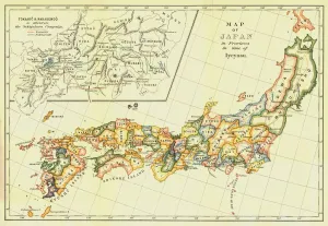
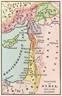
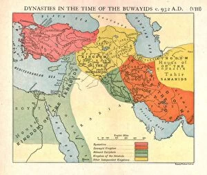
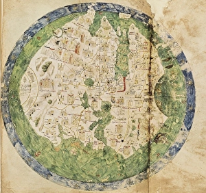
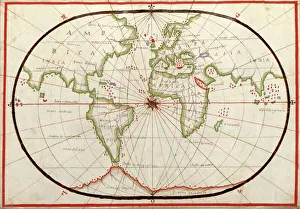
Fraud Blocker Skip to main content

Home > Asia > East Timor > Maps

Maps Collection

Maps of East Timor Asia are useful tools for those who want to explore the country

Choose a picture from our Maps Collection for your Wall Art and Photo Gifts

90 items

Background imageMaps Collection: 17th century world map

17th century world map
World map, published around 1664 in Amsterdam, the Netherlands, by Dutch mapmaker Joan Blaeu (c.1599- 1673). The Latin title is Nova et Accuratissima Totius Terrarum Orbis Tabula

Background imageMaps Collection: Medieval Europe at the start of the Crusades

Medieval Europe at the start of the Crusades
Map of Europe at the time of the First Crusade, 1097 AD. Printed color lithograph of a 19th-century illustration

Background imageMaps Collection: Map of ancient Palestine kingdoms of Judah and Israel

Map of ancient Palestine kingdoms of Judah and Israel
Map of Phoenicia and Judea in the time of King Solomon, 10th century BC. Hand-colored woodcut of a 19th-century illustration

Background imageMaps Collection: Anglo-Saxon 10th century world map

Anglo-Saxon 10th century world map
Anglo-Saxon world map, dating from the 10th century. East is top. This map of the known world was probably produced by an Irish monk

Background imageMaps Collection: Map of Japan in Provinces in time of Iyeyasu, 1903. Creator: Unknown

Map of Japan in Provinces in time of Iyeyasu, 1903. Creator: Unknown
Map of Japan in Provinces in time of Iyeyasu, 1903. Tokugawa Ieyasu (1543-1616) first shogun of the Tokugawa shogunate which ruled Japan from 1600-1868 and is known as the Edo period

Background imageMaps Collection: First geological map of Britain, 1815 C016 / 5683

First geological map of Britain, 1815 C016 / 5683
First geological map of Britain, detail of the north east coast (figure 8). This map was published in 1815 by British geologist William Smith (1769-1839)

Background imageMaps Collection: Map of Palestine in the time of Jesus Christ

Map of Palestine in the time of Jesus Christ
Vintage engraving of Map of Palestine in the time of Jesus Christ

Background imageMaps Collection: Homeric cosmogony

Homeric cosmogony. Map of the Earth based on the myths and knowledge of the Ancient Greeks at the time of Homer (1st or 2nd millennium BC)

Background imageMaps Collection: Mideast map during the Crusades

Mideast map during the Crusades
Map of the Middle East at the time of the Crusades. Printed color lithograph

Background imageMaps Collection: Air traffic visualisation

Air traffic visualisation. Computer artwork of air traffic over the USA. This image is one frame from an animation of air traffic over a 24-hour period

Background imageMaps Collection: Dynasties in the time of the Buwayids, circa 932 A. D. c1915. Creator: Emery Walker Ltd

Dynasties in the time of the Buwayids, circa 932 A. D. c1915. Creator: Emery Walker Ltd
Dynasties in the time of the Buwayids, circa 932 A.D. c1915. Map of civilisations in the Middle East during the 10th century: Byzantine, Buwayid Kingdom, Abbasid Caliphate, Kingdom of the Ikhshids

Background imageMaps Collection: Andrea Biancos Atlas, 1436. Page 10, World Map

Andrea Biancos Atlas, 1436. Page 10, World Map
" Andrea Biancos Atlas, 1436. Page 10, World Map, the East is on the upper side. First time Florida coast is depicted as a big peninsula linked to an island called Antillia (legendary island)

Background imageMaps Collection: Map of the world, 1590

Map of the world, 1590
16th century map of the world. Published around 1590, this map shows the known world, including the new lands being discovered by Europeans exploring across the Atlantic

Background imageMaps Collection: Neri to Akra, c1915. Creator: Stanfords Geographical Establishment

Neri to Akra, c1915. Creator: Stanfords Geographical Establishment
Neri to Akra, c1915. Map showing the journey of British writer, soldier and diplomatic advisor Mark Sykes in Turkey, (at that time part of the Ottoman Empire)

Background imageMaps Collection: Map of Palestine at the time of Jesus Christ, 1908 (printing)

Map of Palestine at the time of Jesus Christ, 1908 (printing)
8672362 Map of Palestine at the time of Jesus Christ, 1908 (printing); Private Collection; (add.info.: Map of Palestine in the time of Our Lord Jesus Christ)

Background imageMaps Collection: Geography: representation of the island of Hispaniola with the east coast of the island of Cuba in

Geography: representation of the island of Hispaniola with the east coast of the island of Cuba in the Caribbean Sea
VEN5031183 Geography: representation of the island of Hispaniola with the east coast of the island of Cuba in the Caribbean Sea

Background imageMaps Collection: Geographic map of the Middle East at the time of the Crusades. Lithography, 19th century

Geographic map of the Middle East at the time of the Crusades. Lithography, 19th century
NWI4876898 Geographic map of the Middle East at the time of the Crusades. Lithography, 19th century.; (add.info.: Geographic map of the Middle East at the time of the Crusades)

Background imageMaps Collection: Primary cities of Europe, their population and degree of trade of individual states (print)

Primary cities of Europe, their population and degree of trade of individual states (print)
6202957 Primary cities of Europe, their population and degree of trade of individual states (print; (add.info.: CARTOGRAPHY "Primary cities of Europe)

Background imageMaps Collection: Map of Persia, Ancient and Modern (litho)

Map of Persia, Ancient and Modern (litho)
8661200 Map of Persia, Ancient and Modern (litho) by English School, (20th century); Private Collection; (add.info.: Map of Persia, Ancient and Modern)

Background imageMaps Collection: The Dannewerk, Kur-Graben, and East Rampart...from a plan by Lieutenant-Colonel W

The Dannewerk, Kur-Graben, and East Rampart...from a plan by Lieutenant-Colonel W. Dreyer..., 1864. Creator: Unknown
The Dannewerk, Kur-Graben, and East Rampart - from a plan by Lieutenant-Colonel W. Dreyer, taken in 1860, 1864. 'By reference to the accompanying Map it will be observed that the East Rampart is so

Background imageMaps Collection: Plan of the Operations against Bushire, 1857. Creator: Unknown

Plan of the Operations against Bushire, 1857. Creator: Unknown
Plan of the Operations against Bushire, 1857. Map showing Persian Gulf, tableland, sandy ravines, swampy marsh, Halilah Bay

Background imageMaps Collection: Map showing the lands assigned to emigrant Indians west of Arkansas and Missouri, 1836

Map showing the lands assigned to emigrant Indians west of Arkansas and Missouri, 1836. Creator: Topographical Bureau
Map showing the lands assigned to emigrant Indians west of Arkansas and Missouri, 1836. Following passage of the Indian Removal Act in 1830

Background imageMaps Collection: Map of The British Empire by Fullarton & Co 1850

Map of The British Empire by Fullarton & Co 1850
Fine reproduction of the attractive World Map showing the British Empire. Mapmaker John Bartholomew and publishers Fullarton were then the first to use red or pink to indicate British possessions

Background imageMaps Collection: Medieval Remains at Lower Greadow Farm, Luxulyan, Cornwall. 1972

Medieval Remains at Lower Greadow Farm, Luxulyan, Cornwall. 1972
Lower Greadow Farm, showing the remains of a medieval monastery building which belonged to Tywardreath Priory. The farm is in Luxulyan Parish

Background imageMaps Collection: Lower Greadow Farmhouse, Luxulyan, Cornwall. 1972

Lower Greadow Farmhouse, Luxulyan, Cornwall. 1972
Lower Greadow Farmhouse, showing the remains of a medieval monastery building which belonged to Tywardreath Priory. The farm is in Luxulyan Parish

Background imageMaps Collection: Map of East Timor - Vector

Map of East Timor - Vector illustration

Background imageMaps Collection: Blackboys Mill a028912

Blackboys Mill a028912
BLACKBOYS POST MILL, FRAMFIELD, WEALDEN, EAST SUSSEX. A view of Blackboys Mill, showing the post mill in working condition

Background imageMaps Collection: Map showing Approximate Distribution of Kurdish Tribes of the Ottoman Empire, c1915

Map showing Approximate Distribution of Kurdish Tribes of the Ottoman Empire, c1915. Diagram by British writer, soldier and diplomatic advisor Mark Sykes (1879-1919)

Background imageMaps Collection: Medieval Remains at Lower Greadow Farm, Luxulyan, Cornwall. 1972

Medieval Remains at Lower Greadow Farm, Luxulyan, Cornwall. 1972
Lower Greadow Farm, showing the remains of a medieval monastery building which belonged to Tywardreath Priory. The farm is in Luxulyan Parish

Background imageMaps Collection: 13869056

13869056

Background imageMaps Collection: 13864015

13864015

Background imageMaps Collection: 13862043

13862043

Background imageMaps Collection: 13849593

13849593

Background imageMaps Collection: 13848805

13848805

Background imageMaps Collection: 13848800

13848800

Background imageMaps Collection: 13831499

13831499

Background imageMaps Collection: 13821873

13821873

Background imageMaps Collection: Map of Brandenburg and Prussia at the time of the Great Elector, 1688

Map of Brandenburg and Prussia at the time of the Great Elector, 1688
7280002 Map of Brandenburg and Prussia at the time of the Great Elector, 1688 by Unknown Artist, (19th century); Private Collection; (add.info)

Background imageMaps Collection: Map of Jerusalem at the time of Jesus Christ

Map of Jerusalem at the time of Jesus Christ
7279462 Map of Jerusalem at the time of Jesus Christ by Unknown Artist, (19th century); Private Collection; (add.info.: Map of Jerusalem at the time of Jesus Christ, Historical)

Background imageMaps Collection: Eton: Jordan from Sheeps Bridge in the Playing-Fields (colour litho)

Eton: Jordan from Sheeps Bridge in the Playing-Fields (colour litho)
7178934 Eton: Jordan from Sheeps Bridge in the Playing-Fields (colour litho) by Brinton, E. D. (fl. 1909); Private Collection; (add.info.: Jordan from Sheeps Bridge in the Playing-Fields)

Background imageMaps Collection: Kampong or Southeast Asian village depicted at the Exposition Universelle, Paris, France

Kampong or Southeast Asian village depicted at the Exposition Universelle, Paris, France, 1889 (b / w photo)
7200482 Kampong or Southeast Asian village depicted at the Exposition Universelle, Paris, France, 1889 (b/w photo) by Brichaut

Background imageMaps Collection: Silver Regimental Medal, Private John Connors, 3rd (The East Kent) Regiment of Foot (The Buffs)

Silver Regimental Medal, Private John Connors, 3rd (The East Kent) Regiment of Foot (The Buffs), 1855 (metal)
5925149 Silver Regimental Medal, Private John Connors, 3rd (The East Kent) Regiment of Foot (The Buffs), 1855 (metal) by British School, (19th century); National Army Museum

Background imageMaps Collection: Silver Regimental Medal, Private John Connors, 3rd (The East Kent) Regiment of Foot (The Buffs)

Silver Regimental Medal, Private John Connors, 3rd (The East Kent) Regiment of Foot (The Buffs), 1855 (metal)
5925150 Silver Regimental Medal, Private John Connors, 3rd (The East Kent) Regiment of Foot (The Buffs), 1855 (metal) by British School, (19th century); National Army Museum

Background imageMaps Collection: Replica Victoria Cross awarded to Private John Connors VC, 3rd (The East Kent)

Replica Victoria Cross awarded to Private John Connors VC, 3rd (The East Kent) Regiment of Foot (The Buffs) (metal)
5925144 Replica Victoria Cross awarded to Private John Connors VC, 3rd (The East Kent) Regiment of Foot (The Buffs) (metal) by British School, (19th century); National Army Museum

Background imageMaps Collection: Wolfgang Amadeus Mozart playing to Emperor Joseph II of Austria at the Schonbrunn Palace, Vienna

Wolfgang Amadeus Mozart playing to Emperor Joseph II of Austria at the Schonbrunn Palace, Vienna, 1787 (engraving)
7148123 Wolfgang Amadeus Mozart playing to Emperor Joseph II of Austria at the Schonbrunn Palace, Vienna, 1787 (engraving) by Benczur

Background imageMaps Collection: Poor homeless boy at a Christmas feast in the East End of London (chromolitho)

Poor homeless boy at a Christmas feast in the East End of London (chromolitho)
7157112 Poor homeless boy at a Christmas feast in the East End of London (chromolitho) by Bulman, Henry Herbert (1872-1928); Private Collection; (add.info)

Background imageMaps Collection: Map of Jerusalem in the time of Herod the Great, 1st Century (litho)

Map of Jerusalem in the time of Herod the Great, 1st Century (litho)
7201942 Map of Jerusalem in the time of Herod the Great, 1st Century (litho) by English School, (20th century); Private Collection; (add.info.: Map of Jerusalem in the time of Herod the Great)

Background imageMaps Collection: St Edmunds College: Refectory, from East End (b / w photo)

St Edmunds College: Refectory, from East End (b / w photo)
7155570 St Edmunds College: Refectory, from East End (b/w photo) by English Photographer, (19th century); Private Collection; (add.info.: Refectory, from East End)


All Professionally Made to Order for Quick Shipping


-

Maps Collection

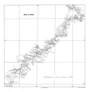
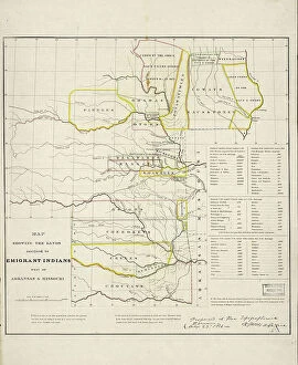
Maps of East Timor Asia are useful tools for those who want to explore the country. The maps provide detailed information about the geography and topography of East Timor, as well as its political divisions, cities, towns, villages and other features. They also show roads and highways that connect different parts of the country. Additionally, they include information about airports and ports in East Timor. Maps of East Timor Asia can be found online or in bookstores in various sizes and styles to suit individual needs, and are an invaluable resource for travelers who wish to explore this beautiful Southeast Asian nation.
+

Our beautiful Wall Art and Photo Gifts include Framed Prints, Photo Prints, Poster Prints, Canvas Prints, Jigsaw Puzzles, Metal Prints and so much more

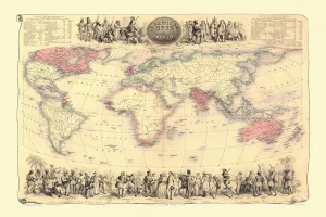
The Maps of East Timor Asia collection is a series of wall art and framed prints available from Media Storehouse. Our collection features various maps that depict the geography, topography, and political boundaries of East Timor, an island nation located in Southeast Asia. These maps were created by cartographers and geographers over time, reflecting the changes in the region's landscape as well as its history. The Maps of East Timor Asia collection offers a unique perspective on this fascinating country's past and present. They are perfect for anyone interested in geography or history or those who want to decorate their homes with beautiful artwork that tells a story. Each print is made using high-quality materials to ensure they last for years to come. Whether you're looking for something educational or decorative, the Maps of East Timor Asia collection has something for everyone. With its rich history and diverse culture, there's no better way to celebrate this beautiful country than with these stunning maps.
+

What are Maps of East Timor Asia art prints?

Maps of East Timor Asia art prints are high-quality reproductions of maps that depict the geography and topography of East Timor, a small island nation located in Southeast Asia. These prints showcase the intricate details and features of the country's landscape, including its mountains, rivers, forests, and coastlines. These art prints are not only visually stunning but also serve as educational tools for those interested in learning more about East Timor's history and culture. They can be used to decorate homes or offices with an Asian theme or to add a unique touch to any space. We offer a wide range of Maps of East Timor Asia art prints that come in various sizes and styles. You can choose from framed or unframed options depending on their preference. All our products are made using high-quality materials to ensure they last for years without fading or losing their vibrancy.
+

What Maps of East Timor Asia art prints can I buy from Media Storehouse?

We offer a wide range of Maps of East Timor Asia art prints that are perfect for anyone who is interested in the geography and history of this fascinating region. These maps come in various sizes and styles, including vintage, antique, and modern designs. You can choose from a variety of materials such as canvas, paper or metal to suit your preference. Some popular options include detailed topographical maps that showcase the terrain and natural features of East Timor. Other options include political maps that show the borders between different countries in Asia. There are also historical maps available which depict how the region has changed over time. Whether you're looking for something to decorate your home or office space with, or simply want to learn more about this unique part of the world, we have plenty of Maps of East Timor Asia art prints to choose from.
+

How do I buy Maps of East Timor Asia art prints?

To purchase Maps of East Timor Asia art prints from Media Storehouse, you can browse our extensive collection of artwork online. Once you have found the print that you are interested in, simply add it to your cart and proceed to checkout. You will be prompted to enter your shipping and payment information before finalizing your order. We offer a variety of sizes and framing options for their art prints, so be sure to select the one that best fits your needs. Additionally, we offer a range of other products featuring this artwork such as canvas prints or posters. If you have any questions about purchasing Maps of East Timor Asia art prints from Media Storehouse, don't hesitate to reach out to our customer service team for assistance. They are always happy to help customers find exactly what they're looking for.
+

How much do Maps of East Timor Asia art prints cost?

We offer a wide range of Maps of East Timor Asia art prints that vary in price depending on the size and type of print. Our collection includes high-quality paper prints, canvas prints, and framed prints that are perfect for home or office decor. We work with some of the best photographers and artists to ensure that our customers receive only the finest quality products. Our Maps of East Timor Asia art prints are available in various sizes ranging from small to large formats. The prices vary accordingly but rest assured that we strive to keep our prices competitive without compromising on quality. Whether you're looking for a simple map or an intricate artistic representation, we have something for everyone. We take pride in offering beautiful and unique art pieces at affordable prices. So if you're interested in purchasing a Map of East Timor Asia art print, browse through our collection today.
+

How will my Maps of East Timor Asia art prints be delivered to me?

Your Maps of East Timor Asia art prints will be delivered to you via standard shipping. The prints are carefully packaged in a protective sleeve and rolled into a sturdy tube for safe transportation. Once the package arrives, simply unroll the print and frame it as desired. We take great care in ensuring that your artwork is delivered to you in pristine condition. Our team works diligently to ensure that each order is processed quickly and accurately, so you can enjoy your new art as soon as possible. We offer a wide selection of high-quality prints from around the world, including maps, vintage posters, and contemporary photography. Whether you're looking for something to decorate your home or office, or searching for a unique gift idea for someone special, our collection has something for everyone. Thank you for choosing Media Storehouse for your art needs.