Fraud Blocker Skip to main content

Home > Asia > Cyprus > Maps

Maps Collection (#5)

Maps of Cyprus Asia are a collection that show the geography and political boundaries of the island nation

472 Items

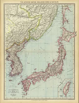
Background imageMaps Collection: The Japanese Empire, including Korea and Sakhalin (colour litho)

The Japanese Empire, including Korea and Sakhalin (colour litho)
7169503 The Japanese Empire, including Korea and Sakhalin (colour litho) by English School, (20th century); Private Collection; (add.info.: The Japanese Empire, including Korea and Sakhalin)

Background imageMaps Collection: Le Vocabulaire Illustre: Chinois; Chinese (engraving)

Le Vocabulaire Illustre: Chinois; Chinese (engraving)
7195372 Le Vocabulaire Illustre: Chinois; Chinese (engraving) by European School, (19th century); Private Collection; (add.info.: Chinois; Chinese)

Background imageMaps Collection: Paying Her Respects to His High Mightiness (colour litho)

Paying Her Respects to His High Mightiness (colour litho)
7185304 Paying Her Respects to His High Mightiness (colour litho) by Conti, Tito (1842-1924); Private Collection; (add.info.: Paying Her Respects to His High Mightiness)

Background imageMaps Collection: America and the Chinese horror: political cartoons (litho)

America and the Chinese horror: political cartoons (litho)
7201794 America and the Chinese horror: political cartoons (litho) by American School, (20th century); Private Collection; (add.info.: America and the Chinese horror: political cartoons)

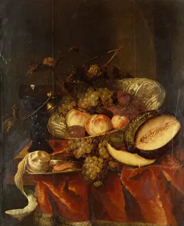
Background imageMaps Collection: Fruit in a Wanli Craak Porcelain Bowl with a Glass, Melon and Pewter plate (oil)

Fruit in a Wanli Craak Porcelain Bowl with a Glass, Melon and Pewter plate (oil)
6201667 Fruit in a Wanli Craak Porcelain Bowl with a Glass, Melon and Pewter plate (oil) by Beyeren, Abraham Hendricksz van (1620/1-91); Private Collection

Background imageMaps Collection: Kitchen-living-room with combination grate for heating and cooking (colour litho)

Kitchen-living-room with combination grate for heating and cooking (colour litho)
7157398 Kitchen-living-room with combination grate for heating and cooking (colour litho) by English School, (20th century); Private Collection; (add.info)

Background imageMaps Collection: Turandot, opera by Giacomo Puccini (colour litho)

Turandot, opera by Giacomo Puccini (colour litho)
7172612 Turandot, opera by Giacomo Puccini (colour litho) by Printz, Hans (1865-1925); Private Collection; (add.info.: Turandot, opera by Giacomo Puccini)

Background imageMaps Collection: Le Vocabulaire Illustre: Soupiere; Soup-tureen; Suppenschussel (engraving)

Le Vocabulaire Illustre: Soupiere; Soup-tureen; Suppenschussel (engraving)
7197613 Le Vocabulaire Illustre: Soupiere; Soup-tureen; Suppenschussel (engraving) by European School, (19th century); Private Collection; (add.info.: Soupiere; Soup-tureen; Suppenschussel)

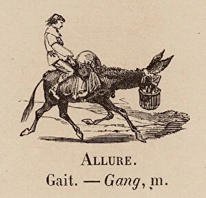
Background imageMaps Collection: Le Vocabulaire Illustre: Allure; Gait; Gang (engraving)

Le Vocabulaire Illustre: Allure; Gait; Gang (engraving)
7194652 Le Vocabulaire Illustre: Allure; Gait; Gang (engraving) by European School, (19th century); Private Collection; (add.info.: Allure; Gait; Gang)

Background imageMaps Collection: The Far East, Industries and Communications (colour litho)

The Far East, Industries and Communications (colour litho)
7169501 The Far East, Industries and Communications (colour litho) by English School, (20th century); Private Collection; (add.info.: The Far East, Industries and Communications)

Background imageMaps Collection: The East Indies and Indo-China, Industries and Communications (colour litho)

The East Indies and Indo-China, Industries and Communications (colour litho)
7169500 The East Indies and Indo-China, Industries and Communications (colour litho) by English School, (20th century); Private Collection; (add.info.: The East Indies and Indo-China)

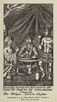
Background imageMaps Collection: Men drinking coffee, tea and chocolate (engraving)

Men drinking coffee, tea and chocolate (engraving)
7172109 Men drinking coffee, tea and chocolate (engraving) by French School, (17th century) (after); Private Collection; (add.info.: Men drinking coffee, tea and chocolate)

Background imageMaps Collection: Flags of All Nations (colour litho)

Flags of All Nations (colour litho)
7178721 Flags of All Nations (colour litho) by American School, (19th century); Private Collection; (add.info.: Flags of All Nations)

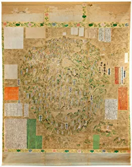
Background imageMaps Collection: Carte du monde bouddhiste - Aquarelle et encre de l ecole japonaise du debut du 18eme siecle

Carte du monde bouddhiste - Aquarelle et encre de l ecole japonaise du debut du 18eme siecle - Adelaide
FIA5397635 Carte du monde bouddhiste - Aquarelle et encre de l ecole japonaise du debut du 18eme siecle - Adelaide, Art Gallery of South Australia, Australie by Japanese School

Background imageMaps Collection: Le Vocabulaire Illustre: Service a the; Set of tea-things; Theegedeck (engraving)

Le Vocabulaire Illustre: Service a the; Set of tea-things; Theegedeck (engraving)
7197559 Le Vocabulaire Illustre: Service a the; Set of tea-things; Theegedeck (engraving) by European School, (19th century); Private Collection; (add.info)

Background imageMaps Collection: Chevalier de Villeclos in Chinese costume (colour litho)

Chevalier de Villeclos in Chinese costume (colour litho)
7201878 Chevalier de Villeclos in Chinese costume (colour litho) by English School, (20th century); Private Collection; (add.info.: Chevalier de Villeclos in Chinese costume)

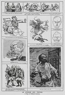
Background imageMaps Collection: Political cartoons (litho)

Political cartoons (litho)
7201772 Political cartoons (litho) by English School, (20th century); Private Collection; (add.info.: Political cartoons. Illustration from The King (George Newnes, Limited, London)

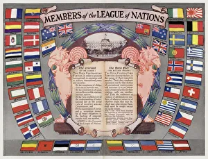
Background imageMaps Collection: Members of the League of Nations (colour litho)

Members of the League of Nations (colour litho)
7163177 Members of the League of Nations (colour litho) by English School, (20th century); Private Collection; (add.info.: Members of the League of Nations)

Background imageMaps Collection: Asia At Night With Country Borders, True Colour Satellite Image

Asia At Night With Country Borders, True Colour Satellite Image. True colour satellite image of Asia at night with country borders

Background imageMaps Collection: Tankard, Bristol, c. 1780. Creator: Unknown

Tankard, Bristol, c. 1780. Creator: Unknown
Tankard, Bristol, c. 1780

Background imageMaps Collection: 7177178

7177178

Background imageMaps Collection: Pitcher, 1812. Creator: Unknown

Pitcher, 1812. Creator: Unknown
Pitcher, 1812. Decorated with the American flag above a map of North America, flanked by a Native American woman an eagle. Made in England for the American market

Background imageMaps Collection: Physical map of asia

Physical map of asia - 1881

Background imageMaps Collection: Antique map of Shanghai China 1898

Antique map of Shanghai China 1898
Map of Shanghai China 1898 Original edition from my own archives Source : Brockhaus 1898

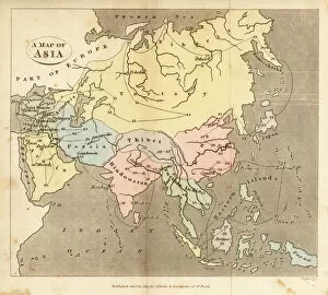
Background imageMaps Collection: Map of Asia, early 19th century

Map of Asia, early 19th century
6337920 Map of Asia, early 19th century by English School, (19th century); (add.info.: Map of Asia, early 19th century. Showing Asia Minor, Arabia, Persia, Siberia, Tartary, Thibet, Hindoostan)

Background imageMaps Collection: US President Harry Truman and General Douglas Mc Arthur during the Korean War (1950-1953)

US President Harry Truman and General Douglas Mc Arthur during the Korean War (1950-1953)
LSE4311566 US President Harry Truman and General Douglas Mc Arthur during the Korean War (1950-1953), in " The Korean War", China, 1959, Coll

Background imageMaps Collection: Map of Shanghai City in 1860, view of Chinese Old Town, and foreign concessions in 1860

Map of Shanghai City in 1860, view of Chinese Old Town, and foreign concessions in 1860
LSE4322236 Map of Shanghai City in 1860, view of Chinese Old Town, and foreign concessions in 1860. Carte in " Le Tour du Monde, Nouveau journal des Voyages", edited by Edouard Charton

Background imageMaps Collection: Map of expeditions of Zheng He (Zheng-He or Cheng Ho) (1371-1433

Map of expeditions of Zheng He (Zheng-He or Cheng Ho) (1371-1433
XEE4409462 Map of expeditions of Zheng He (Zheng-He or Cheng Ho) (1371-1433) or Hajji Mahmud (Arabic name) dated 1431. by Chinese School (15th century); Institut des Hautes Etudes Chinoises

Background imageMaps Collection: Detail of a Catalan nautical chart (portulan) representing Asia of the 13th century

Detail of a Catalan nautical chart (portulan) representing Asia of the 13th century
JLJ4601120 Detail of a Catalan nautical chart (portulan) representing Asia of the 13th century, on which one can see a caravan walking towards Cathay

Background imageMaps Collection: Geographic map of China from 'A discourse of the kingdom of China

Geographic map of China from "A discourse of the kingdom of China
GIA4707749 Geographic map of China from " A discourse of the kingdom of China, taken out of Ricius and Trigautius" by Matteo Ricci (1552-1610), by Italian School

Background imageMaps Collection: Geographic map: China, Ganges Valley, Sumatra, Ceylan. Catalan Atlas (Catalan map) (Spain

Geographic map: China, Ganges Valley, Sumatra, Ceylan. Catalan Atlas (Catalan map) (Spain
JLJ4686532 Geographic map: China, Ganges Valley, Sumatra, Ceylan. Catalan Atlas (Catalan map) (Spain). Manuscript of 1375 (Folio 2v - folio 3) by Abraham Cresques

Background imageMaps Collection: Map of China, c. 1567. (mural painting)

Map of China, c. 1567. (mural painting)
LRI4595589 Map of China, c.1567. (mural painting) by Danti, Egnazio (1536-86); Palazzo Vecchio, Florence, Italy; (add.info.: China Map created by Egnazio Danti (1536-1586) mathematician

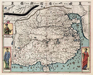
Background imageMaps Collection: (An administrative) Map of the 13 Provinces of the North and South Capitals (of China

(An administrative) Map of the 13 Provinces of the North and South Capitals (of China
986466 (An administrative) Map of the 13 Provinces of the North and South Capitals (of China), c.1712 (black ink and colours on paper) by Chinese School (18th century)

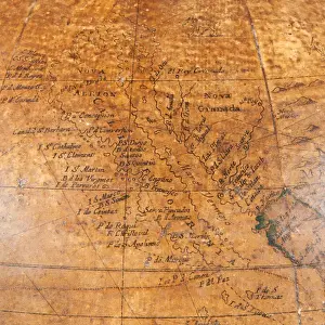
Background imageMaps Collection: Early English terrestrial globe, c. 1673 (engraving, brass, walnut & oak)

Early English terrestrial globe, c. 1673 (engraving, brass, walnut & oak)
3482914 Early English terrestrial globe, c.1673 (engraving, brass, walnut & oak) by Berry, William (1639-1718) & Morden, Robert (c.1650-1703); height: 53 cm; Private Collection; (add.info)

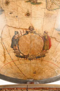
Background imageMaps Collection: Large pair of library globes, the terrestrial 1645 / 48, the celestial after c

Large pair of library globes, the terrestrial 1645 / 48, the celestial after c
3482878 Large pair of library globes, the terrestrial 1645/48, the celestial after c.1630 (plaster, wood & engraved paper) by Blaeu

Background imageMaps Collection: Tea, growing countries (colour litho)

Tea, growing countries (colour litho)
3648616 Tea, growing countries (colour litho) by English School, (20th century); Private Collection; (add.info.: Tea, growing countries)

Background imageMaps Collection: Catalan Atlas, Sheet 9, 1375 (pen and coloured inks on parchment)

Catalan Atlas, Sheet 9, 1375 (pen and coloured inks on parchment)
5054647 Catalan Atlas, Sheet 9, 1375 (pen and coloured inks on parchment) by Cresques, Abraham (1325-87); Bibliotheque Nationale, Paris, France; (add.info.: World map made in Majorca)

Background imageMaps Collection: Catalan Atlas, Sheet 12, 1375 (pen and coloured inks on parchment)

Catalan Atlas, Sheet 12, 1375 (pen and coloured inks on parchment)
5054646 Catalan Atlas, Sheet 12, 1375 (pen and coloured inks on parchment) by Cresques, Abraham (1325-87); Bibliotheque Nationale, Paris, France; (add.info.: World map made in Majorca)

Background imageMaps Collection: Catalan Atlas, Sheet 11, 1375 (pen with coloured inks on parchment)

Catalan Atlas, Sheet 11, 1375 (pen with coloured inks on parchment)
5054644 Catalan Atlas, Sheet 11, 1375 (pen with coloured inks on parchment) by Cresques, Abraham (1325-87); Bibliotheque Nationale, Paris, France; (add.info.: World map made in Majorca)

Background imageMaps Collection: Four vellum leaves of the Catalan Atlas, 1375 (pen and coloured inks on parchment)

Four vellum leaves of the Catalan Atlas, 1375 (pen and coloured inks on parchment)
5895292 Four vellum leaves of the Catalan Atlas, 1375 (pen and coloured inks on parchment) by Cresques, Abraham (1325-87); Bibliotheque Nationale, Paris

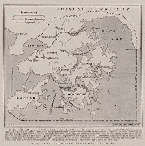
Background imageMaps Collection: Our Newly Acquired Territory in China (engraving)

Our Newly Acquired Territory in China (engraving)
1051849 Our Newly Acquired Territory in China (engraving) by English School, (19th century); Private Collection; (add.info.: Our Newly Acquired Territory in China)

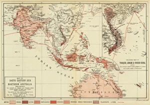
Background imageMaps Collection: Map of South-Eastern Asia and Northern Australia; Enlarged Map of Tonquin

Map of South-Eastern Asia and Northern Australia; Enlarged Map of Tonquin, Annam and Cochhin China (colour litho)
1044731 Map of South-Eastern Asia and Northern Australia; Enlarged Map of Tonquin, Annam and Cochhin China (colour litho) by English School

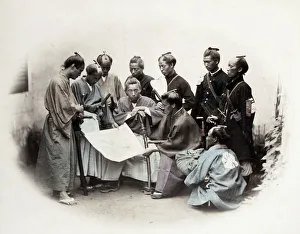
Background imageMaps Collection: 1860s Japan - portrait of a group of southern officers Felice or Felix Beato

1860s Japan - portrait of a group of southern officers Felice or Felix Beato (1832 - 29 January 1909), Italian-British photographer working mostly in India, Japan, China

Background imageMaps Collection: An Imaginary Map of America, 1500 (colour litho)

An Imaginary Map of America, 1500 (colour litho)
3101935 An Imaginary Map of America, 1500 (colour litho) by Ford, Henry Justice (1860-1941); Private Collection; (add.info.: An Imaginary Map of America, 1500)

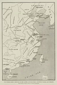
Background imageMaps Collection: The Chinese Crisis, Positions of Port Arthur and Kiau-Chiau, occupied by Russia and Germany

The Chinese Crisis, Positions of Port Arthur and Kiau-Chiau, occupied by Russia and Germany
1615083 The Chinese Crisis, Positions of Port Arthur and Kiau-Chiau, occupied by Russia and Germany, with Names of Treaty Ports and Towns underlined (litho) by Sulman

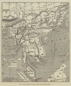
Background imageMaps Collection: Map of the Proposed Route to China from British Burmah (engraving)

Map of the Proposed Route to China from British Burmah (engraving)
1611678 Map of the Proposed Route to China from British Burmah (engraving) by Dower, John (fl.c.1845-55); Private Collection; (add.info.: Map of the Proposed Route to China from British Burmah)

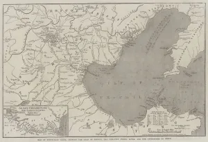
Background imageMaps Collection: Map of North-East China, showing the Gulf of Pechili, the Tien-Tsin (Peiho) River

Map of North-East China, showing the Gulf of Pechili, the Tien-Tsin (Peiho) River
1612285 Map of North-East China, showing the Gulf of Pechili, the Tien-Tsin (Peiho) River, and the Approaches to Pekin (engraving) by Dower

Background imageMaps Collection: Sketch Map shewing Positions, Populations, etc, of the European Settlements in China (engraving)

Sketch Map shewing Positions, Populations, etc, of the European Settlements in China (engraving)
1592038 Sketch Map shewing Positions, Populations, etc, of the European Settlements in China (engraving) by English School


All Professionally Made to Order for Quick Shipping


-

Maps Collection

Maps of Cyprus Asia are a collection that show the geography and political boundaries of the island nation. The maps include physical features such as mountains, rivers, lakes, and coastlines. They also show major cities and towns, roads, airports, ports, archaeological sites and other points of interest. They are be used for planning trips or just to get an overview of the country's geography, and are available in both digital and paper formats for easy access. Maps of Cyprus Asia provide an invaluable resource for anyone interested in learning more about this beautiful Mediterranean island nation.
+

Our beautiful Wall Art and Photo Gifts include Framed Prints, Photo Prints, Poster Prints, Canvas Prints, Jigsaw Puzzles, Metal Prints and so much more

The Maps of Cyprus Asia collection offered by Media Storehouse is a unique and fascinating assortment of vintage maps that showcase the historical significance of the island nation. Our collection features an array of beautifully crafted maps dating back to the 16th century, highlighting various aspects such as topography, political boundaries, and cultural landmarks. These maps provide insight into how Cyprus has evolved over time and offer a glimpse into its rich history. They also serve as decorative pieces for those interested in adding some character to their living spaces or offices. The Maps of Cyprus Asia collection includes prints from renowned cartographers such as Abraham Ortelius, Gerard Mercator, and Jodocus Hondius. These high-quality reproductions are available in different sizes and formats including framed prints and canvas art. Our collection is perfect for anyone who appreciates history or wants to add a touch of elegance to their home or office decor.
+

What are Maps of Cyprus Asia art prints?

Maps of Cyprus Asia art prints are high-quality reproductions of vintage maps that depict the island nation of Cyprus and its surrounding regions in Asia. These prints showcase intricate details such as topography, landmarks, and borders, providing a unique glimpse into the historical geography of this area. These art prints are perfect for those who appreciate history or have an interest in cartography. They can be used to decorate homes, offices, or classrooms and make great gifts for anyone with a passion for travel or culture. We offer a wide selection of Maps of Cyprus Asia art prints to choose from. Each print is carefully crafted using state-of-the-art printing technology to ensure vibrant colors and sharp detail. The prints come in various sizes and can be framed to match any decor style. Maps of Cyprus Asia art prints offer a beautiful way to explore the rich history and geography of this fascinating region.
+

What Maps of Cyprus Asia art prints can I buy from Media Storehouse?

We offer a wide range of Maps of Cyprus Asia art prints that are perfect for those who love to explore the world through art. These maps showcase the beautiful island nation of Cyprus, located in the eastern Mediterranean Sea and its surrounding regions in Asia. You can choose from vintage or modern style maps, each with their own unique features and designs. Some maps may include detailed topography, landmarks, cities and towns while others may focus on political boundaries or historical events. Our collection also includes different sizes and formats such as canvas prints, framed prints or posters so you can find the perfect piece to suit your home decor needs. Whether you're looking for a stunning addition to your living room wall or an educational tool for your classroom, we have got you covered with their diverse selection of Maps of Cyprus Asia art prints.
+

How do I buy Maps of Cyprus Asia art prints?

To purchase Maps of Cyprus Asia art prints from Media Storehouse, you can browse our extensive collection online. Simply search for "Maps of Cyprus Asia" in the search bar on our website and select the print that catches your eye. Once you have found a print you like, click on it to view more details about the artwork. From there, add the print to your cart and proceed to checkout. You will be prompted to enter your shipping information and payment details. We accept various forms of payment including credit cards and PayPal. Once your order is processed, Media Storehouse will begin preparing your Maps of Cyprus Asia art print for shipment. Your order will then be shipped directly to you without any hassle or fuss. Buying Maps of Cyprus Asia art prints from Media Storehouse is an easy process that allows you to enjoy beautiful artwork in no time.
+

How much do Maps of Cyprus Asia art prints cost?

We offer a wide range of Maps of Cyprus Asia art prints for purchase. The cost of these prints varies depending on the size and type of print that you choose. We have options ranging from small to large sizes, as well as different finishes such as canvas or framed prints. Our prices are competitive and affordable, ensuring that you can find the perfect piece to fit your budget. Our Maps of Cyprus Asia art prints are high-quality reproductions that capture every detail and nuance of the original artwork. They make excellent additions to any home or office decor, adding a touch of sophistication and elegance to any space. Whether you're looking for a unique gift for someone special or simply want to treat yourself to some beautiful artwork, our selection of Maps of Cyprus Asia art prints is sure to impress. Browse our collection today and discover the perfect piece for your needs.
+

How will my Maps of Cyprus Asia art prints be delivered to me?

We take great care in ensuring that your Maps of Cyprus Asia art prints are delivered to you safely and securely. We use high-quality packaging materials to protect your artwork during transit and ensure that it arrives at your doorstep in pristine condition. Your art print will be carefully rolled and placed inside a sturdy cardboard tube for shipping. The tube is then sealed with tape to prevent any damage or moisture from entering the package. We work with trusted courier services who offer reliable delivery options worldwide. Once your order has been dispatched, you will receive an email confirmation containing tracking information so that you can keep track of its progress. We understand the importance of delivering your artwork promptly and efficiently. That's why we strive to provide fast and reliable delivery services without compromising on quality or safety.