Fraud Blocker Skip to main content

Home > Asia > China > Maps

Maps Collection (page 3)

Maps of China Asia are maps that show the physical and political features of the region

474 items

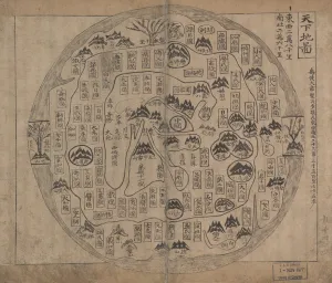
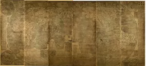
Background imageMaps Collection: Chonhado (World Map)

Chonhado (World Map)
3086646 Chonhado (World Map) by Korean school, (18th century); Private Collection; (add.info.: Korean traditional map of all under heaven presents a flat world with Korea and China in the centre)

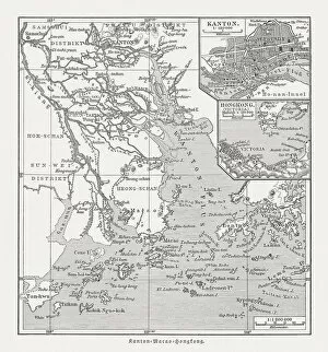
Background imageMaps Collection: Historical map of the Pearl River Delta, woodcut, published 1897

Historical map of the Pearl River Delta, woodcut, published 1897
Historical map of the mouth of the Pearl River Delta (Zhujiang) with the locations of Guangzhou (Canton), Macau and Hong Kong at the end of the 19th century. Wood engraving, published in 1897

Background imageMaps Collection: Chinese Empire with the islands of Japan, engraving by G. Zuliani taken from Tome IV of

Chinese Empire with the islands of Japan, engraving by G. Zuliani taken from Tome IV of the "Newest Atlas" published in Venice in 1784 by Antonio Zatta

Background imageMaps Collection: Old Map of China 1852 by Henry George Collins

Old Map of China 1852 by Henry George Collins
This is a finely detailed map of China remastered from a rare Atlas of the World published in 1852 by Henry George Collins

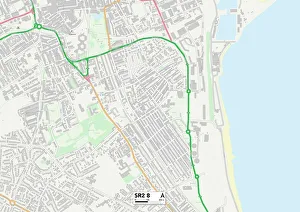
Background imageMaps Collection: Sunderland SR2 8 Map

Sunderland SR2 8 Map
Postcode Sector Map of Sunderland SR2 8

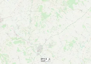
Background imageMaps Collection: North Dorset DT11 8 Map

North Dorset DT11 8 Map
Postcode Sector Map of North Dorset DT11 8

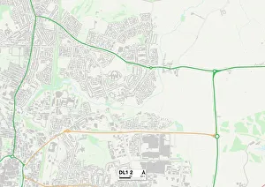
Background imageMaps Collection: Darlington DL1 2 Map

Darlington DL1 2 Map
Postcode Sector Map of Darlington DL1 2

Background imageMaps Collection: Kunyu Wanguo Quantu (Map of the Myriad Countries of the World), 1602. Creator: Ricci

Kunyu Wanguo Quantu (Map of the Myriad Countries of the World), 1602. Creator: Ricci
Kunyu Wanguo Quantu (Map of the Myriad Countries of the World), 1602. Found in the Collection of Nanjing Museum

Background imageMaps Collection: Map of China and Japan 1889

Map of China and Japan 1889
Comprehensive Geography by James Monteith - American Book Company 1882, 1889

Background imageMaps Collection: Map of China and Japan 1900

Map of China and Japan 1900
Meyers hand-Atlas Leipzig und Wien Verlag des Bibliographischen Instituts 1900

Background imageMaps Collection: Map of the Indian Ocean

Map of the Indian Ocean. Map showing the Indian subcontinent, East Africa, the Arabian peninsula, Indo-China and Western Australia. Plate 54 from The Times Atlas

Background imageMaps Collection: Political map of China

Political map of China. Map showing China, Mongolia, East Turkestan, Tibet and the Korean peninsula. Plate 62 from The Times Atlas

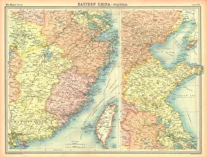
Background imageMaps Collection: Political map of Eastern China

Political map of Eastern China, showing Taiwan, Tianjin and the Bohai Sea. Plate 64 from The Times Atlas

Background imageMaps Collection: Kunyu Wanguo Quantu (A Map of the Myriad Countries of the World), 1602

Kunyu Wanguo Quantu (A Map of the Myriad Countries of the World), 1602. Artist: Zhong Wentao (17th century)
Kunyu Wanguo Quantu (A Map of the Myriad Countries of the World), 1602. Found in the collection of the Biblioteca Apostolica Vaticana

Background imageMaps Collection: View on the upper Yang-Tze-Kiang, c1890

View on the upper Yang-Tze-Kiang, c1890. The Yangtse river in China. Illustration from The Universal Geography with Illustrations and Maps, Division XIII, (Virtue & Co Limited, London, c1890)

Background imageMaps Collection: Map of Asia 1877

Map of Asia 1877
Warrens Common School Geography 1877

Background imageMaps Collection: The New Imperialism. American cartoon, 1951, by D. R. Fitzpatrick on the growing empire of Joseph

The New Imperialism. American cartoon, 1951, by D. R. Fitzpatrick on the growing empire of Joseph Stalins Soviet Union
RUSSIA: IMPERIALISM, 1951. The New Imperialism. American cartoon, 1951, by D.R. Fitzpatrick on the growing empire of Joseph Stalins Soviet Union

Background imageMaps Collection: SHANGHAI

SHANGHAI
StudioSix

Background imageMaps Collection: HONG KONG

HONG KONG
StudioSix

Background imageMaps Collection: China

China

Background imageMaps Collection: 13849201

13849201

Background imageMaps Collection: 13825172

13825172

Background imageMaps Collection: 13825076

13825076

Background imageMaps Collection: Big Game hunting Antquie map of Asia, showing locations of animals, Victorian 1860s, 19th Century

Big Game hunting Antquie map of Asia, showing locations of animals, Victorian 1860s, 19th Century
Vintage illustration of Big Game hunting Antquie map of Asia, showing locations of animals, Victorian 1860s, 19th Century

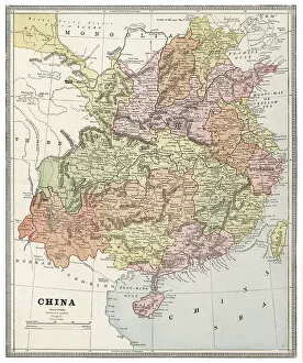
Background imageMaps Collection: Map of China 1883

Map of China 1883

Background imageMaps Collection: Old Antique map of China, detail of Pekin and Nanjing, Shanghai, 1890s

Old Antique map of China, detail of Pekin and Nanjing, Shanghai, 1890s, Victorian 19th Century history, 1890s

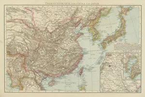
Background imageMaps Collection: Old chromolithograph map of China and Japan Islands

Old chromolithograph map of China and Japan Islands
Copyright has expired on this artwork. From my own archives, digitally restored

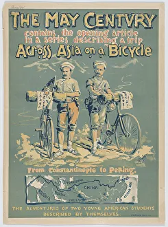
Background imageMaps Collection: The May Century: Across Asia on a Bicycle, 1894 (lithograph)

The May Century: Across Asia on a Bicycle, 1894 (lithograph)
7317735 The May Century: Across Asia on a Bicycle, 1894 (lithograph) by Lincoln, A.W.B. (active 1890s); 45.6 -- 33 cm; (add.info.: From Constantinople to Peking)

Background imageMaps Collection: Antique map of Central Asia, Afghanistan, Kashmir, Persia, Turkestan, 19th Century, 1890s

Antique map of Central Asia, Afghanistan, Kashmir, Persia, Turkestan, 19th Century, 1890s
Vintage illustration, Antique map of Central Asia, Afghanistan, Kashmir, Persia, Turkestan, 19th Century, 1890s

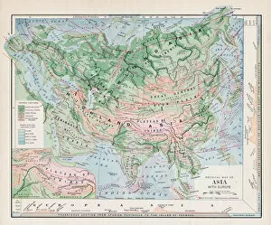
Background imageMaps Collection: Antique map of Asia, with cross section of terrain, Mountains, 19th Century

Antique map of Asia, with cross section of terrain, Mountains, 19th Century
Vintage illustration, Antique map of Asia, with cross section of terrain, Mountains, 19th Century

Background imageMaps Collection: Old Antique map of Chinese Empire, China, Hong Kong, Canton, 1890s, Victorian 19th Century history

Old Antique map of Chinese Empire, China, Hong Kong, Canton, 1890s, Victorian 19th Century history
Antique map of Chinese Empire, China, Hong Kong, Canton, 1890s, Victorian 19th Century history

Background imageMaps Collection: Map of the compasssole from a 16th century atlas, based on the original preserved in the library

Map of the compasssole from a 16th century atlas, based on the original preserved in the library of the Museo Civico in
LSE4102206 Map of the compasssole from a 16th century atlas, based on the original preserved in the library of the Museo Civico in Venice by Italian School

Background imageMaps Collection: Old engraved map of Beijing city, worlds most populous national capital city, China

Old engraved map of Beijing city, worlds most populous national capital city, China
Copyright has expired on this artwork. From my own archives, digitally restored

Background imageMaps Collection: Catalan Atlas, Sheet 10, 1375 (pen with coloured inks on parchment)

Catalan Atlas, Sheet 10, 1375 (pen with coloured inks on parchment)
5054670 Catalan Atlas, Sheet 10, 1375 (pen with coloured inks on parchment) by Cresques, Abraham (1325-87); Bibliotheque Nationale, Paris, France; (add.info.: World map made in Majorca)

Background imageMaps Collection: Map of China, Chinese Empire just before the start of the Boxer Rebellion, 1898

Map of China, Chinese Empire just before the start of the Boxer Rebellion, 1898
Vintage illustration, Map of China, Chinese Empire just before the start of the Boxer Rebellion, 1898

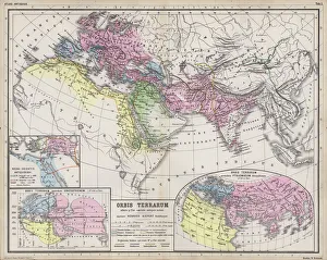
Background imageMaps Collection: Maps showing the extent of realms of the known World in ancient times (coloured engraving)

Maps showing the extent of realms of the known World in ancient times (coloured engraving)
7148245 Maps showing the extent of realms of the known World in ancient times (coloured engraving) by Kiepert, Heinrich (1818-99); Private Collection; (add.info)

Background imageMaps Collection: L Assiette au Beurre, number 183, Satirical in Colors, 1904_10_8

L Assiette au Beurre, number 183, Satirical in Colors, 1904_10_8
ICA4892969 L Assiette au Beurre, number 183, Satirical in Colors, 1904_10_8 by Camara, Leal de (1877-1948); (add.info.: Europe, China, Geographic Maps)

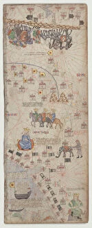
Background imageMaps Collection: Map of China (Cathay), with descriptions of small scenes, delimitation of the kingdoms with its

Map of China (Cathay), with descriptions of small scenes, delimitation of the kingdoms with its sovereign represented
AIS5350367 Map of China (Cathay), with descriptions of small scenes, delimitation of the kingdoms with its sovereign represented each time, 1375 (manuscript) by Cresques

Background imageMaps Collection: Awkward Ada (colour litho)

Awkward Ada (colour litho)
7157023 Awkward Ada (colour litho) by Hassall, John (1868-1948) (after); Private Collection; (add.info.: Awkward Ada. Illustration from Six and Twenty Boys and Girls (Blackie & Son Limited, London)

Background imageMaps Collection: Map of China with inset portraits of Matteo Ricci and two Chinese costumed figures, c

Map of China with inset portraits of Matteo Ricci and two Chinese costumed figures, c. 1625-26 (coloured engraving)
BON111186 Map of China with inset portraits of Matteo Ricci and two Chinese costumed figures, c.1625-26 (coloured engraving) by Purchas

Background imageMaps Collection: View of China (Cambaluc, now Beijing) Detail of the world map (mappamundi) of brother Maurus (Mauro)

View of China (Cambaluc, now Beijing) Detail of the world map (mappamundi) of brother Maurus (Mauro)
LRI4648478 View of China (Cambaluc, now Beijing) Detail of the world map (mappamundi) of brother Maurus (Mauro) Camaldolese 1459 (map) by Fra Mauro (1385-1460); Biblioteca Nazionale Marciana, Venice

Background imageMaps Collection: Plan of the city of Beijing, China (coloured engraving)

Plan of the city of Beijing, China (coloured engraving)
7148372 Plan of the city of Beijing, China (coloured engraving) by European School, (19th century); Private Collection; (add.info.: Plan of the city of Beijing, China)

Background imageMaps Collection: Germany and China (engraving)

Germany and China (engraving)
7157242 Germany and China (engraving) by Radiguet, Maurice (1866-1941); Private Collection; (add.info.: Germany and China. French cartoon from Le Rire, 1900)

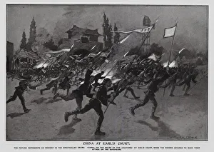
Background imageMaps Collection: Re-enactment of the Boxer Rebellion, Earls Court, London (litho)

Re-enactment of the Boxer Rebellion, Earls Court, London (litho)
7201860 Re-enactment of the Boxer Rebellion, Earls Court, London (litho) by Goble, Warwick (1862-1943) (after); Private Collection; (add.info)

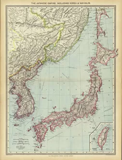
Background imageMaps Collection: The Japanese Empire, including Korea and Sakhalin (colour litho)

The Japanese Empire, including Korea and Sakhalin (colour litho)
7169503 The Japanese Empire, including Korea and Sakhalin (colour litho) by English School, (20th century); Private Collection; (add.info.: The Japanese Empire, including Korea and Sakhalin)

Background imageMaps Collection: Le Vocabulaire Illustre: Chinois; Chinese (engraving)

Le Vocabulaire Illustre: Chinois; Chinese (engraving)
7195372 Le Vocabulaire Illustre: Chinois; Chinese (engraving) by European School, (19th century); Private Collection; (add.info.: Chinois; Chinese)

Background imageMaps Collection: Paying Her Respects to His High Mightiness (colour litho)

Paying Her Respects to His High Mightiness (colour litho)
7185304 Paying Her Respects to His High Mightiness (colour litho) by Conti, Tito (1842-1924); Private Collection; (add.info.: Paying Her Respects to His High Mightiness)

Background imageMaps Collection: America and the Chinese horror: political cartoons (litho)

America and the Chinese horror: political cartoons (litho)
7201794 America and the Chinese horror: political cartoons (litho) by American School, (20th century); Private Collection; (add.info.: America and the Chinese horror: political cartoons)


All Professionally Made to Order for Quick Shipping


-

Maps Collection

Maps of China Asia are maps that show the physical and political features of the region. They include rivers, mountains, cities, provinces, and other geographical features. They also show major roads and railways as well as national boundaries. Maps of China Asia can be used to plan trips or research a particular area in more detail and are useful for understanding the size and scale of the region as well as its relative location to other countries in Asia. Maps of China Asia can be found online or in print form at bookstores or libraries.
+

Our beautiful pictures are available as Framed Prints, Photos, Wall Art and Photo Gifts

The Maps of China Asia collection from Media Storehouse is a stunning compilation of vintage and contemporary maps that showcase the diverse geography, history, and culture of China and its neighboring countries in Asia. Our collection features over 1,000 high-quality prints that are available as wall art or framed prints. Each map is carefully selected for its accuracy, detail, and aesthetic appeal. The Maps of China Asia collection includes antique maps dating back to the 16th century as well as modern topographical maps that highlight the natural landscapes and urban areas of this vast region. Some notable pieces include detailed city plans of Beijing and Shanghai from the early 20th century, colorful illustrations depicting traditional Chinese customs and landmarks, and satellite images showing the dramatic changes in land use over time. Whether you're a history buff, an avid traveler or simply appreciate beautiful artwork with cultural significance - there's something for everyone in this impressive collection.
+

What are Maps of China Asia art prints?

Maps of China Asia art prints are beautiful and intricate depictions of the geography, culture, and history of China and its surrounding regions. These prints showcase a variety of styles, from antique maps that highlight the trade routes and political boundaries of ancient empires to modern interpretations that incorporate vibrant colors and artistic flourishes. These art prints are perfect for anyone who loves Chinese culture or wants to add an exotic touch to their home decor. They can be used as wall art in living rooms, bedrooms, or offices, or as educational tools in classrooms or libraries. Whether you're interested in exploring the Silk Road, learning about traditional Chinese medicine, or simply admiring the stunning landscapes of this vast region, Maps of China Asia art prints offer something for everyone. With so many different styles and sizes available at Media Storehouse , it's easy to find the perfect print for your needs.
+

What Maps of China Asia art prints can I buy from Media Storehouse?

We offer a wide range of Maps of China Asia art prints that are perfect for those who love geography, history or simply want to decorate their homes with beautiful and unique artwork. These maps showcase the different regions and cities in China, as well as other countries in Asia such as Japan, Korea and India. Some of the popular Maps of China Asia art prints available at Media Storehouse include antique maps from the 18th century, vintage travel posters from the early 20th century, modern satellite images and artistic interpretations by contemporary artists. These prints come in various sizes and formats including canvas prints, framed prints or unframed posters. Whether you're looking for a map to hang on your living room wall or a gift for someone who loves Asian culture, we have something for everyone. With its extensive collection of Maps of China Asia art prints, you'll surely find one that suits your taste and style.
+

How do I buy Maps of China Asia art prints?

To buy Maps of China Asia art prints from Media Storehouse, you can browse our extensive collection online. Simply search for the specific map or artwork that you are interested in and add it to your cart. You can also refine your search by selecting different categories such as color, orientation, and style. Once you have added all the items you want to purchase to your cart, proceed to checkout where you will be prompted to enter your shipping information and payment details. We accept a variety of payment methods including credit cards and PayPal. After completing your order, Media Storehouse will process it promptly and ship it out to you. We offer worldwide shipping so no matter where you are located, they can deliver straight to your doorstep. Buying Maps of China Asia art prints from Media Storehouse is a simple process that allows anyone with an interest in these beautiful pieces of art access them easily.
+

How much do Maps of China Asia art prints cost?

We offer a wide range of Maps of China Asia art prints that vary in price depending on the size and type of print. Our collection includes both vintage and modern maps, as well as artistic interpretations of the region. The prices for our Maps of China Asia art prints are competitive and affordable, making it easy for anyone to add a touch of culture to their home or office decor. We take pride in offering high-quality prints that are produced using state-of-the-art printing technology to ensure vibrant colors and sharp details. Whether you're looking for a small print to hang on your wall or a large canvas to make a statement piece, we have something for everyone at Media Storehouse. Explore our collection today and find the perfect map print to suit your style.
+

How will my Maps of China Asia art prints be delivered to me?

We take great care in ensuring that your Maps of China Asia art prints are delivered to you in the best possible condition. We use high-quality packaging materials and reliable shipping methods to ensure that your order arrives safely at your doorstep. Your Maps of China Asia art prints will be carefully rolled and packaged in a sturdy tube to prevent any damage during transit. The package will also include instructions on how to unroll and flatten the print without causing any creases or wrinkles. We work with trusted courier partners who provide tracking information for all orders, so you can easily monitor the progress of your delivery. Once your order has been dispatched, you will receive an email notification with a tracking number and estimated delivery date. Westrive to provide our customers with a seamless shopping experience from start to finish. If you have any questions or concerns about your order, please do not hesitate to contact us for assistance.