Home > Maps and Charts > Americas
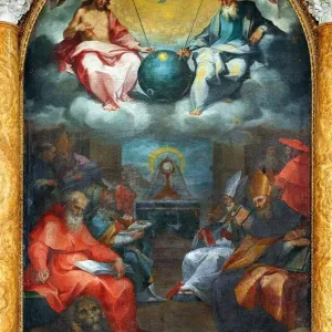
Photographic Print : Map of east coast of North America from Labrador to Cape Florida and featuring mouth of St Lawrence


![]()
Photo Prints from Universal Images Group (UIG)
Map of east coast of North America from Labrador to Cape Florida and featuring mouth of St Lawrence
Map of east coast of North America from Labrador to Cape Florida and featuring mouth of St Lawrence. Map of pre-1547 based on Jacques Cartiers discoveries of 1534-1541
Universal Images Group (UIG) manages distribution for many leading specialist agencies worldwide
Media ID 9788655
© Universal History Archive/Universal Images Group
America Based Cape Coast Discoveries East Featuring Florida Jacques Labrador Lawrence Mouth North Cartier
14"x11" Photo Print
Discover the rich history of North America's eastern coast with our stunning vintage Map of the East Coast of North America from Media Storehouse. This captivating print, sourced from Universal Images Group (UIG), takes you back in time to the pre-1547 era. Based on Jacques Cartier's discoveries between 1534 and 1541, this map showcases the East Coast from Labrador to Cape Florida, and highlights the mouth of the St. Lawrence. A perfect addition to any home or office, this photographic print brings history to life and makes for a thoughtful gift. Immerse yourself in the past and explore the stories of early exploration with Media Storehouse's vintage map collection.
Photo prints are produced on Kodak professional photo paper resulting in timeless and breath-taking prints which are also ideal for framing. The colors produced are rich and vivid, with accurate blacks and pristine whites, resulting in prints that are truly timeless and magnificent. Whether you're looking to display your prints in your home, office, or gallery, our range of photographic prints are sure to impress. Dimensions refers to the size of the paper in inches.
Our Photo Prints are in a large range of sizes and are printed on Archival Quality Paper for excellent colour reproduction and longevity. They are ideal for framing (our Framed Prints use these) at a reasonable cost. Alternatives include cheaper Poster Prints and higher quality Fine Art Paper, the choice of which is largely dependant on your budget.
Estimated Image Size (if not cropped) is 35.5cm x 25cm (14" x 9.8")
Estimated Product Size is 35.5cm x 27.9cm (14" x 11")
These are individually made so all sizes are approximate
Artwork printed orientated as per the preview above, with landscape (horizontal) orientation to match the source image.
FEATURES IN THESE COLLECTIONS
> Maps and Charts
> Related Images
> North America
> Related Images
> Universal Images Group (UIG)
> History
EDITORS COMMENTS
This print showcases a historical treasure - a map of the east coast of North America from Labrador to Cape Florida, highlighting the majestic mouth of St. Lawrence. This remarkable cartographic masterpiece is based on Jacques Cartier's groundbreaking discoveries between 1534 and 1541. Transport yourself back in time as you explore this pre-1547 map, meticulously crafted to depict Cartier's extraordinary voyages and his invaluable contributions to our understanding of early North American geography. The intricate details and precision evident in this artwork are truly awe-inspiring. As your eyes wander across the vibrant hues and delicate lines, you can almost hear the echoes of exploration that once resonated along these shores. From the rugged landscapes of Labrador to the sun-kissed beauty of Cape Florida, every inch of this coastline has been lovingly captured by skilled hands. Allow yourself to be immersed in history as you trace Cartier's footsteps through this visual narrative. Marvel at how he navigated uncharted waters with unwavering determination, forever etching his name into the annals of discovery. Whether you're an avid cartography enthusiast or simply appreciate artistry that transcends time, this print from Universal Images Group (UIG) is sure to captivate your imagination. Let it transport you on a journey through centuries past, where untamed frontiers beckoned intrepid explorers like Jacques Cartier to chart new horizons for generations yet unborn.
MADE IN THE USA
Safe Shipping with 30 Day Money Back Guarantee
FREE PERSONALISATION*
We are proud to offer a range of customisation features including Personalised Captions, Color Filters and Picture Zoom Tools
SECURE PAYMENTS
We happily accept a wide range of payment options so you can pay for the things you need in the way that is most convenient for you
* Options may vary by product and licensing agreement. Zoomed Pictures can be adjusted in the Cart.