Premium Framed Print > Europe > United Kingdom > Scotland > Caithness
Premium Framed Print : Old County Map of Caithness Scotland 1847 by A&C Black


![]()
Framed Photos From MapSeeker
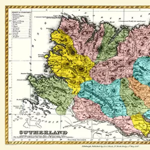
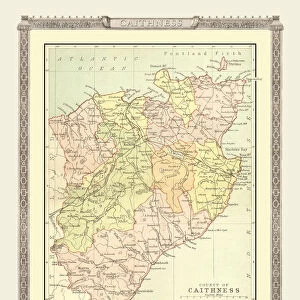
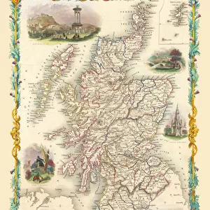
Old County Map of Caithness Scotland 1847 by A&C Black
A finely detailed facimile remastered in full colour from an antique original map of Caithness featured in A&C Blacks Atlas of 1847. Each Parish is numbered using an index table, colour rendition beautifully differentiating all of the Parishes. As well as principal roads, towns, villages and hamlets, these county maps of Scotland feature key battle sites marked with two crossed swords and the date of the battle
Welcome to the Mapseeker Image library and enter an historic gateway to one of the largest on-line collections of Historic Maps, Nostalgic Views, Vista's and Panorama's from a World gone by.
Media ID 20347455
© Mapseeker Publishing Ltd
A And C Black A And C Black Atlas A And C Black Map County Map County Map Of Scotland Historic Map Old County Map Old Scottish County Map Scottish County Map Caithness
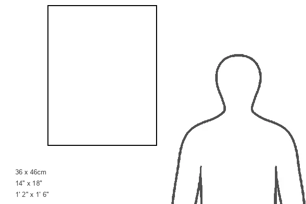
14"x18" Premium Frame
Contemporary style Premium Wooden Frame with 8"x12" Print. Complete with 2" White Mat and 1.25" thick MDF frame. Printed on 260 gsm premium paper. Glazed with shatter proof UV coated acrylic glass. Backing is paper covered backing with rubber bumpers. Supplied ready to hang with a pre-installed sawtooth/wire hanger. Care Instructions: Spot clean with a damp cloth. Securely packaged in a clear plastic bag and envelope in a reinforced cardboard shipper
FSC Real Wood Frame and Double Mounted with White Conservation Mountboard - Professionally Made and Ready to Hang
Estimated Image Size (if not cropped) is 20.3cm x 30.4cm (8" x 12")
Estimated Product Size is 35.6cm x 45.8cm (14" x 18")
These are individually made so all sizes are approximate
Artwork printed orientated as per the preview above, with portrait (vertical) orientation to match the source image.
FEATURES IN THESE COLLECTIONS
> MapSeeker
> Maps from the British Isles
> Scotland and Counties PORTFOLIO
> Arts
> Photorealistic artworks
> Detailed art pieces
> Masterful detailing in art
> Europe
> United Kingdom
> Scotland
> Caithness
> Europe
> United Kingdom
> Scotland
> Maps
> Maps and Charts
> Early Maps
EDITORS COMMENTS
This stunning print showcases the "Old County Map of Caithness Scotland 1847" by A&C Black, a true masterpiece in cartography. Remastered in full color from an antique original map featured in A&C Blacks Atlas of 1847, this finely detailed facsimile takes us back to the historical roots of Caithness. What sets this map apart is its meticulous attention to detail and vibrant color rendition. Each Parish is numbered using an index table, allowing for easy navigation across the county. The beautiful differentiation of colors further enhances our understanding and appreciation of each individual Parish. Beyond highlighting the Parishes, this remarkable piece also features principal roads, towns, villages, and hamlets that were integral to life in Caithness during that era. Moreover, it goes above and beyond by marking key battle sites with two crossed swords alongside their respective dates - a testament to Scotland's rich history. Immerse yourself in the captivating world of old Scottish maps with this historic gem depicting Caithness County. Whether you are a history enthusiast or simply appreciate fine craftsmanship, this print will transport you back in time while adding a touch of elegance to any space
MADE IN THE USA
Safe Shipping with 30 Day Money Back Guarantee
FREE PERSONALISATION*
We are proud to offer a range of customisation features including Personalised Captions, Color Filters and Picture Zoom Tools
SECURE PAYMENTS
We happily accept a wide range of payment options so you can pay for the things you need in the way that is most convenient for you
* Options may vary by product and licensing agreement. Zoomed Pictures can be adjusted in the Basket.