Premium Framed Print > South America > Related Images
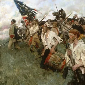
Premium Framed Print : Map of the siege of Yorktown, compiled from the Faden (London, 1781) and the Renault (American, 1781) maps by Lieut. L. V. Caziarc, 1881
 and the Renault (American, 1781) maps by Lieut. L. V. Caziarc, 1881")
 and the Renault (American, 1781) maps by Lieut. L. V. Caziarc, 1881")


![]()
Framed Photos From Granger
Map of the siege of Yorktown, compiled from the Faden (London, 1781) and the Renault (American, 1781) maps by Lieut. L. V. Caziarc, 1881
BATTLE OF YORKTOWN, 1781.
Map of the siege of Yorktown, compiled from the Faden (London, 1781) and the Renault (American, 1781) maps by Lieut. L.V. Caziarc, 1881
Granger holds millions of images spanning more than 25,000 years of world history, from before the Stone Age to the dawn of the Space Age
Media ID 7964149
1781 American Revolution Document Rebellion Siege Of Yorktown South East United States Yorktown Faden Renault
14"x16" Premium Frame
Contemporary style Premium Wooden Frame with 8"x10" Print. Complete with 2" White Mat and 1.25" thick MDF frame. Printed on 260 gsm premium paper. Glazed with shatter proof UV coated acrylic glass. Backing is paper covered backing with rubber bumpers. Supplied ready to hang with a pre-installed sawtooth/wire hanger. Care Instructions: Spot clean with a damp cloth. Securely packaged in a clear plastic bag and envelope in a reinforced cardboard shipper
FSC Real Wood Frame and Double Mounted with White Conservation Mountboard - Professionally Made and Ready to Hang
Estimated Image Size (if not cropped) is 20.3cm x 25.4cm (8" x 10")
Estimated Product Size is 35.6cm x 40.6cm (14" x 16")
These are individually made so all sizes are approximate
Artwork printed orientated as per the preview above, with portrait (vertical) orientation to match the source image.
FEATURES IN THESE COLLECTIONS
> Granger Art on Demand
> American Revolution
> Europe
> United Kingdom
> England
> London
> Related Images
> South America
> Related Images
EDITORS COMMENTS
This print showcases a historical treasure, the "Map of the siege of Yorktown" meticulously compiled by Lieutenant L. V. Caziarc in 1881. This remarkable document is a fusion of two significant maps from 1781: the Faden map from London and the Renault map from America. The Battle of Yorktown, which took place during the American Revolution in 1781, marked a turning point in history as it led to British surrender and ultimately paved the way for American independence. This map vividly illustrates the strategic layout of Yorktown, situated in South East United States. Lieutenant Caziarc's dedication to preserving this crucial piece of history is evident through his careful compilation and attention to detail. The merging of these two original maps provides an invaluable resource for historians and enthusiasts alike, offering insights into troop movements, fortifications, and geographical features that played pivotal roles during this historic battle. As we explore this image further, we are transported back in time to witness how rivers shaped military strategies while towns like Yorktown became focal points for rebellion against British rule. It serves as a reminder not only of our nation's struggle for freedom but also highlights the importance of cartography as an essential tool for understanding past events. Granger Art on Demand has once again provided us with a visual gem that encapsulates both artistry and historical significance within its frame—a true testament to their commitment to sharing knowledge through stunning imagery.
MADE IN THE USA
Safe Shipping with 30 Day Money Back Guarantee
FREE PERSONALISATION*
We are proud to offer a range of customisation features including Personalised Captions, Color Filters and Picture Zoom Tools
FREE COLORIZATION SERVICE
You can choose advanced AI Colorization for this picture at no extra charge!
SECURE PAYMENTS
We happily accept a wide range of payment options so you can pay for the things you need in the way that is most convenient for you
* Options may vary by product and licensing agreement. Zoomed Pictures can be adjusted in the Basket.