Premium Framed Print : Roanoke Island


![]()
Framed Photos From Fine Art Storehouse
Roanoke Island
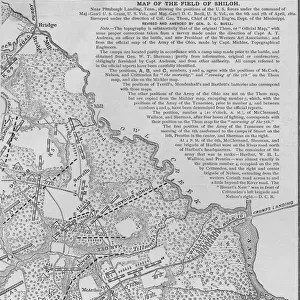
A map of Roanoke Island during the US civil war, circa 1860s. (Photo by Archive Photos/Getty Images)
Unleash your creativity and transform your space into a visual masterpiece!
Kean Collection
Media ID 11926506
© 2010 Getty Images
17037 Civil Huty Huty17037 War, No
14"x16" Premium Frame
Contemporary style Premium Wooden Frame with 8"x10" Print. Complete with 2" White Mat and 1.25" thick MDF frame. Printed on 260 gsm premium paper. Glazed with shatter proof UV coated acrylic glass. Backing is paper covered backing with rubber bumpers. Supplied ready to hang with a pre-installed sawtooth/wire hanger. Care Instructions: Spot clean with a damp cloth. Securely packaged in a clear plastic bag and envelope in a reinforced cardboard shipper
FSC Real Wood Frame and Double Mounted with White Conservation Mountboard - Professionally Made and Ready to Hang
Estimated Image Size (if not cropped) is 20.3cm x 25.4cm (8" x 10")
Estimated Product Size is 35.6cm x 40.6cm (14" x 16")
These are individually made so all sizes are approximate
Artwork printed orientated as per the preview above, with portrait (vertical) orientation to match the source image.
EDITORS COMMENTS
This print of Roanoke Island during the US Civil War transports us back to a pivotal moment in American history. The map, dating back to the 1860s, offers a glimpse into the strategic importance of this island during one of the most tumultuous periods in our nation's past.
As we study the intricate details and markings on this historical map, we can almost feel the tension and uncertainty that must have permeated the air during those turbulent times. The lines and boundaries drawn on this map tell a story of conflict, sacrifice, and resilience as forces clashed for control over this crucial piece of land.
Roanoke Island served as a key battleground during the Civil War, with both Union and Confederate troops vying for dominance over its shores. This map serves as a reminder of the sacrifices made by countless individuals who fought bravely for their beliefs and ideals.
Through this photo print, we are granted a rare opportunity to connect with our past and gain a deeper understanding of how events unfolded during this defining chapter in American history. It is a testament to our shared heritage and serves as a poignant reminder of the struggles endured by those who came before us.
In studying this image, we are reminded that history is not just confined to textbooks - it lives on through artifacts like this one, preserving moments that shaped our nation forever.
MADE IN THE USA
Safe Shipping with 30 Day Money Back Guarantee
FREE PERSONALISATION*
We are proud to offer a range of customisation features including Personalised Captions, Color Filters and Picture Zoom Tools
SECURE PAYMENTS
We happily accept a wide range of payment options so you can pay for the things you need in the way that is most convenient for you
* Options may vary by product and licensing agreement. Zoomed Pictures can be adjusted in the Basket.