Premium Framed Print > Europe > Poland > Maps
Premium Framed Print : Prussia and german states map 1867


![]()
Framed Photos from Fine Art Storehouse
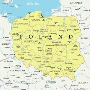
Prussia and german states map 1867
Mitchellas Modern Atlas - Published by E.H. Butler and Co - Philadelphia 1867
Unleash your creativity and transform your space into a visual masterpiece!
THEPALMER
Media ID 13609203
© This content is subject to copyright
14"x16" Premium Frame
Contemporary style Premium Wooden Frame with 8"x10" Print. Complete with 2" White Mat and 1.25" thick MDF frame. Printed on 260 gsm premium paper. Glazed with shatter proof UV coated acrylic glass. Backing is paper covered backing with rubber bumpers. Supplied ready to hang with a pre-installed sawtooth/wire hanger. Care Instructions: Spot clean with a damp cloth. Securely packaged in a clear plastic bag and envelope in a reinforced cardboard shipper
FSC Real Wood Frame and Double Mounted with White Conservation Mountboard - Professionally Made and Ready to Hang
Estimated Image Size (if not cropped) is 25.4cm x 20.3cm (10" x 8")
Estimated Product Size is 40.6cm x 35.6cm (16" x 14")
These are individually made so all sizes are approximate
Artwork printed orientated as per the preview above, with landscape (horizontal) orientation to match the source image.
FEATURES IN THESE COLLECTIONS
> Fine Art Storehouse
> Map
> Historical Maps
> Fine Art Storehouse
> Map
> USA Maps
> Europe
> Germany
> Related Images
> Europe
> Poland
> Related Images
> Maps and Charts
> Related Images
EDITORS COMMENTS
This print showcases a historical gem, the "Prussia and German States Map 1867" taken from Mitchellas Modern Atlas and published by E. H. Butler and Co in Philadelphia back in 1867. The image portrays an intricate engraving of the map, capturing the essence of German culture during that era. The map itself is a testament to the rich history of Germany, with its detailed cartography depicting not only Prussia but also various other German states. It offers a glimpse into the political landscape of the time, showcasing borders and regions that have since evolved or disappeared altogether. The craftsmanship evident in this old lithograph is truly remarkable; every line etched with precision tells a story about physical geography and territorial divisions. As one gazes upon it, they are transported back to an age when maps were meticulously hand-drawn works of art rather than digital renderings. This particular print captures not just a piece of history but also serves as a reminder of how far we have come in terms of mapping technology. It stands as a tribute to both American publishing excellence (being printed by E. H. Butler & Co) and European cartographic expertise. "The Prussia and German States Map 1867" by THEPALMER is more than just an antique; it represents our fascination with exploration, cultural heritage, and our ever-evolving understanding of our world's past.
MADE IN THE USA
Safe Shipping with 30 Day Money Back Guarantee
FREE PERSONALISATION*
We are proud to offer a range of customisation features including Personalised Captions, Color Filters and Picture Zoom Tools
SECURE PAYMENTS
We happily accept a wide range of payment options so you can pay for the things you need in the way that is most convenient for you
* Options may vary by product and licensing agreement. Zoomed Pictures can be adjusted in the Cart.