Premium Framed Print > Maps and Charts > Related Images
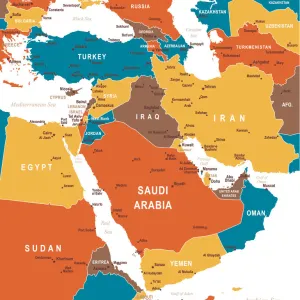
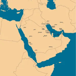
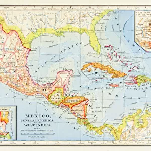
Premium Framed Print : Map of the Middle East


![]()
Framed Photos from Fine Art Storehouse
Map of the Middle East
wov041.jpg
Unleash your creativity and transform your space into a visual masterpiece!
Jennifer Thermes
Media ID 13880247
© This content is subject to copyright
16"x16" Premium Frame
Contemporary style Premium Wooden Frame with 10"x10" Print. Complete with 2" White Mat and 1.25" thick MDF frame. Printed on 260 gsm premium paper. Glazed with shatter proof UV coated acrylic glass. Backing is paper covered backing with rubber bumpers. Supplied ready to hang with a pre-installed sawtooth/wire hanger. Care Instructions: Spot clean with a damp cloth. Securely packaged in a clear plastic bag and envelope in a reinforced cardboard shipper
FSC Real Wood Frame and Double Mounted with White Conservation Mountboard - Professionally Made and Ready to Hang
Estimated Image Size (if not cropped) is 25.4cm x 25.4cm (10" x 10")
Estimated Product Size is 40.6cm x 40.6cm (16" x 16")
These are individually made so all sizes are approximate
Artwork printed orientated as per the preview above, with landscape (horizontal) or portrait (vertical) orientation to match the source image.
FEATURES IN THESE COLLECTIONS
> Maps and Charts
> Related Images
EDITORS COMMENTS
This photo print, titled "Map of the Middle East (wov041. jpg)" by Jennifer Thermes, takes us on a visual journey through the intricate tapestry of the region. With its vibrant colors and meticulous details, this artwork invites us to explore the rich history and diverse cultures that have shaped the Middle East. The map serves as a gateway to understanding the complexities and interconnectedness of nations in this part of the world. It beautifully captures both ancient landmarks and modern cities, showcasing iconic sites like Egypt's pyramids, Jordan's Petra, or Israel's Dome of the Rock. As our eyes wander across its surface, we are transported from bustling markets to serene deserts and lush oases. Jennifer Thermes' masterful technique is evident in every brushstroke; her attention to detail allows for an immersive experience as we examine each border line or decipher place names etched delicately onto parchment-like paper. The choice of warm hues evokes a sense of timelessness while highlighting regional diversity. This print not only appeals to cartography enthusiasts but also sparks curiosity among those seeking cultural enlightenment. It serves as a reminder that beyond political boundaries lie stories waiting to be discovered – tales woven into landscapes that have witnessed centuries-old civilizations rise and fall. Whether displayed in homes or educational institutions, "Map of the Middle East (wov041. jpg)" is sure to captivate viewers with its beauty and inspire them to delve deeper into this fascinating part of our world's heritage.
MADE IN THE USA
Safe Shipping with 30 Day Money Back Guarantee
FREE PERSONALISATION*
We are proud to offer a range of customisation features including Personalised Captions, Color Filters and Picture Zoom Tools
SECURE PAYMENTS
We happily accept a wide range of payment options so you can pay for the things you need in the way that is most convenient for you
* Options may vary by product and licensing agreement. Zoomed Pictures can be adjusted in the Cart.