Premium Framed Print > Fine Art Storehouse > Map
Premium Framed Print : Map of the commerce routes of the world 1889


![]()
Framed Photos from Fine Art Storehouse
Map of the commerce routes of the world 1889
Indiana Educational Series The Complete Geography - Indianapolis 1889
Unleash your creativity and transform your space into a visual masterpiece!
THEPALMER
Media ID 14756312
© This content is subject to copyright
14"x18" Premium Frame
Contemporary style Premium Wooden Frame with 8"x12" Print. Complete with 2" White Mat and 1.25" thick MDF frame. Printed on 260 gsm premium paper. Glazed with shatter proof UV coated acrylic glass. Backing is paper covered backing with rubber bumpers. Supplied ready to hang with a pre-installed sawtooth/wire hanger. Care Instructions: Spot clean with a damp cloth. Securely packaged in a clear plastic bag and envelope in a reinforced cardboard shipper
FSC Real Wood Frame and Double Mounted with White Conservation Mountboard - Professionally Made and Ready to Hang
Estimated Image Size (if not cropped) is 30.4cm x 20.3cm (12" x 8")
Estimated Product Size is 45.8cm x 35.6cm (18" x 14")
These are individually made so all sizes are approximate
Artwork printed orientated as per the preview above, with landscape (horizontal) orientation to match the source image.
FEATURES IN THESE COLLECTIONS
> Fine Art Storehouse
> Map
> Historical Maps
EDITORS COMMENTS
This print titled "Map of the commerce routes of the world 1889" takes us back in time to an era when global trade was beginning to shape the modern world. The image, part of Indiana Educational Series' The Complete Geography collection from Indianapolis in 1889, offers a glimpse into the intricate web of commerce that connected nations and continents. As we gaze upon this historical artifact, our eyes are immediately drawn to the beautifully detailed cartography that spans across every inch of the map. Each line represents a vital trade route, connecting bustling ports and distant lands with threads of economic exchange. It is as if we can almost hear the echoes of merchant ships sailing through treacherous waters and caravans traversing vast deserts. The significance of this map lies not only in its aesthetic appeal but also in its ability to transport us back to a pivotal moment in history. It reminds us that long before globalization became a buzzword, humans were already forging connections across borders for mutual prosperity. "The Map of Commerce Routes" by THEPALMER serves as both an educational tool and a work of art. Its presence on display at Fine Art Storehouse allows us to appreciate how geography has shaped our world throughout centuries. This remarkable piece invites viewers to explore their curiosity about past civilizations while contemplating how these ancient networks continue influencing our interconnected planet today.
MADE IN THE USA
Safe Shipping with 30 Day Money Back Guarantee
FREE PERSONALISATION*
We are proud to offer a range of customisation features including Personalised Captions, Color Filters and Picture Zoom Tools
SECURE PAYMENTS
We happily accept a wide range of payment options so you can pay for the things you need in the way that is most convenient for you
* Options may vary by product and licensing agreement. Zoomed Pictures can be adjusted in the Cart.
![L. M. & S. R. Brownhills - Proposed Raising of Platform [N. D. ]](/sq/229/l-m-s-r-brownhills-proposed-raising-12618219.jpg.webp)
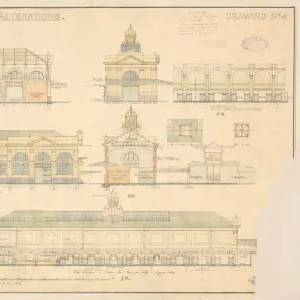
![S. E. R Proposed Alterations at West St Leonards Station [N. D]](/sq/229/s-e-r-proposed-alterations-west-st-leonards-13575906.jpg.webp)
![Cleethorpes Proposed New Messroom For Women Carriage Cleaners (Amendment) [N. D]](/sq/229/cleethorpes-proposed-new-messroom-women-carriage-13779893.jpg.webp)
![The Railway Executive - Eastern Region Clethorpes - Proposed Station Improvements [N. D]](/sq/229/railway-executive-eastern-region-clethorpes-13779895.jpg.webp)