Premium Framed Print > Maps and Charts > Related Images
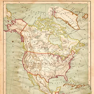
Premium Framed Print : Antique map: Eastern Hemisphere


![]()
Framed Photos From Fine Art Storehouse
Antique map: Eastern Hemisphere
Unleash your creativity and transform your space into a visual masterpiece!
ilbusca
Media ID 21004157
14"x16" Premium Frame
Contemporary style Premium Wooden Frame with 8"x10" Print. Complete with 2" White Mat and 1.25" thick MDF frame. Printed on 260 gsm premium paper. Glazed with shatter proof UV coated acrylic glass. Backing is paper covered backing with rubber bumpers. Supplied ready to hang with a pre-installed sawtooth/wire hanger. Care Instructions: Spot clean with a damp cloth. Securely packaged in a clear plastic bag and envelope in a reinforced cardboard shipper
FSC Real Wood Frame and Double Mounted with White Conservation Mountboard - Professionally Made and Ready to Hang
Estimated Image Size (if not cropped) is 20.3cm x 25.4cm (8" x 10")
Estimated Product Size is 35.6cm x 40.6cm (14" x 16")
These are individually made so all sizes are approximate
Artwork printed orientated as per the preview above, with portrait (vertical) orientation to match the source image.
FEATURES IN THESE COLLECTIONS
> Fine Art Storehouse
> Map
> Historical Maps
> Maps and Charts
> Related Images
EDITORS COMMENTS
This print titled "Antique map: Eastern Hemisphere" takes us on a journey back in time, immersing us in the rich history of cartography. Crafted by the talented artist ilbusca and available at Fine Art Storehouse, this piece is a true testament to the beauty and intricacy of antique maps. The image showcases an exquisite representation of the Eastern Hemisphere, meticulously hand-drawn with remarkable attention to detail. Every contour and feature has been delicately etched onto aged parchment, evoking a sense of nostalgia for a bygone era when exploration was paramount. As we gaze upon this masterpiece, our eyes are drawn to the intricate borders adorned with mythical creatures and celestial symbols. The continents come alive with vibrant colors that hint at undiscovered lands waiting to be explored. Each country is labeled in elegant calligraphy, reminding us of the artistry involved in creating these historical artifacts. This print not only serves as a stunning decorative piece but also as a window into our collective past. It sparks curiosity about ancient civilizations and their perceptions of the world around them. Whether displayed in an office or home setting, it invites conversation and encourages viewers to embark on their own voyages of discovery. With its timeless appeal and undeniable charm, this antique map transports us through time while celebrating human ingenuity and our unending thirst for knowledge.
MADE IN THE USA
Safe Shipping with 30 Day Money Back Guarantee
FREE PERSONALISATION*
We are proud to offer a range of customisation features including Personalised Captions, Color Filters and Picture Zoom Tools
SECURE PAYMENTS
We happily accept a wide range of payment options so you can pay for the things you need in the way that is most convenient for you
* Options may vary by product and licensing agreement. Zoomed Pictures can be adjusted in the Basket.