Premium Framed Print > Europe > France > Maps
Premium Framed Print : Map of Corsica, France dated 1735. (print)
")
")


![]()
Framed Photos From Fine Art Finder
Map of Corsica, France dated 1735. (print)
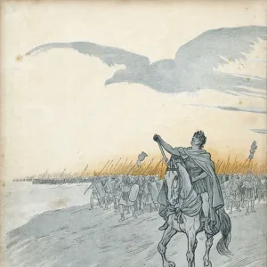
7419872 Map of Corsica, France dated 1735. (print); (add.info.: Map of Corsica, France dated 1735. By an unidentified cartographer.); Photo © Ken Welsh. All rights reserved 2024
Media ID 38412866
© © Ken Welsh. All rights reserved 2024 / Bridgeman Images
Ageing Corsica Islands Isles Run Down 18th Centuries Geographer
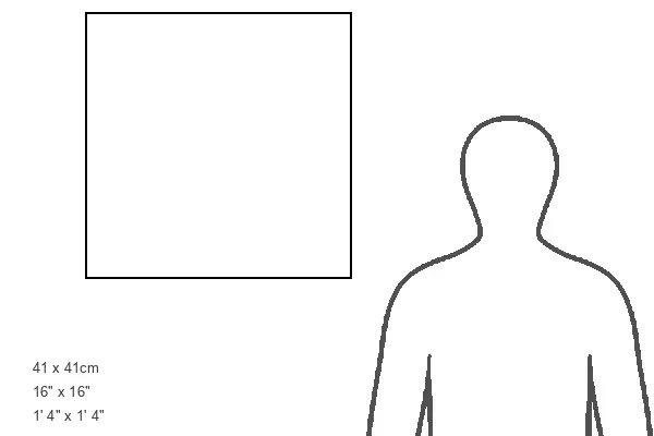
16"x16" Premium Frame
Contemporary style Premium Wooden Frame with 10"x10" Print. Complete with 2" White Mat and 1.25" thick MDF frame. Printed on 260 gsm premium paper. Glazed with shatter proof UV coated acrylic glass. Backing is paper covered backing with rubber bumpers. Supplied ready to hang with a pre-installed sawtooth/wire hanger. Care Instructions: Spot clean with a damp cloth. Securely packaged in a clear plastic bag and envelope in a reinforced cardboard shipper
FSC Real Wood Frame and Double Mounted with White Conservation Mountboard - Professionally Made and Ready to Hang
Estimated Image Size (if not cropped) is 25.4cm x 25.4cm (10" x 10")
Estimated Product Size is 40.6cm x 40.6cm (16" x 16")
These are individually made so all sizes are approximate
Artwork printed orientated as per the preview above, with landscape (horizontal) or portrait (vertical) orientation to match the source image.
FEATURES IN THESE COLLECTIONS
> Fine Art Finder
> Artists
> pseudonym for Onfray de Breville
> Maps and Charts
> Early Maps
> Maps and Charts
> Related Images
EDITORS COMMENTS
This stunning print captures a piece of history with a Map of Corsica, France dated 1735. The intricate details and vibrant colors bring to life the cartography of this beautiful island in the Mediterranean. Created by an unidentified cartographer, this map is a true work of art that showcases the geography and history of Corsica in the 18th century.
The aged look of the print adds to its charm, giving it a sense of authenticity and nostalgia. As you study each line and symbol on the map, you can't help but feel transported back in time to when Corsica was a bustling hub of activity and trade.
Corsica's unique shape and topography are highlighted in this map, showing off its rugged coastline and mountainous terrain. The French influence on the island is evident in the names and borders depicted on the map, providing insight into Corsica's place within European history.
Whether you're a lover of art, geography, or history, this Map of Corsica from 1735 is sure to captivate your imagination. It serves as a reminder of how far we've come since those early days while also preserving a piece of our past for generations to come.
MADE IN THE USA
Safe Shipping with 30 Day Money Back Guarantee
FREE PERSONALISATION*
We are proud to offer a range of customisation features including Personalised Captions, Color Filters and Picture Zoom Tools
SECURE PAYMENTS
We happily accept a wide range of payment options so you can pay for the things you need in the way that is most convenient for you
* Options may vary by product and licensing agreement. Zoomed Pictures can be adjusted in the Basket.