Premium Framed Print > Europe > Spain > Maps
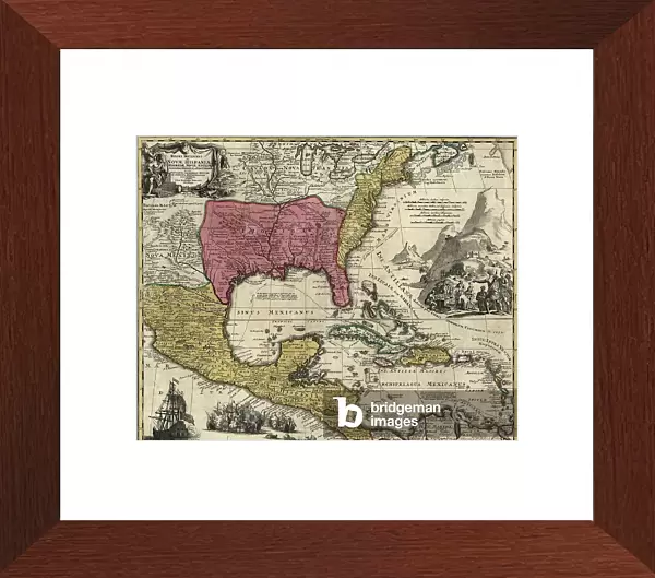
Premium Framed Print : Dominions of New Spain in North America, 1759


![]()
Framed Photos From Fine Art Finder
Dominions of New Spain in North America, 1759
2902801 Dominions of New Spain in North America, 1759; (add.info.: Dominions of New Spain in North America, 1759.); Buyenlarge Archive/UIG
Media ID 38452854
© Buyenlarge Archive/UIG / Bridgeman Images
1750s Carolina Cartographic Florida Pennsylvania Virginia New Britain
14"x16" Premium Frame
Contemporary style Premium Wooden Frame with 8"x10" Print. Complete with 2" White Mat and 1.25" thick MDF frame. Printed on 260 gsm premium paper. Glazed with shatter proof UV coated acrylic glass. Backing is paper covered backing with rubber bumpers. Supplied ready to hang with a pre-installed sawtooth/wire hanger. Care Instructions: Spot clean with a damp cloth. Securely packaged in a clear plastic bag and envelope in a reinforced cardboard shipper
FSC Real Wood Frame and Double Mounted with White Conservation Mountboard - Professionally Made and Ready to Hang
Estimated Image Size (if not cropped) is 25.4cm x 20.3cm (10" x 8")
Estimated Product Size is 40.6cm x 35.6cm (16" x 14")
These are individually made so all sizes are approximate
Artwork printed orientated as per the preview above, with landscape (horizontal) orientation to match the source image.
FEATURES IN THESE COLLECTIONS
> Europe
> United Kingdom
> Maps
> Maps and Charts
> Related Images
> Maps and Charts
> Spain
> North America
> Mexico
> Related Images
> North America
> United States of America
> Florida
> Related Images
> North America
> United States of America
> Maps
> North America
> United States of America
> New Mexico
> Related Images
EDITORS COMMENTS
This stunning print captures the intricate and detailed map of the Dominions of New Spain in North America from 1759. The map showcases the vast territories under Spanish rule during this time, including present-day Mexico, parts of the United States such as Florida and Virginia, as well as other regions in North America.
The cartography displayed in this print is a true testament to the exploration and colonization efforts of Spain during the 18th century. It provides a glimpse into the geopolitical landscape of that era, highlighting the extent of Spanish influence across different continents.
As we study this historical map, we are transported back in time to an era when empires vied for control over new lands and resources. The attention to detail and precision in mapping out these dominions is truly remarkable, showcasing both artistic skill and scientific knowledge.
This print serves as a reminder of our shared history and how borders have shifted over time. It invites us to reflect on the impact of colonialism on indigenous populations and how it has shaped modern-day nations. Overall, this image is not just a map but a window into a bygone era filled with exploration, conquest, and cultural exchange.
MADE IN THE USA
Safe Shipping with 30 Day Money Back Guarantee
FREE PERSONALISATION*
We are proud to offer a range of customisation features including Personalised Captions, Color Filters and Picture Zoom Tools
SECURE PAYMENTS
We happily accept a wide range of payment options so you can pay for the things you need in the way that is most convenient for you
* Options may vary by product and licensing agreement. Zoomed Pictures can be adjusted in the Basket.