Poster Print > Europe > France > Canton > Landes
Poster Print : Ohios early land divisions

![]()
Poster Prints From North Wind
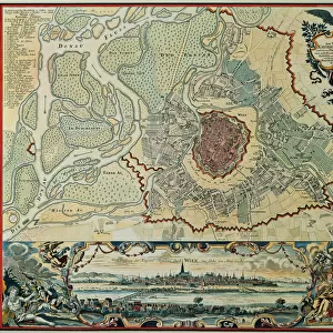
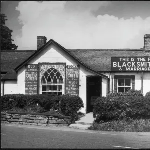
Ohios early land divisions
Land division and early settlements in Ohio Territory.
Printed color lithograph of a 19th-century illustration
North Wind Picture Archives brings history to life with stock images and hand-colored illustrations
Media ID 5882535
© North Wind Picture Archives
1700s 18th Century Frontier Lake Erie Northwest Territory Ohio Settlement Territory
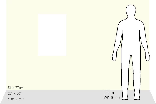
20x30 inch Poster Print
_Step back in time with Media Storehouse's captivating Poster Prints, featuring an intriguing illustration of Ohio's early land divisions from North Wind Picture Archives. This beautifully detailed, printed color lithograph transports you back to the 19th century, offering a fascinating glimpse into the history of land division and early settlements in the Ohio Territory. Add this historic piece to your home or office décor and bring a touch of the past into your space._
Poster prints are budget friendly enlarged prints in standard poster paper sizes. Printed on 150 gsm Matte Paper for a natural feel and supplied rolled in a tube. Great for framing and should last many years. To clean wipe with a microfiber, non-abrasive cloth or napkin. Our Archival Quality Photo Prints and Fine Art Paper Prints are printed on higher quality paper and the choice of which largely depends on your budget.
Poster prints are budget friendly enlarged prints in standard poster paper sizes (A0, A1, A2, A3 etc). Whilst poster paper is sometimes thinner and less durable than our other paper types, they are still ok for framing and should last many years. Our Archival Quality Photo Prints and Fine Art Paper Prints are printed on higher quality paper and the choice of which largely depends on your budget.
Estimated Product Size is 51.4cm x 76.8cm (20.2" x 30.2")
These are individually made so all sizes are approximate
Artwork printed orientated as per the preview above, with landscape (horizontal) or portrait (vertical) orientation to match the source image.
FEATURES IN THESE COLLECTIONS
> Animals
> Mammals
> Muridae
> Western Mouse
> Europe
> France
> Canton
> Landes
> Maps and Charts
> Early Maps
> Maps and Charts
> Related Images
EDITORS COMMENTS
This vibrant and detailed lithograph takes us back in time to Ohio's early land divisions and settlements in the 18th century. The print showcases the rich history of this frontier territory, capturing the essence of a bygone era. The illustration depicts a map of Ohio Territory, adorned with printed colors that bring life to its various regions. From Lake Erie in the north to the vast Northwest Territory in the west, every corner is meticulously portrayed, offering a glimpse into how this land was divided during those formative years. As we delve deeper into this vintage artwork, we are transported to an age when Ohio was still being shaped by pioneers and settlers seeking new opportunities. The image highlights key settlements that dotted the landscape at that time, showcasing their significance as they played a crucial role in shaping Ohio's future. With its traditional style and historic charm, this print captures not only geographical details but also evokes a sense of adventure and exploration. It serves as a visual testament to America's westward expansion during the 1700s while paying homage to Ohio's unique place within it. Whether you're an art enthusiast or a history buff, this lithograph offers an engaging window into Ohio's past – reminding us of our roots and igniting curiosity about those who came before us.
MADE IN THE USA
Safe Shipping with 30 Day Money Back Guarantee
FREE PERSONALISATION*
We are proud to offer a range of customisation features including Personalised Captions, Color Filters and Picture Zoom Tools
SECURE PAYMENTS
We happily accept a wide range of payment options so you can pay for the things you need in the way that is most convenient for you
* Options may vary by product and licensing agreement. Zoomed Pictures can be adjusted in the Basket.