Fraud Blocker Skip to main content

Poster Print > Maps and Charts

Maps and Charts Poster Print Collection

Discover the world in stunning detail with our Maps and Charts collection of poster prints from Media Storehouse. Each print is meticulously designed, showcasing intricate cartography and geographical information. From vintage world maps to nautical charts and astronomical diagrams, our collection offers a captivating exploration of the wonders of our planet and beyond. Hang one of these beautiful prints in your home or office to inspire curiosity and ignite conversation. Perfect for avid travelers, history buffs, or anyone with a passion for geography, these high-quality poster prints are sure to become cherished additions to your space.
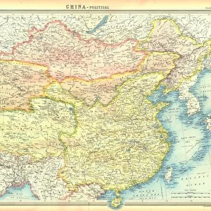
Maps and charts on photo prints are a unique way to display geographical information and can be used to showcase different types of data

Choose a picture from our Maps and Charts Poster Print Collection for your Wall Art and Photo Gifts

Welcome to Media Storehouse's collection of over 87,000 images of maps and charts from around the globe where you will find a wealth of cartographic marvels.  Explore the world's splendour via the eyes of renowned cartographers like Abraham Ortelius, Mercator, and Blaeu, whose enduring creations never cease to enthral and inspire. From ancient maps that depict the locations of early civilisations to complex charts that depict the course of modern discovery, this collection encompasses the whole spectrum of human knowledge and curiosity. 

64 Poster Prints

Maps and Charts Poster Print Collection: Popular Maps

Popular Maps Collection
62 Poster Prints

Maps and Charts Poster Print Collection: Willem Janszoon Blaeu

Willem Janszoon Blaeu Collection
130 Poster Prints

Maps and Charts Poster Print Collection: Abraham Ortelius

Abraham Ortelius Collection
292 Poster Prints

Maps and Charts Poster Print Collection: Gerardus Mercator's Cartographic Legacy

Gerardus Mercator's Cartographic Legacy Collection
205 Poster Prints

Maps and Charts Poster Print Collection: Africa

Africa Collection
1,616 Poster Prints

Maps and Charts Poster Print Collection: Albania

Albania Collection
33 Poster Prints

Maps and Charts Poster Print Collection: Americas

Americas Collection
3,791 Poster Prints

Maps and Charts Poster Print Collection: Armenia

Armenia Collection
63 Poster Prints

Maps and Charts Poster Print Collection: Australia

Australia Collection
554 Poster Prints

Maps and Charts Poster Print Collection: Austria

Austria Collection
570 Poster Prints

Maps and Charts Poster Print Collection: Azerbaijan

Azerbaijan Collection
16 Poster Prints

Maps and Charts Poster Print Collection: Belarus

Belarus Collection
19 Poster Prints

Maps and Charts Poster Print Collection: Belgium

Belgium Collection
657 Poster Prints

Maps and Charts Poster Print Collection: Bosnia and Herzegovina

Bosnia and Herzegovina Collection
37 Poster Prints

Maps and Charts Poster Print Collection: British Empire Maps

British Empire Maps Collection
542 Poster Prints

Maps and Charts Poster Print Collection: Bulgaria

Bulgaria Collection
69 Poster Prints

Maps and Charts Poster Print Collection: Croatia

Croatia Collection
47 Poster Prints

Maps and Charts Poster Print Collection: Cyprus

Cyprus Collection
96 Poster Prints

Maps and Charts Poster Print Collection: Denmark

Denmark Collection
385 Poster Prints

Maps and Charts Poster Print Collection: Early Maps

Early Maps Collection
24,656 Poster Prints

Maps and Charts Poster Print Collection: Estonia

Estonia Collection
35 Poster Prints

Maps and Charts Poster Print Collection: Finland

Finland Collection
117 Poster Prints

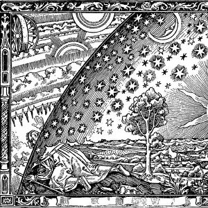
Maps and Charts Poster Print Collection: Flat Earth

Flat Earth Collection
132 Poster Prints

Maps and Charts Poster Print Collection: France

France Collection
10,852 Poster Prints

Maps and Charts Poster Print Collection: Geological Map

Geological Map Collection
409 Poster Prints

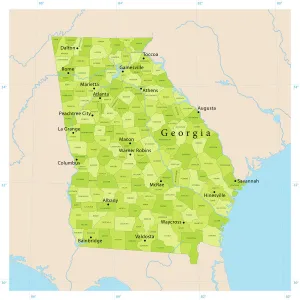
Maps and Charts Poster Print Collection: Georgia

Georgia Collection
356 Poster Prints

Maps and Charts Poster Print Collection: Germany

Germany Collection
6,465 Poster Prints

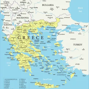
Maps and Charts Poster Print Collection: Greece

Greece Collection
1,170 Poster Prints

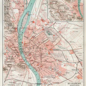
Maps and Charts Poster Print Collection: Hungary

Hungary Collection
195 Poster Prints

Maps and Charts Poster Print Collection: Iceland

Iceland Collection
105 Poster Prints

Maps and Charts Poster Print Collection: India

India Collection
659 Poster Prints

Maps and Charts Poster Print Collection: Ireland

Ireland Collection
1,158 Poster Prints

Maps and Charts Poster Print Collection: Italy

Italy Collection
2,866 Poster Prints

Maps and Charts Poster Print Collection: Kazakhstan

Kazakhstan Collection
13 Poster Prints

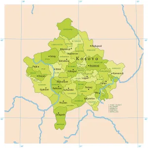
Maps and Charts Poster Print Collection: Kosovo

Kosovo Collection
3 Poster Prints

Maps and Charts Poster Print Collection: Latvia

Latvia Collection
33 Poster Prints

Maps and Charts Poster Print Collection: Liechtenstein

Liechtenstein Collection
74 Poster Prints

Maps and Charts Poster Print Collection: Lithuania

Lithuania Collection
55 Poster Prints

Maps and Charts Poster Print Collection: Luxembourg

Luxembourg Collection
54 Poster Prints

Maps and Charts Poster Print Collection: Malta

Malta Collection
91 Poster Prints

Maps and Charts Poster Print Collection: Moldova

Moldova Collection
13 Poster Prints

Maps and Charts Poster Print Collection: Monaco

Monaco Collection
32 Poster Prints

Maps and Charts Poster Print Collection: Montenegro

Montenegro Collection
32 Poster Prints

Maps and Charts Poster Print Collection: Netherlands

Netherlands Collection
537 Poster Prints

Maps and Charts Poster Print Collection: North Macedonia

North Macedonia Collection
70 Poster Prints

Maps and Charts Poster Print Collection: Norway

Norway Collection
313 Poster Prints

Maps and Charts Poster Print Collection: Poland

Poland Collection
246 Poster Prints

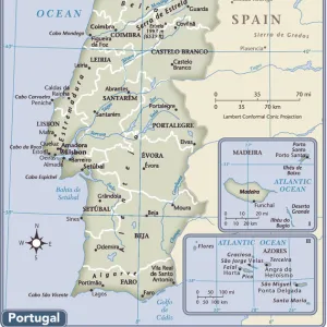
Maps and Charts Poster Print Collection: Portugal

Portugal Collection
374 Poster Prints


All Professionally Made to Order for Quick Shipping


-

Maps and Charts Poster Print Collection

Maps and charts on photo prints are a unique way to display geographical information and can be used to showcase different types of data, such as population density or topography, and provide an easy-to-understand visual representation of complex information. These prints are perfect for educational purposes, as they allow students to better understand the world around them. Additionally, maps and charts on photo prints can be used as decorative pieces that also serve a functional purpose. Overall, maps and charts on photo prints offer a creative way to display important information while adding aesthetic value to any space.
+

Our beautiful pictures are available as Framed Prints, Photos, Wall Art and Photo Gifts

Media Storehouse offers a vast collection of Maps and Charts in the form of wall art and framed prints. Our collection includes antique maps, vintage charts, city plans, topographical maps, nautical charts, and more. These pieces are perfect for decorating homes or offices with an interest in geography or history. The Maps and Charts collection features works from renowned cartographers such as John Speed, Gerard Mercator, Abraham Ortelius, and many others. Our collection spans various regions across the globe including Europe, Asia, Africa, North America among others. These high-quality prints are available in different sizes to suit individual preferences. Customers can choose from a range of materials like canvas or paper to print their chosen map on. Overall our Maps and Charts collection is an excellent resource for anyone looking to add some historical charm to their space while also learning about the world's geography through beautiful artwork.
+

What are Maps and Charts art prints?

Maps and charts art prints are reproductions of historical or contemporary maps and charts that have been transformed into high-quality art prints. These prints can be used for decorative purposes in homes, offices, or public spaces. We offer a unique way to showcase one's interests in geography, history, or travel. Maps and charts art prints come in various styles ranging from vintage to modern designs. Some feature intricate details such as topography lines, landmarks, and borders while others focus on the overall aesthetic appeal of the map or chart. These art prints are made using high-quality printing techniques that ensure they retain their original colors and details for years to come. They can be framed with different materials such as wood or metal to match any decor style. Maps and charts art prints provide an excellent opportunity for individuals to display their love for cartography while adding a touch of sophistication to any space.
+

What Maps and Charts art prints can I buy from Media Storehouse?

We offer a wide range of Maps and Charts art prints that you can buy. These include antique maps, vintage charts, city maps, world maps, nautical charts, topographic maps and more. You can choose from a variety of styles such as black and white or colourful designs to suit your taste. The antique map collection includes historic maps from around the world dating back to the 16th century. The vintage chart collection features intricate illustrations of sea creatures and ships used for navigation in the past. City map prints showcase famous cities like Paris, New York and London with detailed street layouts. For those interested in geography or travel enthusiasts, Media Storehouse also has an extensive selection of world maps including physical and political versions. Topographic map prints display terrain details such as mountains, valleys and rivers. Overall there is something for everyone at Media Storehouse when it comes to Maps and Charts art prints.
+

How do I buy Maps and Charts art prints?

To buy Maps and Charts art prints from Media Storehouse, you can browse our extensive collection of high-quality images online. Once you have found the print that you would like to purchase, simply add it to your cart and proceed to checkout. During the checkout process, you will be prompted to enter your payment information and shipping address. We offer a range of sizes for their Maps and Charts art prints, so be sure to select the size that best fits your needs. You can also choose between different paper types depending on how you plan on displaying your print. Once your order has been processed, Media Storehouse will carefully package your print and ship it directly to your doorstep. Whether you are looking for a vintage map or a modern chart, Media Storehouse makes it easy to find and purchase beautiful Maps and Charts art prints for any space in your home or office.
+

How much do Maps and Charts art prints cost?

The cost of Maps and Charts art prints varies depending on a number of factors, such as the size, quality, and type of print. Generally speaking, smaller prints will be less expensive than larger ones, while higher-quality materials like canvas or fine art paper may increase the price. Additionally, limited edition prints or those featuring rare maps or charts may also command a higher price. It's important to note that prices can vary widely between different retailers and sellers. Some may offer more affordable options for budget-conscious buyers, while others specialize in high-end prints for collectors and enthusiasts. Ultimately, the best way to determine the cost of Maps and Charts art prints is to browse through various online galleries or visit local art stores to compare prices and options. By doing so, you can find a print that fits your budget without sacrificing quality or style.
+

How will my Maps and Charts art prints be delivered to me?

We take great care in delivering your Maps and Charts art prints to you. We use high-quality packaging materials that ensure your artwork arrives in perfect condition. Your print will be carefully rolled and placed inside a sturdy cardboard tube for protection during transit. We work with trusted delivery partners who offer reliable shipping services worldwide. Once your order is dispatched, you will receive an email notification with tracking information so you can monitor the progress of your delivery. Our standard delivery service typically takes between 3-5 working days within the UK and up to 14 working days for international orders. However, please note that delivery times may vary depending on your location and any customs or import procedures. Rest assured that we are committed to providing a seamless shopping experience from start to finish, ensuring that your Maps and Charts art prints arrive safely at their destination.