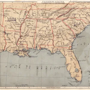
Poster Print > North America > United States of America > New York > New York > Maps
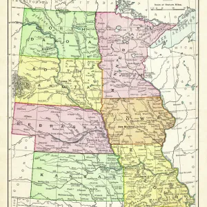
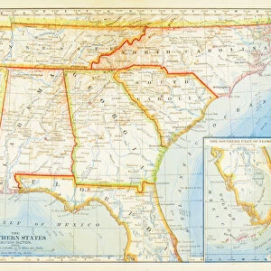
Poster Print : Map of USA Central states 1883


![]()
Poster Prints From Fine Art Storehouse
Map of USA Central states 1883
The Eclectic Elementary Geography by Van Antwerp, Bragg & C0 / Cincinnati -New York 1883
Unleash your creativity and transform your space into a visual masterpiece!
THEPALMER
Media ID 18357187
18x24 inch Poster Print
Step back in time with our vintage Map of USA Central States 1883 print from ThePalmer's Eclectic Elementary Geography by Van Antwerp, Bragg & Co. This beautiful fine art print, published in Cincinnati-New York 1883, offers a captivating glimpse into the geography of the United States over a century ago. With intricate detail and authentic antique charm, this poster print adds a unique and educational touch to any room in your home or office. Travel back in time and explore the history of our country with this captivating piece of Americana.
Poster prints are budget friendly enlarged prints in standard poster paper sizes. Printed on 150 gsm Matte Paper for a natural feel and supplied rolled in a tube. Great for framing and should last many years. To clean wipe with a microfiber, non-abrasive cloth or napkin. Our Archival Quality Photo Prints and Fine Art Paper Prints are printed on higher quality paper and the choice of which largely depends on your budget.
Poster prints are budget friendly enlarged prints in standard poster paper sizes (A0, A1, A2, A3 etc). Whilst poster paper is sometimes thinner and less durable than our other paper types, they are still ok for framing and should last many years. Our Archival Quality Photo Prints and Fine Art Paper Prints are printed on higher quality paper and the choice of which largely depends on your budget.
Estimated Product Size is 61.6cm x 46.3cm (24.3" x 18.2")
These are individually made so all sizes are approximate
Artwork printed orientated as per the preview above, with landscape (horizontal) orientation to match the source image.
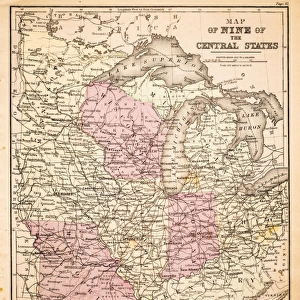
FEATURES IN THESE COLLECTIONS
> Fine Art Storehouse
> Map
> Historical Maps
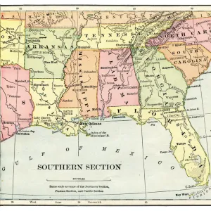
> Fine Art Storehouse
> Map
> USA Maps
> Maps and Charts
> Related Images
> North America
> United States of America
> Maps
> North America
> United States of America
> New York
> New York
> Maps
> North America
> United States of America
> New York
> Related Images
EDITORS COMMENTS
This print showcases a remarkable piece of history, the "Map of USA Central states 1883". Taken from "The Eclectic Elementary Geography" by Van Antwerp, Bragg & C0 and published in Cincinnati-New York in 1883, this vintage map offers a fascinating glimpse into the past. The intricate details and vibrant colors bring to life the geography of America's heartland during that era. As we explore this snapshot from Fine Art Storehouse, we are transported back to a time when cartography was an art form. Every line and contour on this map tells a story of exploration, settlement, and progress. From the mighty Mississippi River winding its way through fertile plains to the majestic Rocky Mountains standing tall against vast prairies - each feature is meticulously depicted with precision. This particular print captures not only geographical information but also serves as a historical artifact. It allows us to understand how people perceived their surroundings over a century ago. As we examine it closely, we can almost feel the excitement and curiosity that must have accompanied those who embarked on journeys across these central states. "The Map of USA Central states 1883" by THEPALMER is more than just an image; it represents our collective heritage and reminds us of our connection to the land beneath our feet. Whether you're an avid historian or simply appreciate fine artistry, this print is sure to captivate your imagination while providing valuable insights into America's rich past.
MADE IN THE USA
Safe Shipping with 30 Day Money Back Guarantee
FREE PERSONALISATION*
We are proud to offer a range of customisation features including Personalised Captions, Color Filters and Picture Zoom Tools
SECURE PAYMENTS
We happily accept a wide range of payment options so you can pay for the things you need in the way that is most convenient for you
* Options may vary by product and licensing agreement. Zoomed Pictures can be adjusted in the Basket.