Poster Print > Europe > United Kingdom > Northern Ireland > Maps
Poster Print : Map showing the British Control over India


![]()
Poster Prints From Fine Art Finder
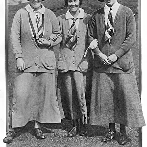
Map showing the British Control over India
3523302 Map showing the British Control over India; (add.info.: Map showing the British Control over India. Dated 19th Century); Universal History Archive/UIG
Media ID 38348388
© Universal History Archive/UIG / Bridgeman Images
British Empire British Rule Control Distance
18x24 inch Poster Print
"Step back in time with our stunning Poster Print from the Media Storehouse range, featuring "Map showing the British Control over India" by Bridgeman Images from Fine Art Finder. This captivating print showcases a detailed illustration of British colonial rule in India during the 19th century, offering a fascinating glimpse into history. Perfect for anyone interested in geography, politics, or vintage art, this poster is sure to make a statement in any room."
Poster prints are budget friendly enlarged prints in standard poster paper sizes. Printed on 150 gsm Matte Paper for a natural feel and supplied rolled in a tube. Great for framing and should last many years. To clean wipe with a microfiber, non-abrasive cloth or napkin. Our Archival Quality Photo Prints and Fine Art Paper Prints are printed on higher quality paper and the choice of which largely depends on your budget.
Poster prints are budget friendly enlarged prints in standard poster paper sizes (A0, A1, A2, A3 etc). Whilst poster paper is sometimes thinner and less durable than our other paper types, they are still ok for framing and should last many years. Our Archival Quality Photo Prints and Fine Art Paper Prints are printed on higher quality paper and the choice of which largely depends on your budget.
Estimated Product Size is 61.6cm x 46.3cm (24.3" x 18.2")
These are individually made so all sizes are approximate
Artwork printed orientated as per the preview above, with landscape (horizontal) orientation to match the source image.
FEATURES IN THESE COLLECTIONS
> Fine Art Finder
> Artists
> Unknown photographer
> Asia
> India
> Related Images
> Europe
> Republic of Ireland
> Maps
> Europe
> United Kingdom
> Maps
> Europe
> United Kingdom
> Northern Ireland
> Maps
> Europe
> United Kingdom
> Northern Ireland
> Posters
> Europe
> United Kingdom
> Northern Ireland
> Related Images
> Maps and Charts
> British Empire Maps
> Maps and Charts
> India
EDITORS COMMENTS
This historical map print showcases the extent of British control over India in the 19th century, highlighting the vast empire that once spanned across Asia. The intricate cartography and detailed key provide a glimpse into the power dynamics of the time, illustrating how the British Empire exerted its influence over Indian territories.
The map serves as a reminder of Britain's imperial past and its impact on shaping global history. It symbolizes an era when colonial powers dominated regions far beyond their own borders, leaving a lasting legacy that continues to shape geopolitical relationships today.
Through this visual representation, viewers are transported back in time to an era of exploration, conquest, and exploitation. The lines demarcating British-controlled areas evoke a sense of authority and dominance, reflecting the complex web of political alliances and conflicts that defined this period.
As we reflect on this map showing British control over India, we are reminded of the importance of understanding our shared history and its implications for our present-day world. It is through studying such artifacts that we can gain insights into how empires rise and fall, leaving behind legacies that continue to shape societies centuries later.
MADE IN THE USA
Safe Shipping with 30 Day Money Back Guarantee
FREE PERSONALISATION*
We are proud to offer a range of customisation features including Personalised Captions, Color Filters and Picture Zoom Tools
SECURE PAYMENTS
We happily accept a wide range of payment options so you can pay for the things you need in the way that is most convenient for you
* Options may vary by product and licensing agreement. Zoomed Pictures can be adjusted in the Basket.