Pillow > Asia > India > Maps
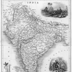
Pillow : Map of India in 1750. (print)
![]()

Home Decor From Fine Art Finder
Map of India in 1750. (print)
7420059 Map of India in 1750. (print); (add.info.: Map of India in 1750. From the book Outline of History by H.G. Wells, published 1920.); Photo © Ken Welsh. All rights reserved 2024
Media ID 38412880
© © Ken Welsh. All rights reserved 2024 / Bridgeman Images
Ageing Chart Diagram Graph Run Down 18th Centuries Asiae Geographer
18"x18" (46x46cm) Pillow
18"x18" (46x46cm) Faux Suede Pillow with a plush soft feel. Your choice of image fills the front, with a stone colored faux suede back. Flat sewn concealed white zip.
Accessorise your space with decorative, soft pillows
Estimated Product Size is 45.7cm x 45.7cm (18" x 18")
These are individually made so all sizes are approximate
Artwork printed orientated as per the preview above, with landscape (horizontal) or portrait (vertical) orientation to match the source image.
FEATURES IN THESE COLLECTIONS
> Asia
> India
> Related Images
> Maps and Charts
> Early Maps
> Maps and Charts
> India
> Maps and Charts
> Related Images
EDITORS COMMENTS
This stunning print of a Map of India in 1750 offers a glimpse into the intricate cartography of the past. Created by an unknown geographer and engraver, this historical map from the 18th century showcases the detailed boundaries and regions of India during that time.
The black and white aesthetic adds to the vintage charm of this piece, highlighting its age and historical significance. The aging quality of the print gives it a sense of authenticity, as if it has weathered centuries to tell its story.
As we study this map, we can imagine the explorers and travelers who relied on such charts to navigate through unfamiliar territories. Each line and symbol on this map represents a piece of history, capturing the essence of India in 1750.
From bustling cities to remote villages, every corner of India is meticulously depicted on this map. It serves as a reminder of how far cartography has come since then, yet still holds value as a snapshot in time.
Whether you are a history buff or simply appreciate fine art, this Map of India in 1750 is sure to spark curiosity and admiration for the rich tapestry that is Indian geography. Let yourself be transported back in time with this print by © Ken Welsh from Fine Art Finder.
MADE IN THE USA
Safe Shipping with 30 Day Money Back Guarantee
FREE PERSONALISATION*
We are proud to offer a range of customisation features including Personalised Captions, Color Filters and Picture Zoom Tools
SECURE PAYMENTS
We happily accept a wide range of payment options so you can pay for the things you need in the way that is most convenient for you
* Options may vary by product and licensing agreement. Zoomed Pictures can be adjusted in the Basket.


