Photographic Print > Europe > United Kingdom > England > London > Towns > Pentonville
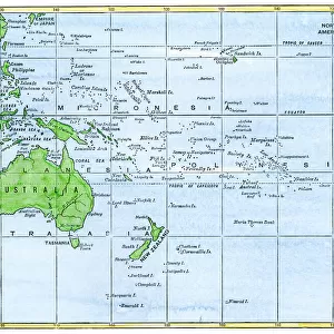
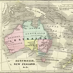
Photographic Print : Map of Australia and New Zealand Drawn and engraved by J Archer Pentonville London c 1830


![]()
Photo Prints from Universal Images Group (UIG)
Map of Australia and New Zealand Drawn and engraved by J Archer Pentonville London c 1830
Universal Images Group (UIG) manages distribution for many leading specialist agencies worldwide
Media ID 20165255
© Universal Images Group
Australia Color Colour Mapmaking New Zealand Welsh
10"x8" Photo Print
Step back in time with our exquisite collection of historical prints from Universal History Archive. This beautiful Map of Australia and New Zealand, drawn and engraved by J. Archer in Pentonville, London around 1830, is a fascinating glimpse into the cartographic history of the region. With intricate detail and authentic antique charm, this print is a must-have for history enthusiasts, geography buffs, and decorators seeking a unique and educational addition to their space. Bring the past into the present with the timeless beauty of our Media Storehouse range of Photographic Prints.
Photo prints are produced on Kodak professional photo paper resulting in timeless and breath-taking prints which are also ideal for framing. The colors produced are rich and vivid, with accurate blacks and pristine whites, resulting in prints that are truly timeless and magnificent. Whether you're looking to display your prints in your home, office, or gallery, our range of photographic prints are sure to impress. Dimensions refers to the size of the paper in inches.
Our Photo Prints are in a large range of sizes and are printed on Archival Quality Paper for excellent colour reproduction and longevity. They are ideal for framing (our Framed Prints use these) at a reasonable cost. Alternatives include cheaper Poster Prints and higher quality Fine Art Paper, the choice of which is largely dependant on your budget.
Estimated Product Size is 25.4cm x 20.3cm (10" x 8")
These are individually made so all sizes are approximate
Artwork printed orientated as per the preview above, with landscape (horizontal) or portrait (vertical) orientation to match the source image.
FEATURES IN THESE COLLECTIONS
> Europe
> United Kingdom
> England
> London
> Towns
> Pentonville
> Maps and Charts
> Early Maps
> Maps and Charts
> Related Images
> Oceania
> Australia
> Related Images
> Oceania
> New Zealand
> Maps
> Oceania
> New Zealand
> Related Images
> Universal Images Group (UIG)
> History
> Historical Maps
EDITORS COMMENTS
This print showcases a remarkable piece of cartographic artistry from the early 19th century. The "Map of Australia and New Zealand Drawn and engraved by J Archer Pentonville London c 1830" is a horizontal, color illustration that takes us on a journey through time to explore the geographical wonders of these two distant lands. With its vibrant hues and intricate details, this antique map offers a glimpse into the historical significance of Australia and New Zealand. Created by Welsh mapmaker J Archer in Pentonville, London, this masterpiece reflects his meticulous craftsmanship and dedication to accuracy. As we delve into the map's intricacies, we are transported back to an era when exploration was at its peak. Each contour line represents not only physical geography but also tells stories of discovery and adventure. From sprawling coastlines to majestic mountain ranges, every element has been carefully etched onto this timeless canvas. The Map of Australia and New Zealand serves as a testament to humanity's thirst for knowledge about our world. It reminds us that even in an age without satellites or GPS technology, individuals like J Archer possessed an innate ability to capture the essence of vast territories with precision. Today, as we gaze upon this extraordinary artifact preserved by Universal Images Group (UIG), let it inspire us to appreciate both the beauty found within nature's boundaries and humankind's unwavering curiosity about our planet's past.
MADE IN THE USA
Safe Shipping with 30 Day Money Back Guarantee
FREE PERSONALISATION*
We are proud to offer a range of customisation features including Personalised Captions, Color Filters and Picture Zoom Tools
SECURE PAYMENTS
We happily accept a wide range of payment options so you can pay for the things you need in the way that is most convenient for you
* Options may vary by product and licensing agreement. Zoomed Pictures can be adjusted in the Cart.