Photographic Print > Europe > France > Canton > Landes
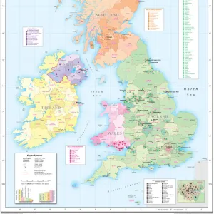
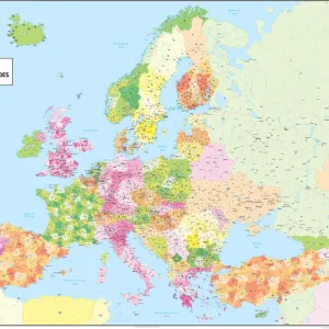
Photographic Print : Childrens Political Europe Map


![]()
Photo Prints From Map Marketing
Childrens Political Europe Map
A Political map of Europe designed for school children. Based on the Lambert Conformal Conic projection, the Europe map covers the whole of the continent from northern Africa to Norwayaes North Cape and from the Azores to the Caspian Sea. The map clearly marks each country in a different colour and shows all capitals and major cities in five different population bands. It also includes a handy map insert detailing current and potential future EU member countries. The key features a useful graph detailing the top five European countries by population and by land mass
Media ID 19950521
© Map Marketing Ltd
10"x8" Photo Print
Photo prints are produced on Kodak professional photo paper resulting in timeless and breath-taking prints which are also ideal for framing. The colors produced are rich and vivid, with accurate blacks and pristine whites, resulting in prints that are truly timeless and magnificent. Whether you're looking to display your prints in your home, office, or gallery, our range of photographic prints are sure to impress. Dimensions refers to the size of the paper in inches.
Our Photo Prints are in a large range of sizes and are printed on Archival Quality Paper for excellent colour reproduction and longevity. They are ideal for framing (our Framed Prints use these) at a reasonable cost. Alternatives include cheaper Poster Prints and higher quality Fine Art Paper, the choice of which is largely dependant on your budget.
Estimated Product Size is 25.4cm x 20.3cm (10" x 8")
These are individually made so all sizes are approximate
Artwork printed orientated as per the preview above, with landscape (horizontal) orientation to match the source image.
FEATURES IN THESE COLLECTIONS
> Europe
> France
> Canton
> Landes
> Maps and Charts
> Related Images
MADE IN THE USA
Safe Shipping with 30 Day Money Back Guarantee
FREE PERSONALISATION*
We are proud to offer a range of customisation features including Personalised Captions, Color Filters and Picture Zoom Tools
SECURE PAYMENTS
We happily accept a wide range of payment options so you can pay for the things you need in the way that is most convenient for you
* Options may vary by product and licensing agreement. Zoomed Pictures can be adjusted in the Basket.