Photographic Print > Asia > Japan > Maps
Photographic Print : Map of China and Japan 1896


![]()
Photo Prints From Fine Art Storehouse
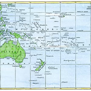
Map of China and Japan 1896
Andres Allgemeiner Handatlas - Bielefeld und Leipzig 1896
Unleash your creativity and transform your space into a visual masterpiece!
THEPALMER
Media ID 18356845
12"x8" Photo Print
Step back in time with our exquisite 'Map of China and Japan' print from THEPALMER's Fine Art Storehouse collection. This captivating vintage map, originally published in Andres Allgemeiner Handatlas in 1896, showcases intricate detail and historical accuracy. Transport yourself to a bygone era as you explore the borders and territories of China and Japan during this pivotal period in world history. Perfect for adding a unique touch to your home or office decor, or as a thoughtful gift for the history or cartography enthusiast in your life.
Photo prints are produced on Kodak professional photo paper resulting in timeless and breath-taking prints which are also ideal for framing. The colors produced are rich and vivid, with accurate blacks and pristine whites, resulting in prints that are truly timeless and magnificent. Whether you're looking to display your prints in your home, office, or gallery, our range of photographic prints are sure to impress. Dimensions refers to the size of the paper in inches.
Our Photo Prints are in a large range of sizes and are printed on Archival Quality Paper for excellent colour reproduction and longevity. They are ideal for framing (our Framed Prints use these) at a reasonable cost. Alternatives include cheaper Poster Prints and higher quality Fine Art Paper, the choice of which is largely dependant on your budget.
Estimated Product Size is 30.5cm x 20.3cm (12" x 8")
These are individually made so all sizes are approximate
Artwork printed orientated as per the preview above, with landscape (horizontal) orientation to match the source image.
FEATURES IN THESE COLLECTIONS
> Asia
> Japan
> Related Images
> Maps and Charts
> Related Images
EDITORS COMMENTS
This print showcases a vintage map of China and Japan from the year 1896, sourced from Andres Allgemeiner Handatlas - Bielefeld und Leipzig. With intricate details and exquisite craftsmanship, this piece takes us back in time to an era when cartography was both art and science. The map itself is a testament to the skill and dedication of its creator, THEPALMER. Every contour line, river system, mountain range, and city is meticulously depicted with precision and accuracy. The delicate shading techniques employed bring depth to the landforms while highlighting the rich cultural heritage of these two nations. China's vast expanse unfolds before our eyes as we explore its provinces, major cities like Beijing and Shanghai, ancient landmarks such as the Great Wall of China, and iconic rivers like the Yangtze. Meanwhile, Japan emerges as an archipelago bursting with character—its islands interconnected by bridges of knowledge that have shaped its history. As we gaze upon this historical artifact preserved through time on fine art paper at Fine Art Storehouse, we are reminded not only of how far cartography has evolved but also how it continues to shape our understanding of the world. This stunning print serves as a window into an era long gone yet forever etched in our collective memory—a tribute to human curiosity and exploration that transcends borders. Whether displayed in a study or adorning a living room wall, this Map of China and Japan 1896 invites us on a journey through space and time—an invitation impossible
MADE IN THE USA
Safe Shipping with 30 Day Money Back Guarantee
FREE PERSONALISATION*
We are proud to offer a range of customisation features including Personalised Captions, Color Filters and Picture Zoom Tools
SECURE PAYMENTS
We happily accept a wide range of payment options so you can pay for the things you need in the way that is most convenient for you
* Options may vary by product and licensing agreement. Zoomed Pictures can be adjusted in the Basket.