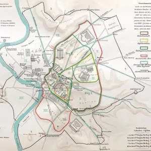
Photographic Print > Europe > Italy > Lazio > Rome
Photographic Print : Map of ancient Rome


![]()
Photo Prints From Fine Art Storehouse
Map of ancient Rome
Illustration from 19th century
Unleash your creativity and transform your space into a visual masterpiece!
clu
Media ID 18298741
10"x8" Photo Print
Step back in time with our exquisite 'Map of Ancient Rome' print from the Media Storehouse Fine Art collection. This stunning 19th-century illustration by artist clu transports you to the heart of the ancient world. Explore the intricate details of the Roman Empire's vast territories, from the Italian peninsula to the far reaches of its dominion. A captivating addition to any home or office, this print brings history to life and makes a thoughtful gift for history enthusiasts and art lovers alike.
Photo prints are produced on Kodak professional photo paper resulting in timeless and breath-taking prints which are also ideal for framing. The colors produced are rich and vivid, with accurate blacks and pristine whites, resulting in prints that are truly timeless and magnificent. Whether you're looking to display your prints in your home, office, or gallery, our range of photographic prints are sure to impress. Dimensions refers to the size of the paper in inches.
Our Photo Prints are in a large range of sizes and are printed on Archival Quality Paper for excellent colour reproduction and longevity. They are ideal for framing (our Framed Prints use these) at a reasonable cost. Alternatives include cheaper Poster Prints and higher quality Fine Art Paper, the choice of which is largely dependant on your budget.
Estimated Image Size (if not cropped) is 25.4cm x 18.8cm (10" x 7.4")
Estimated Product Size is 25.4cm x 20.3cm (10" x 8")
These are individually made so all sizes are approximate
Artwork printed orientated as per the preview above, with landscape (horizontal) orientation to match the source image.
FEATURES IN THESE COLLECTIONS
> Europe
> Italy
> Lazio
> Rome
> Maps and Charts
> Early Maps
> Maps and Charts
> Related Images
EDITORS COMMENTS
This print showcases a mesmerizing "Map of ancient Rome" that takes us on a journey back in time to the illustrious days of the Roman Empire. Illustrated during the 19th century, this intricate artwork by clu is an exquisite depiction of one of history's most iconic cities. The map itself is a testament to the meticulous attention to detail and artistic skill employed by its creator. Every street, building, and landmark has been intricately drawn with precision, offering viewers an immersive experience into ancient Rome's grandeur. The vibrant colors used in this illustration bring life to each corner of the city, allowing us to visualize how it may have looked centuries ago. As we explore this historical masterpiece, our eyes are drawn towards notable landmarks such as the Colosseum, Pantheon, and Roman Forum. These architectural marvels stand proudly amidst bustling streets filled with chariots and pedestrians going about their daily lives. It is through these visual cues that we can truly appreciate the magnificence and scale of ancient Rome. Whether you are an art enthusiast or history buff, this print serves as both a visually stunning piece for your collection and an educational tool that transports you back in time. Displaying it within your home or office will undoubtedly spark conversations about one of civilization's greatest achievements - Ancient Rome!
MADE IN THE USA
Safe Shipping with 30 Day Money Back Guarantee
FREE PERSONALISATION*
We are proud to offer a range of customisation features including Personalised Captions, Color Filters and Picture Zoom Tools
SECURE PAYMENTS
We happily accept a wide range of payment options so you can pay for the things you need in the way that is most convenient for you
* Options may vary by product and licensing agreement. Zoomed Pictures can be adjusted in the Basket.