Photo Mug > Universal Images Group (UIG) > Universal Images Group > Satellite and Aerial > Planet Observer 4
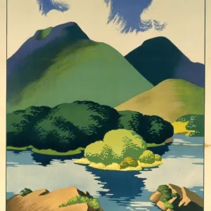
Photo Mug : Ireland, Relief Map With Border and Mask


![]()
Home Decor from Universal Images Group (UIG)
Ireland, Relief Map With Border and Mask
Relief map of Ireland (with border and mask). This image was compiled from data acquired by landsat 5 & 7 satellites combined with elevation data
Universal Images Group (UIG) manages distribution for many leading specialist agencies worldwide
Media ID 9619115
© Planet Observer/UIG
British Isles Coastline Cork Dublin Ireland Relief Map Shore Satellite View Shannon
Large Photo Mug (15 oz)
Bring a piece of the Emerald Isle into your daily routine with our Media Storehouse Photo Mug featuring a stunning relief map of Ireland. Meticulously crafted from high-quality materials, this mug showcases a detailed and captivating image of Ireland's borders and terrain, derived from satellite data acquired by Landsat 5 & 7. The added mask design adds an authentic touch to this unique mug, making it a perfect gift for anyone who cherishes the beauty of Ireland. Enjoy your favorite beverage while admiring this exquisite representation of the Emerald Isle.
Elevate your coffee or tea experience with our premium white ceramic mug. Its wide, comfortable handle makes drinking easy, and you can rely on it to be both microwave and dishwasher safe. Sold in single units, preview may show both sides of the same mug so you can see how the picture wraps around.
Elevate your coffee or tea experience with our premium white ceramic mug. Its wide, comfortable handle makes drinking easy, and you can rely on it to be both microwave and dishwasher safe. Sold in single units, preview may show both sides of the same mug so you can see how the picture wraps around.
These are individually made so all sizes are approximate
EDITORS COMMENTS
This stunning print captures the intricate details of Ireland's relief map, showcasing its diverse topography and breathtaking natural beauty. Compiled from data acquired by landsat 5 & 7 satellites combined with elevation data, this image offers a unique perspective on the physical geography of Ireland. The border and mask surrounding the relief map add a touch of elegance to this already captivating piece. From Dublin to Cork, Shannon to the shores of Ireland, every contour is meticulously depicted in vibrant colors that bring the landscape to life. As you gaze upon this vertical photograph, you can almost feel yourself transported to Europe's westernmost island. The absence of people allows for an uninterrupted appreciation of Ireland's rugged coastline and rolling hills. This image serves as a testament to the artistry behind cartography and satellite technology. It showcases not only the technical prowess involved in creating such detailed maps but also highlights how photography can be used as a medium for capturing geographical wonders. Whether you are an enthusiast of physical geography or simply appreciate the beauty found in nature's creations, this print will undoubtedly captivate your imagination. Display it proudly in your home or office space as a reminder of Ireland's majestic landscapes and rich history – all captured within one remarkable image.
MADE IN THE USA
Safe Shipping with 30 Day Money Back Guarantee
FREE PERSONALISATION*
We are proud to offer a range of customisation features including Personalised Captions, Color Filters and Picture Zoom Tools
SECURE PAYMENTS
We happily accept a wide range of payment options so you can pay for the things you need in the way that is most convenient for you
* Options may vary by product and licensing agreement. Zoomed Pictures can be adjusted in the Cart.