Home > Asia > Kuwait > Maps
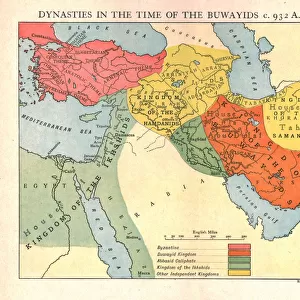
Ottoman Turkish Map of Southern Iraq

![]()
Wall Art and Photo Gifts from Mary Evans Picture Library
Ottoman Turkish Map of Southern Iraq
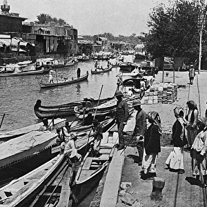
Ottoman Turkish Map of the southern province of Iraq and the territory which is now Kuwait, The area depicted focusses on Basra and the Shatt al-Arab region leading out into the Persian Gulf (lower right hand section of the map) Date: circa 1907
Mary Evans Picture Library makes available wonderful images created for people to enjoy over the centuries
Media ID 7212951
© Mary Evans Picture Library 2015 - https://copyrighthub.org/s0/hub1/creation/maryevans/MaryEvansPictureID/10423435
Arab Basra Gulf Iran Iraq Kuwait Mesopotamia Persia Persian Shatt Southern Ottoman
FEATURES IN THESE COLLECTIONS
EDITORS COMMENTS
This Ottoman Turkish map, dated circa 1907, offers a fascinating glimpse into the historical geography of the southern region of Iraq and the territory that is now Kuwait. The map's focus is primarily on the province of Basra and the strategic Shatt al-Arab region, which leads out into the Persian Gulf. At the time, the Ottoman Empire held significant influence over this area, which was a crucial trade hub between the Mediterranean and the Indian Ocean. The map's intricate details reveal the various cities, towns, and villages that dotted the landscape, including Basra, Umm Qasr, and Amara. The Shatt al-Arab, a major waterway that connects the Tigris and Euphrates rivers to the Persian Gulf, is depicted with remarkable accuracy, highlighting the importance of water transportation in this region. The map also showcases the complex political and administrative divisions of the Ottoman Empire, with various provinces and districts marked out in meticulous detail. The border between the Ottoman territories and those of Persia (Iran) is clearly demarcated, reflecting the ongoing tensions and negotiations between these two powerful empires. The lower right hand section of the map is dominated by the Persian Gulf, with various islands and coastal towns depicted. The map's cartographic precision and rich detail provide valuable insights into the geography, politics, and economic importance of the southern Iraqi region during the late Ottoman period. This map is an essential resource for scholars, historians, and anyone interested in the history of the Middle East, particularly in the context of the Ottoman Empire's influence in the region.
MADE IN THE USA
Safe Shipping with 30 Day Money Back Guarantee
FREE PERSONALISATION*
We are proud to offer a range of customisation features including Personalised Captions, Color Filters and Picture Zoom Tools
SECURE PAYMENTS
We happily accept a wide range of payment options so you can pay for the things you need in the way that is most convenient for you
* Options may vary by product and licensing agreement. Zoomed Pictures can be adjusted in the Cart.