Fraud Blocker Skip to main content

Home > North America > Jamaica > Maps

Maps Collection (#3)

Jamaica is an island nation located in the Caribbean Sea, south of Cuba and west of Haiti

147 Items

Background imageMaps Collection: Port Royal, Jamaica (engraving)

Port Royal, Jamaica (engraving)
7188160 Port Royal, Jamaica (engraving) by English School, (19th century); Private Collection; (add.info.: Port Royal, Jamaica)

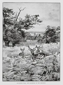
Background imageMaps Collection: Richmond Park and Kingston in the distance (litho)

Richmond Park and Kingston in the distance (litho)
7188365 Richmond Park and Kingston in the distance (litho) by Luker, William (1820-92); Private Collection; (add.info.: Richmond Park and Kingston in the distance)

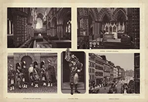
Background imageMaps Collection: Glasgow: Interior Glasgow Cathedral Choir, West; Chancel, Glasgow Cathedral; Highland Military

Glasgow: Interior Glasgow Cathedral Choir, West; Chancel, Glasgow Cathedral; Highland Military Costumes; Highland
7198936 Glasgow: Interior Glasgow Cathedral Choir, West; Chancel, Glasgow Cathedral; Highland Military Costumes; Highland Piper; Jamaica Street (litho) by English School

Background imageMaps Collection: Kingston Bridge (b / w photo)

Kingston Bridge (b / w photo)
7184628 Kingston Bridge (b/w photo) by English Photographer, (19th century); Private Collection; (add.info.: Kingston Bridge)

Background imageMaps Collection: Kingston Church, North (b / w photo)

Kingston Church, North (b / w photo)
7184627 Kingston Church, North (b/w photo) by English Photographer, (19th century); Private Collection; (add.info.: Kingston Church, North)

Background imageMaps Collection: West Indies and Central America, Industries and Communications (colour litho)

West Indies and Central America, Industries and Communications (colour litho)
7169506 West Indies and Central America, Industries and Communications (colour litho) by English School, (20th century); Private Collection; (add.info.: West Indies and Central America)

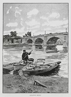
Background imageMaps Collection: Kingston Bridge (litho)

Kingston Bridge (litho)
7188597 Kingston Bridge (litho) by Luker, William (1820-92); Private Collection; (add.info.: Kingston Bridge. Illustration for London City Suburbs As They Are To-day by Percy Fitzgerald)

Background imageMaps Collection: Glasgow: Jamaica Street (litho)

Glasgow: Jamaica Street (litho)
7181087 Glasgow: Jamaica Street (litho) by English School, (19th century); Private Collection; (add.info.: Jamaica Street. Illustration for The Cabinet Album of Glasgow, c 1895)

Background imageMaps Collection: Map of North America (Greenland, Canada, USA, Mexico and the Caribbean Islands: Cuba

Map of North America (Greenland, Canada, USA, Mexico and the Caribbean Islands: Cuba
LRI4706891 Map of North America (Greenland, Canada, USA, Mexico and the Caribbean Islands: Cuba, Haiti, Jamaica, West Indies) (etching, 1730) by Delisle

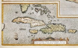
Background imageMaps Collection: The islands of the Greater Antilles and the Lesser Antilles in the Caribbean Sea (map

The islands of the Greater Antilles and the Lesser Antilles in the Caribbean Sea (map
LRI4648655 The islands of the Greater Antilles and the Lesser Antilles in the Caribbean Sea (map, 1500) by Unknown Artist, (16th century); Museo de America, Madrid

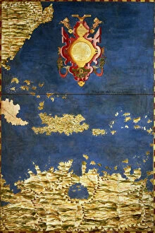
Background imageMaps Collection: Map of Mexico, Cuba, Florida and Jamaica, c. 1567. (mural painting)

Map of Mexico, Cuba, Florida and Jamaica, c. 1567. (mural painting)
LRI4595645 Map of Mexico, Cuba, Florida and Jamaica, c.1567. (mural painting) by Danti, Egnazio (1536-86); Palazzo Vecchio, Florence, Italy; (add.info.: Mexico, Cuba)

Background imageMaps Collection: Map of Mexico and Florida (USA) with the Caribbean Islands (Cuba, Haiti, Jamaica

Map of Mexico and Florida (USA) with the Caribbean Islands (Cuba, Haiti, Jamaica
LRI4707037 Map of Mexico and Florida (USA) with the Caribbean Islands (Cuba, Haiti, Jamaica, Antilles) (etching, 1730) by Delisle

Background imageMaps Collection: Map of Hispaniola (San Domingo, Haiti), West Indies

Map of Hispaniola (San Domingo, Haiti), West Indies. The island is now divided into two separate nations: Haiti to the west (French Creole-speaking)

Background imageMaps Collection: Jamaica, engraving by G. Zuliani taken from Tome I of the 'Newest Atlas'published in Venice in

Jamaica, engraving by G. Zuliani taken from Tome I of the "Newest Atlas"published in Venice in 1778 by
3572559 Jamaica, engraving by G. Zuliani taken from Tome I of the " Newest Atlas" published in Venice in 1778 by Antonio Zatta, Private Collection by Zuliani, G

Background imageMaps Collection: Map of Central America (coloured engraving)

Map of Central America (coloured engraving)
VNK284159 Map of Central America (coloured engraving) by Netherlandish School, (17th century); Vorontsov Palace, Crimea, Ukraine; (add.info)

Background imageMaps Collection: Capture of the Spanish fleet by the Dutch under Admiral Piet Heyn (1578-1629

Capture of the Spanish fleet by the Dutch under Admiral Piet Heyn (1578-1629
STC221816 Capture of the Spanish fleet by the Dutch under Admiral Piet Heyn (1578-1629) off Matanzas, Cuba, 1628, from Newe Welt und Americanische Historien by Johann Ludwig Gottfried

Background imageMaps Collection: Barbados and Jamaica, detail from a map of English Colonies in the Caribbean, pub

Barbados and Jamaica, detail from a map of English Colonies in the Caribbean, pub
STC101838 Barbados and Jamaica, detail from a map of English Colonies in the Caribbean, pub. by Homanns Heirs, Nuremberg, c.1750 (engraving) (detail of 101836) by German School

Background imageMaps Collection: Map of the Caribbean and Venezuela, from the Sala delle Carte Geografiche

Map of the Caribbean and Venezuela, from the Sala delle Carte Geografiche
BEN95488 Map of the Caribbean and Venezuela, from the Sala delle Carte Geografiche (Hall of Geographical Maps) c.1570 (oil on panel) by Danti

Background imageMaps Collection: Map: Island of Jamaica, by G H Swanston, Edinburgh (colour litho)

Map: Island of Jamaica, by G H Swanston, Edinburgh (colour litho)
6004715 Map: Island of Jamaica, by G H Swanston, Edinburgh (colour litho) by English School, (19th century); Private Collection; (add.info.: Island of Jamaica, by G H Swanston, Edinburgh)

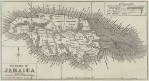
Background imageMaps Collection: Map of the Island of Jamaica (engraving)

Map of the Island of Jamaica (engraving)
1099228 Map of the Island of Jamaica (engraving) by Dower, John (fl.c.1845-55); Private Collection; (add.info.: Map of the Island of Jamaica)

Background imageMaps Collection: Representation of the island of Jamaica. Isolario (map of islands) by Benedetto Bordone

Representation of the island of Jamaica. Isolario (map of islands) by Benedetto Bordone
GIA4784066 Representation of the island of Jamaica. Isolario (map of islands) by Benedetto Bordone. Venice 1547 by Italian School

Background imageMaps Collection: Map of English Colonies in the Caribbean, pub. by Homanns Heirs, Nuremberg, c

Map of English Colonies in the Caribbean, pub. by Homanns Heirs, Nuremberg, c
STC101836 Map of English Colonies in the Caribbean, pub. by Homanns Heirs, Nuremberg, c.1750 (engraving) (see 101837-38 for details) by German School

Background imageMaps Collection: Cuba, Jamaica, Haiti, Puerto Rico (Caribbean) (engraving, 1596)

Cuba, Jamaica, Haiti, Puerto Rico (Caribbean) (engraving, 1596)
LRI4718854 Cuba, Jamaica, Haiti, Puerto Rico (Caribbean) (engraving, 1596) by Mercator, Gerardus (1512-94); Private Collection; (add.info.: Cuba insula, Iamaica, S. Joannis, Is)

Background imageMaps Collection: Hampshire PO12 1 Map

Hampshire PO12 1 Map
Postcode Sector Map of Hampshire PO12 1

Background imageMaps Collection: Renfrewshire PA15 1 Map

Renfrewshire PA15 1 Map
Postcode Sector Map of Renfrewshire PA15 1

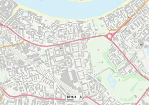
Background imageMaps Collection: Southwark SE16 4 Map

Southwark SE16 4 Map
Postcode Sector Map of Southwark SE16 4

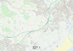
Background imageMaps Collection: Newport NP10 8 Map

Newport NP10 8 Map
Postcode Sector Map of Newport NP10 8

Background imageMaps Collection: Liverpool L1 0 Map

Liverpool L1 0 Map
Postcode Sector Map of Liverpool L1 0

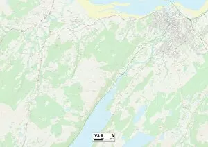
Background imageMaps Collection: Highland IV3 8 Map

Highland IV3 8 Map
Postcode Sector Map of Highland IV3 8

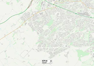
Background imageMaps Collection: South Lanarkshire G75 8 Map

South Lanarkshire G75 8 Map
Postcode Sector Map of South Lanarkshire G75 8

Background imageMaps Collection: Glasgow G1 4 Map

Glasgow G1 4 Map
Postcode Sector Map of Glasgow G1 4

Background imageMaps Collection: Tower Hamlets E1 3 Map

Tower Hamlets E1 3 Map
Postcode Sector Map of Tower Hamlets E1 3

Background imageMaps Collection: Croydon CR7 7 Map

Croydon CR7 7 Map
Postcode Sector Map of Croydon CR7 7

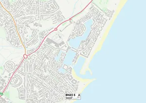
Background imageMaps Collection: Eastbourne BN23 5 Map

Eastbourne BN23 5 Map
Postcode Sector Map of Eastbourne BN23 5

Background imageMaps Collection: BS Bristol, BS2 8

BS Bristol, BS2 8
BS2 8

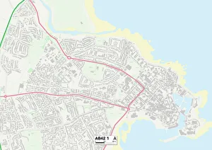
Background imageMaps Collection: Aberdeenshire AB42 1 Map

Aberdeenshire AB42 1 Map
Postcode Sector Map of Aberdeenshire AB42 1

Background imageMaps Collection: Antique illustration from US navy and army: Haiti, Jamaica and Puerto Rico Map

Antique illustration from US navy and army: Haiti, Jamaica and Puerto Rico Map

Background imageMaps Collection: Map of the West Indies and Central America, 1902. Creator: Unknown

Map of the West Indies and Central America, 1902. Creator: Unknown
Map of the West Indies and Central America, 1902. Showing the various Caribbean islands, and the north coast of South America. From The Century Atlas of the World. [John Walker & Co, Ltd

Background imageMaps Collection: Geographical map of the West Indies

Geographical map of the West Indies. Map of the Caribbean, showing the Isthmus of Panama, the north coast of South America, the Greater Antilles, and various other islands

Background imageMaps Collection: Jamaica country map

Jamaica country map
2011 edition

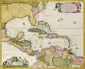
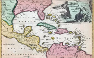
Background imageMaps Collection: 18th century map of Central America and the Gulf of Mexico engraved by Balthasar Ruyter

18th century map of Central America and the Gulf of Mexico engraved by Balthasar Ruyter

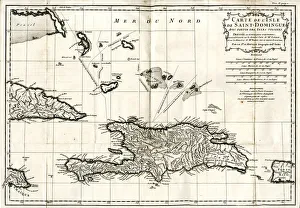
Background imageMaps Collection: Map Of Jamaica Circa. 1760. From 'Atlas De Toutes Les Parties Connues Du Globe Terrestre 'By

Map Of Jamaica Circa. 1760. From "Atlas De Toutes Les Parties Connues Du Globe Terrestre "By Cartographer
Map Of Jamaica Circa.1760. From " Atlas De Toutes Les Parties Connues Du Globe Terrestre " By Cartographer Rigobert Bonne. Published Geneva Circa. 1760

Background imageMaps Collection: Map of Jamaica

Map of Jamaica

Background imageMaps Collection: Map of Jamaica, Port Royal before earthquake in 1692, From Journal by Edward Barlow

Map of Jamaica, Port Royal before earthquake in 1692, From Journal by Edward Barlow
Cartography, Jamaica, 17th century. Port Royal before the earthquake in 1692. From the Journal by Edward Barlow

Background imageMaps Collection: Pleasure routes across the Atlantic

Pleasure routes across the Atlantic
Pleasure routes in the wake of Columbus - mapped in the manner of the old cartographers: ocean cruises to the Caribbean and the romantic islands of the West Indies, once the haunt of the buccaneers

Background imageMaps Collection: ORTELIUS, Abraham (1527-1598). Theatrum Orbis Terrarum

ORTELIUS, Abraham (1527-1598). Theatrum Orbis Terrarum. 1570. It is considered to be the first modern atlas. Map of the Caribbean Sea with the islands of Cuba, Cayman Islands

Background imageMaps Collection: MAP: JAMAICA, 1764. French map of Port Royal, Jamaica, by Jacques Nicolas Bellin

MAP: JAMAICA, 1764. French map of Port Royal, Jamaica, by Jacques Nicolas Bellin, published 1764

Background imageMaps Collection: MAP: JAMAICA, 1755. British map of Jamaica from surveys by Mr. Sheffield, drawn by Patrick Browne

MAP: JAMAICA, 1755. British map of Jamaica from surveys by Mr. Sheffield, drawn by Patrick Browne, 1755


All Professionally Made to Order for Quick Shipping


-

Maps Collection

Jamaica is an island nation located in the Caribbean Sea, south of Cuba and west of Haiti, and is the third-largest island in the Greater Antilles region and has a population of approximately 2.9 million people. Jamaica is known for its lush tropical landscape, white-sand beaches, vibrant culture, and rich history. The country's topography consists mostly of mountains with some coastal plains and valleys. Its highest point is Blue Mountain Peak at 7402 feet above sea level. Jamaica has a long history as an important trading post between Europe and the Americas, making it a major hub for commerce throughout its history. Today it continues to be an important tourist destination due to its stunning natural beauty and unique culture that blends African, European, Indian, Chinese, Middle Eastern influences into one dynamic mix that makes Jamaica truly unique among Caribbean nations.
+

Our beautiful Wall Art and Photo Gifts include Framed Prints, Photo Prints, Poster Prints, Canvas Prints, Jigsaw Puzzles, Metal Prints and so much more

Media Storehouse offers a collection of maps of Jamaica North America that are perfect for wall art and framed prints. Our collection includes vintage maps dating back to the 18th century, as well as more modern designs. These maps showcase the geography, topography, and political boundaries of Jamaica in great detail. The Maps of Jamaica North America collection is an excellent resource for historians, cartographers, and anyone interested in Jamaican history or geography. The detailed depictions provide insight into how the island has changed over time and how it fits into the larger context of North America. The high-quality prints are available in various sizes to suit different spaces and preferences. They make great additions to homes, offices, schools, libraries or any other space where historical or geographical knowledge is appreciated. Overall our collection provides a unique opportunity to explore Jamaica's past through its cartographic representation while adding aesthetic value to any room they adorn.
+

What are Maps of Jamaica North America art prints?

Maps of Jamaica North America art prints are high-quality reproductions of antique and contemporary maps depicting the island nation of Jamaica. These prints showcase the intricate details, vibrant colors, and historical significance of various maps that have been created over time by cartographers and artists. These art prints offer a unique way to explore the geography, topography, landmarks, and cultural heritage of Jamaica. They can be used for educational purposes in classrooms or as decorative pieces in homes or offices. Some popular examples include vintage maps from the 18th century that show plantations, ports, and towns; modern road maps with tourist attractions highlighted; or satellite images that reveal natural features like mountains and rivers. Whether you are a history buff interested in tracing the evolution of Jamaican cartography or simply looking for an eye-catching piece to adorn your walls, Maps of Jamaica North America art prints provide a fascinating glimpse into this beautiful Caribbean country.
+

What Maps of Jamaica North America art prints can I buy from Media Storehouse?

We offer a wide range of Maps of Jamaica North America art prints that you can buy. These maps are available in different sizes and styles, including vintage, antique, and modern designs. You can choose from a variety of map types such as topographical, political, physical or satellite imagery. The collection includes detailed maps showing the cities and towns of Jamaica along with their major landmarks and attractions. Some maps also highlight the country's natural features like rivers, mountains, forests and beaches. Whether you're looking for a decorative piece to hang on your wall or an educational tool for your classroom or office space, we have something to suit every taste and need. Their high-quality prints are produced using state-of-the-art printing technology to ensure vibrant colors and sharp details. So if you want to explore the beauty of Jamaica through its geography or simply add some Caribbean flair to your decor, check out our selection of Maps of Jamaica North America art prints today.
+

How do I buy Maps of Jamaica North America art prints?

To buy Maps of Jamaica North America art prints from Media Storehouse, you can browse our extensive collection of high-quality prints online. Simply search for "Maps of Jamaica North America" in the search bar on our website and select the print that you like best. Once you have found your desired print, choose the size and framing options that suit your preferences. We offer a range of framing options to complement your chosen print, including black or white frames, canvas wraps, and unframed prints. You can also choose between different paper types such as glossy or matte finishes. When purchasing your Maps of Jamaica North America art print from Media Storehouse, be sure to check out any current promotions or discounts they may be offering. Additionally, keep an eye out for new arrivals and featured collections for more inspiration on decorating your home with beautiful artwork.
+

How much do Maps of Jamaica North America art prints cost?

The cost of Maps of Jamaica North America art prints varies depending on the size, quality, and type of print. There are different options available such as canvas prints, framed prints, and poster prints. The price range can start from a few dollars for small poster prints to hundreds or even thousands of dollars for large canvas or framed prints. The cost also depends on where you purchase the print from as different retailers may have varying prices. We offer a wide selection of Maps of Jamaica North America art prints at competitive prices. We offer high-quality reproductions that capture every detail and color accurately. Whether you're looking for a vintage map or a contemporary design, they have something to suit all tastes and budgets. Our collection includes maps in various sizes and formats so that you can choose what best suits their needs without breaking the bank.
+

How will my Maps of Jamaica North America art prints be delivered to me?

Your Maps of Jamaica North America art prints will be delivered to you in a safe and secure manner by Media Storehouse. The company takes great care in packaging your order to ensure that it arrives at your doorstep undamaged. Your art prints will be rolled up and placed inside a sturdy cardboard tube, which is then sealed with tape to prevent any moisture or dust from entering. Media Storehouse uses reliable shipping carriers who offer tracking services so that you can monitor the progress of your delivery. Once your order has been dispatched, you will receive an email notification containing the tracking information. Rest assured that Media Storehouse values customer satisfaction and strives to provide excellent service throughout the entire ordering process. You can expect your Maps of Jamaica North America art prints to arrive promptly and in pristine condition, ready for framing or display as desired.