Fraud Blocker Skip to main content

Mouse Mat > MapSeeker > Maps of Europe > Old Maps of Europe and Small Islands of

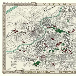
Mouse Mat : Two Maps of Central Europe that illustrate how the region looked during the years of conflict between AD 1804 and AD 1809

Two Maps of Central Europe that illustrate how the region looked during the years of conflict between AD 1804 and AD 1809


We accept all major credit cards


Photo Prints
Jigsaw Puzzles
Poster Prints
Canvas Prints
Fine Art Prints
Metal Prints
Home Decor
Background Images


MapSeeker

Home Decor From MapSeeker

Two Maps of Central Europe that illustrate how the region looked during the years of conflict between AD 1804 and AD 1809

EHIST012

Welcome to the Mapseeker Image library and enter an historic gateway to one of the largest on-line collections of Historic Maps, Nostalgic Views, Vista's and Panorama's from a World gone by.

Media ID 20348276

Europe Europe Map Map Of Europe


Mouse Pad

Standard Size Mouse Pad 7.75" x 9..25". High density Neoprene w linen surface. Easy to clean, stain resistant finish. Rounded corners.

Archive quality photographic print in a durable wipe clean mouse mat with non slip backing. Works with all computer mice

Estimated Product Size is 23.7cm x 20.2cm (9.3" x 8")

These are individually made so all sizes are approximate

Artwork printed orientated as per the preview above, with landscape (horizontal) or portrait (vertical) orientation to match the source image.


MADE IN THE USA
Safe Shipping with 30 Day Money Back Guarantee

FREE PERSONALISATION*
We are proud to offer a range of customisation features including Personalised Captions, Color Filters and Picture Zoom Tools

SECURE PAYMENTS
We happily accept a wide range of payment options so you can pay for the things you need in the way that is most convenient for you

* Options may vary by product and licensing agreement. Zoomed Pictures can be adjusted in the Basket.


public
Made in USA
thumb_up
Professional quality finish
diamond
Made with high-grade materials
inventory_2
Carefully packed to aid safe arrival


Related Images


George Bradshaws Plan of Vienna, Austria 1896
Cityscape Map of York 2017
Map of England and Wales as it appeared after the Accession of The House of Tuder
Map of England and Wales as it appeared before the Norman Conquest
Map of Europe showing how it appeared at the time of the Accession of The Emperor Charles V in AD 1519
Old Map Titled "Travelling on the Liverpool to Manchester Railway 1830"
Pictorial History Map of England and Wales 1963
Old Map of the Counties of Stirling and Clackmannan from the Philips Handy Atlas of 1882
Old Map of the County of Inverness from the Philips Handy Atlas of 1882
Map of England and Wales as it appeared in the Reign of Edward I
Old Map of Edinburgh Scotland 1851 by John Tallis
Old County Map of Buckinghamshire 1648 by Johan Blaeu from the Atlas Novus

+

Shipping

+

Choices

+

Reviews

+

Guaranteed