Mouse Mat > Europe > United Kingdom > Scotland > Edinburgh > Edinburgh
Mouse Mat : Map of Persia, 1902. Creator: Unknown


![]()
Home Decor From Heritage Images
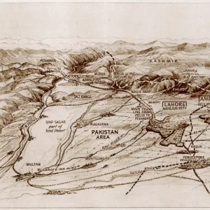
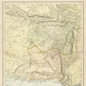
Map of Persia, 1902. Creator: Unknown
Map of Persia, 1902. Showing Persia, Afghanistan and Baluchistan, and the Persian Gulf. From The Century Atlas of the World. [John Walker & Co, Ltd. London, 1902]
Heritage Images features heritage image collections
Media ID 15512430
© The Print Collector / Heritage-Images
Afghanistan Baluchistan Edinburgh Geographical Institute Iran Pakistan Persia Persian Gulf
Mouse Pad
Standard Size Mouse Pad 7.75" x 9..25". High density Neoprene w linen surface. Easy to clean, stain resistant finish. Rounded corners.
Archive quality photographic print in a durable wipe clean mouse mat with non slip backing. Works with all computer mice
Estimated Image Size (if not cropped) is 23.7cm x 19.6cm (9.3" x 7.7")
Estimated Product Size is 23.7cm x 20.2cm (9.3" x 8")
These are individually made so all sizes are approximate
Artwork printed orientated as per the preview above, with landscape (horizontal) orientation to match the source image.
FEATURES IN THESE COLLECTIONS
> Asia
> Afghanistan
> Maps
> Asia
> Afghanistan
> Related Images
> Asia
> Iran
> Related Images
> Asia
> Pakistan
> Related Images
> Europe
> United Kingdom
> Scotland
> Edinburgh
> Edinburgh
> Europe
> United Kingdom
> Scotland
> Lothian
> Edinburgh
> Maps and Charts
> Related Images
> Maps and Charts
> World
EDITORS COMMENTS
This print showcases a historical treasure - the Map of Persia, 1902. Created by an unknown artist, this map offers a fascinating glimpse into the geopolitical landscape of early 20th century Asia. The intricate details and vibrant colors bring to life the regions of Persia, Afghanistan, and Baluchistan, along with their surrounding areas including the Persian Gulf. Published in The Century Atlas of the World by John Walker & Co. , Ltd. in London in 1902, this map is a testament to the meticulous cartographic work done during that era. It was produced at a time when exploration and discovery were key components of geographical knowledge. The Edinburgh Geographical Institute played a significant role in creating this masterpiece as it provided accurate information about Iran's geography and location. Its inclusion adds credibility to this valuable piece of history. Preserved by The Print Collector, this print allows us to appreciate not only its aesthetic beauty but also its educational value. As we examine each line and contour on this map, we are transported back in time to an era where borders were different yet equally important for understanding global politics. While commercial use may be restricted for this particular image from Heritage Images' collection, it serves as a reminder that art can transcend boundaries and connect us with our pasts - reminding us how far we have come while honoring those who came before us.
MADE IN THE USA
Safe Shipping with 30 Day Money Back Guarantee
FREE PERSONALISATION*
We are proud to offer a range of customisation features including Personalised Captions, Color Filters and Picture Zoom Tools
SECURE PAYMENTS
We happily accept a wide range of payment options so you can pay for the things you need in the way that is most convenient for you
* Options may vary by product and licensing agreement. Zoomed Pictures can be adjusted in the Basket.