Mouse Mat > Aerial Photography > Related Images
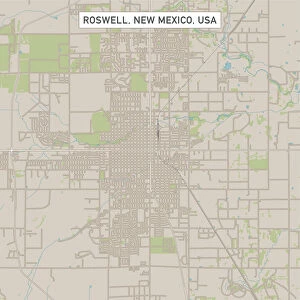
Mouse Mat : Las Cruces New Mexico US City Street Map

![]()
Home Decor from Fine Art Storehouse
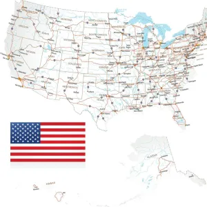
Las Cruces New Mexico US City Street Map
Vector Illustration of a City Street Map of Las Cruces, New Mexico, USA. Scale 1:60, 000.
All source data is in the public domain.
U.S. Geological Survey, US Topo
Used Layers:
USGS The National Map: National Hydrography Dataset (NHD)
USGS The National Map: National Transportation Dataset (NTD)
Unleash your creativity and transform your space into a visual masterpiece!
Frank Ramspott
Media ID 15215840
© Frank Ramspott, all rights reserved
Aerial View City Map Computer Graphic Directly Above Downtown District Gray New Mexico Road Map Text Digitally Generated Image Green Color Las Cruces Rio Grande White Color
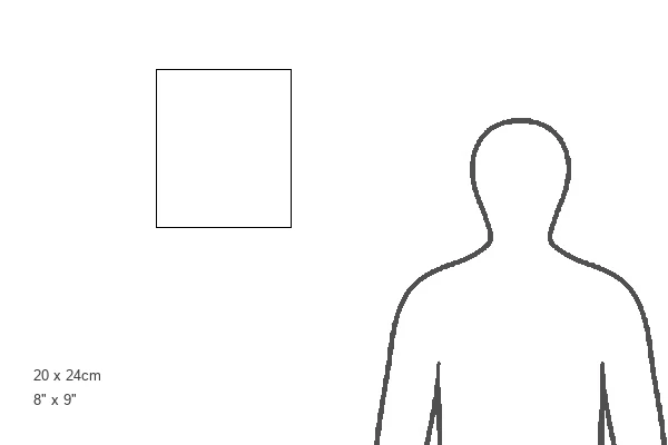
Mouse Pad
Standard Size Mouse Pad 7.75" x 9..25". High density Neoprene w linen surface. Easy to clean, stain resistant finish. Rounded corners.
Archive quality photographic print in a durable wipe clean mouse mat with non slip backing. Works with all computer mice
Estimated Product Size is 20.2cm x 23.7cm (8" x 9.3")
These are individually made so all sizes are approximate
Artwork printed orientated as per the preview above, with landscape (horizontal) or portrait (vertical) orientation to match the source image.
FEATURES IN THESE COLLECTIONS
> Fine Art Storehouse
> Map
> Street Maps
> Fine Art Storehouse
> Map
> USA Maps
> Aerial Photography
> Related Images
> Animals
> Insects
> Hemiptera
> Green Scale
> Arts
> Contemporary art
> Digital artwork
> Street art
> Arts
> Landscape paintings
> Waterfall and river artworks
> River artworks
> Arts
> Portraits
> Pop art gallery
> Street art portraits
> Arts
> Street art graffiti
> Digital art
> Digital paintings
> Arts
> Street art graffiti
> Digital art
> Vector illustrations
> Maps and Charts
> Geological Map
> Maps and Charts
> Related Images
> North America
> Mexico
> Lakes
> Related Images
EDITORS COMMENTS
This print showcases a detailed and intricate city street map of Las Cruces, New Mexico. With its vibrant colors and precise design, this vector illustration captures the essence of this bustling US city. The scale of 1:60,000 allows for an in-depth exploration of the streets and landmarks that make up Las Cruces. The source data used to create this masterpiece is all in the public domain, courtesy of the U. S. Geological Survey's National Map. Layers from their National Hydrography Dataset (NHD) and National Transportation Dataset (NTD) were utilized to ensure accuracy and authenticity. From the majestic Rio Grande flowing through its heart to the charming downtown district dotted with shops and restaurants, every aspect of Las Cruces is beautifully represented on this map. The presence of a lake adds a touch of tranquility amidst the urban landscape. With no people visible in this digitally generated image taken from an aerial view directly above, it solely focuses on showcasing the city's layout and geography. The combination of gray, blue, white, and green colors creates a visually appealing contrast that enhances readability. Designed by Frank Ramspott exclusively for Fine Art Storehouse, this stunning print is perfect for anyone who appreciates cartography or wants to celebrate their love for Las Cruces' unique charm.
MADE IN THE USA
Safe Shipping with 30 Day Money Back Guarantee
FREE PERSONALISATION*
We are proud to offer a range of customisation features including Personalised Captions, Color Filters and Picture Zoom Tools
SECURE PAYMENTS
We happily accept a wide range of payment options so you can pay for the things you need in the way that is most convenient for you
* Options may vary by product and licensing agreement. Zoomed Pictures can be adjusted in the Cart.