Mouse Mat > Europe > United Kingdom > Scotland > Strathclyde > Hamilton
Mouse Mat : MA Worcester Vector Road Map

![]()
Home Decor From Fine Art Storehouse
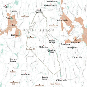
MA Worcester Vector Road Map
MA Worcester Vector Road Map. All source data is in the public domain. U.S. Census Bureau Census Tiger. Used Layers: areawater, linearwater, roads, rails, cousub, pointlm, uac10
Unleash your creativity and transform your space into a visual masterpiece!
Frank Ramspott
Media ID 20691461
© Frank Ramspott, all rights reserved
City Map Computer Graphic County Digital Composite District Geographical Border Massachusetts Road Map Text Vector Worcester Cambridge Digitally Generated Image Hamilton Lakeview Ludlow Westchester
Mouse Pad
Standard Size Mouse Pad 7.75" x 9..25". High density Neoprene w linen surface. Easy to clean, stain resistant finish. Rounded corners.
Archive quality photographic print in a durable wipe clean mouse mat with non slip backing. Works with all computer mice
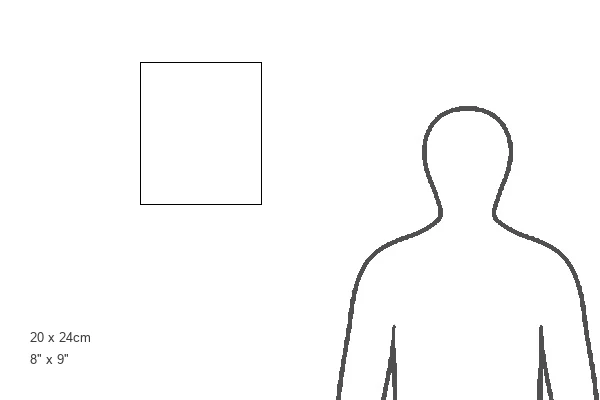
Estimated Product Size is 20.2cm x 23.7cm (8" x 9.3")
These are individually made so all sizes are approximate
Artwork printed orientated as per the preview above, with landscape (horizontal) or portrait (vertical) orientation to match the source image.
FEATURES IN THESE COLLECTIONS
> Fine Art Storehouse
> Map
> Reference Maps
> Animals
> Mammals
> Cats (Wild)
> Tiger
> Arts
> Contemporary art
> Digital artwork
> Street art
> Arts
> Street art graffiti
> Digital art
> Digital paintings
> Europe
> United Kingdom
> Scotland
> Strathclyde
> Hamilton
> Maps and Charts
> Related Images
> North America
> United States of America
> Massachusetts
> Cambridge
> North America
> United States of America
> Massachusetts
> Worcester
> Popular Themes
> Lake District
EDITORS COMMENTS
This print titled "MA Worcester Vector Road Map" showcases the intricate and detailed cartography of Worcester, Massachusetts. Created by Frank Ramspott, this digitally generated image is a testament to his exceptional skills in design and map-making. Using various layers such as areawater, linearwater, roads, rails, cousub, pointlm, and uac10 sourced from the U. S. Census Bureau Census Tiger database (all of which are in the public domain), Ramspott has beautifully captured the physical geography of Worcester County. The vibrant colors and precise vector lines bring life to this computer graphic composition. The map highlights key features including rivers like Pakachoag and Tatnuck Lakeview as well as cities such as Cambridge and Westchester. It provides an excellent reference for navigating through Worcester's streets with clarity and ease. With no people present in the image itself but rich with textual information about geographical borders and city names, this visually striking artwork serves both practical purposes for navigation enthusiasts while also being a stunning piece of art that can be appreciated purely for its aesthetic appeal
MADE IN THE USA
Safe Shipping with 30 Day Money Back Guarantee
FREE PERSONALISATION*
We are proud to offer a range of customisation features including Personalised Captions, Color Filters and Picture Zoom Tools
SECURE PAYMENTS
We happily accept a wide range of payment options so you can pay for the things you need in the way that is most convenient for you
* Options may vary by product and licensing agreement. Zoomed Pictures can be adjusted in the Basket.