Mouse Mat > Historic > Ancient civilizations > Ancient Greece > Greek history
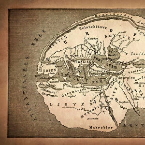
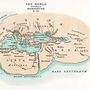
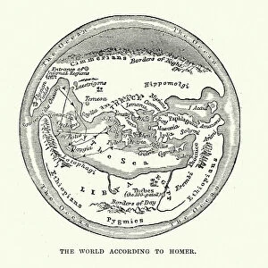
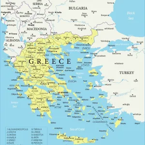
Mouse Mat : Map of the Ancient World according to Herodotus

![]()
Home Decor from Fine Art Storehouse
Map of the Ancient World according to Herodotus
Vintage engraving of a Map of the Ancient World according to Herodotus. Herodotus was a Greek historian who was born in Halicarnassus, Caria and lived in the fifth century BC
Unleash your creativity and transform your space into a visual masterpiece!
duncan1890
Media ID 18305857
© duncan1890
Asia Pac Greco Roman Wrestling Middle East
Mouse Pad
Standard Size Mouse Pad 7.75" x 9..25". High density Neoprene w linen surface. Easy to clean, stain resistant finish. Rounded corners.
Archive quality photographic print in a durable wipe clean mouse mat with non slip backing. Works with all computer mice
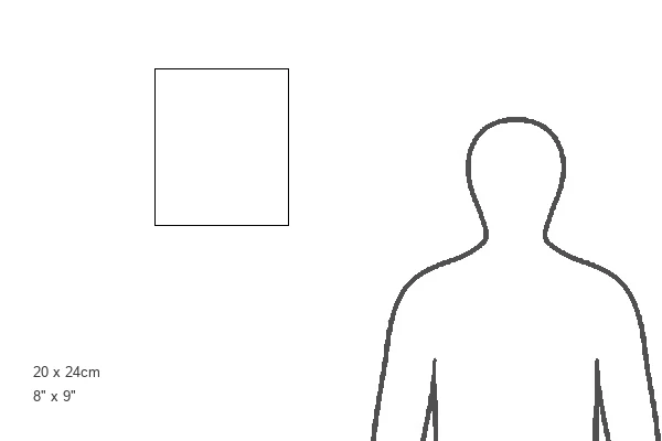
Estimated Product Size is 20.2cm x 23.7cm (8" x 9.3")
These are individually made so all sizes are approximate
Artwork printed orientated as per the preview above, with landscape (horizontal) or portrait (vertical) orientation to match the source image.
FEATURES IN THESE COLLECTIONS
> Fine Art Storehouse
> Map
> Historical Maps
> Arts
> Artists
> R
> Roman Roman
> Asia
> Related Images
> Europe
> Greece
> Related Images
> Europe
> Related Images
> Historic
> Ancient civilizations
> Ancient Greece
> Greek history
> Maps and Charts
> Early Maps
> Maps and Charts
> Related Images
EDITORS COMMENTS
This vintage engraving takes us on a journey back in time, showcasing the "Map of the Ancient World according to Herodotus". Crafted by the skilled hands of Duncan1890 and available at Fine Art Storehouse, this print is a true testament to the rich history and cultural heritage that lies within our past. Herodotus, an esteemed Greek historian who lived during the fifth century BC, meticulously documented his observations and knowledge about various civilizations. This map serves as a visual representation of his extensive research, offering us a glimpse into how he perceived the world during his time. The intricate details depicted in this artwork highlight regions such as Greco-Roman wrestling, Asia Pacific, Middle East, Europe and more. Each section showcases distinct characteristics that were significant to their respective cultures. The careful cartography employed here allows us to appreciate not only Herodotus' contributions but also marvel at the ancient world's vastness and diversity. As we gaze upon this remarkable piece of artistry, we are transported through time and space. It reminds us of our shared human history while igniting curiosity about those who came before us. Whether you are an avid collector or simply intrigued by historical artifacts, this print will undoubtedly be a cherished addition to your collection or home decor
MADE IN THE USA
Safe Shipping with 30 Day Money Back Guarantee
FREE PERSONALISATION*
We are proud to offer a range of customisation features including Personalised Captions, Color Filters and Picture Zoom Tools
SECURE PAYMENTS
We happily accept a wide range of payment options so you can pay for the things you need in the way that is most convenient for you
* Options may vary by product and licensing agreement. Zoomed Pictures can be adjusted in the Cart.