Mouse Mat > Maps and Charts > Americas
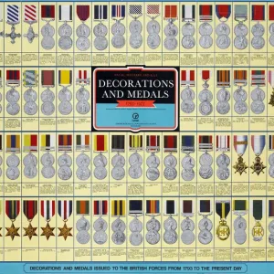
Mouse Mat : Naval Military Map of the United States, 1862
![]()

Home Decor From Fine Art Finder
Naval Military Map of the United States, 1862
2902808 Naval Military Map of the United States, 1862; (add.info.: Naval Military Map of the United States, 1862.); Buyenlarge Archive/UIG
Media ID 38152482
© Buyenlarge Archive/UIG / Bridgeman Images
1860s Amred Forces Cartographic Civil War Federal Union Marines Maritime Force Naval Force Naval Infantry
Mouse Pad
Standard Size Mouse Pad 7.75" x 9..25". High density Neoprene w linen surface. Easy to clean, stain resistant finish. Rounded corners.
Archive quality photographic print in a durable wipe clean mouse mat with non slip backing. Works with all computer mice
Estimated Product Size is 23.7cm x 20.2cm (9.3" x 8")
These are individually made so all sizes are approximate
Artwork printed orientated as per the preview above, with landscape (horizontal) orientation to match the source image.
FEATURES IN THESE COLLECTIONS
> Maps and Charts
> Related Images
> Services
> Royal Navy
EDITORS COMMENTS
This stunning print captures a piece of American history with the Naval Military Map of the United States from 1862. The intricate details and precision of this map showcase the strategic importance of naval forces during the Civil War era.
The map provides a glimpse into the military tactics and movements that were crucial in shaping the outcome of battles on both land and sea. It highlights key locations, routes, and territories controlled by Union forces as they fought to preserve the unity of the nation.
As we study this map, we can imagine the dedication and bravery of those who served in the navy, marines, army, and other armed forces during this tumultuous time in our country's past. Each line drawn represents a decision made on how best to defend against enemy attacks or launch offensives to gain ground.
Through cartography, we are able to visualize not only geographical landscapes but also historical events that have shaped our nation. This Naval Military Map serves as a reminder of the sacrifices made by those who fought for freedom and unity during one of America's most challenging periods.
Let us honor their legacy by preserving these important artifacts that tell stories of courage, resilience, and determination in times of conflict.
MADE IN THE USA
Safe Shipping with 30 Day Money Back Guarantee
FREE PERSONALISATION*
We are proud to offer a range of customisation features including Personalised Captions, Color Filters and Picture Zoom Tools
SECURE PAYMENTS
We happily accept a wide range of payment options so you can pay for the things you need in the way that is most convenient for you
* Options may vary by product and licensing agreement. Zoomed Pictures can be adjusted in the Basket.


