Mouse Mat > Maps and Charts > Americas
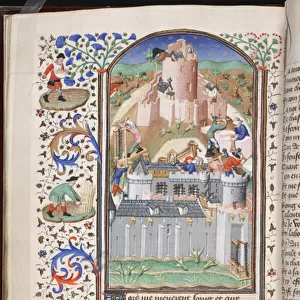
Mouse Mat : Map of the County of Philadelphia From Actual Survey, 1843 (hand-coloured engraving)
![]()

Home Decor From Fine Art Finder
Map of the County of Philadelphia From Actual Survey, 1843 (hand-coloured engraving)
486269 Map of the County of Philadelphia From Actual Survey, 1843 (hand-coloured engraving)
by Ellet, Charles Jr. (1810-62); 90x114 cm; Free Library of Philadelphia; eFree Library of Philadelphia; American, out of copyright
Media ID 22923802
© Free Library of Philadelphia / Bridgeman Images
Counties County Development Mapping North American Philadelphia
Mouse Pad
Standard Size Mouse Pad 7.75" x 9..25". High density Neoprene w linen surface. Easy to clean, stain resistant finish. Rounded corners.
Archive quality photographic print in a durable wipe clean mouse mat with non slip backing. Works with all computer mice
Estimated Image Size (if not cropped) is 23.7cm x 14.4cm (9.3" x 5.7")
Estimated Product Size is 23.7cm x 20.2cm (9.3" x 8")
These are individually made so all sizes are approximate
Artwork printed orientated as per the preview above, with landscape (horizontal) orientation to match the source image.
FEATURES IN THESE COLLECTIONS
> Fine Art Finder
> Artists
> Master Fastolf
> Fine Art Finder
> Maps (celestial & Terrestrial)
EDITORS COMMENTS
This hand-coloured engraving, titled "Map of the County of Philadelphia From Actual Survey, 1843" takes us back in time to witness the development and urbanization of one of America's most historic cities. Spanning an impressive 90x114 cm, this map offers a detailed glimpse into the county's intricate layout and architectural evolution. Created by Charles Ellet Jr. , a renowned American cartographer from the early 19th century, this masterpiece showcases his exceptional skill in capturing every minute detail with precision. The vibrant colours used to bring life to this engraving further enhance its visual appeal. As we explore this map, we are transported through time as it reveals the growth and expansion that transformed Philadelphia into a bustling metropolis. Each street, neighborhood, and landmark is meticulously documented on this piece of artistry. The Map of the County of Philadelphia serves not only as an invaluable historical artifact but also as a testament to human progress. It reminds us how cities evolve over time while preserving their unique character and heritage. Now housed at the Free Library of Philadelphia, this print allows us to appreciate both Ellet's talent and our city's rich history. Whether you're a historian or simply fascinated by cartography, gazing upon this enchanting engraving will undoubtedly transport you back in time to experience the birthplace of American independence like never before.
MADE IN THE USA
Safe Shipping with 30 Day Money Back Guarantee
FREE PERSONALISATION*
We are proud to offer a range of customisation features including Personalised Captions, Color Filters and Picture Zoom Tools
SECURE PAYMENTS
We happily accept a wide range of payment options so you can pay for the things you need in the way that is most convenient for you
* Options may vary by product and licensing agreement. Zoomed Pictures can be adjusted in the Basket.


