Mouse Mat > Europe > United Kingdom > Scotland > Moray > Keith
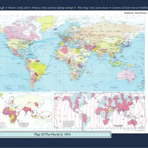
Mouse Mat : World showing British Possessions and Dependencies (colour litho)
![]()

Home Decor From Fine Art Finder
World showing British Possessions and Dependencies (colour litho)
8652268 World showing British Possessions and Dependencies (colour litho) by English School, (19th century); Private Collection; (add.info.: World showing British Possessions and Dependencies. Illustration for The Half-Crown Atlas of British History by Keith Johnston (W & A K Johnston, c.1865).); © Look and Learn
Media ID 38499326
© © Look and Learn / Bridgeman Images
British Empire The British Empire
Mouse Pad
Standard Size Mouse Pad 7.75" x 9..25". High density Neoprene w linen surface. Easy to clean, stain resistant finish. Rounded corners.
Archive quality photographic print in a durable wipe clean mouse mat with non slip backing. Works with all computer mice
Estimated Image Size (if not cropped) is 23.7cm x 17cm (9.3" x 6.7")
Estimated Product Size is 23.7cm x 20.2cm (9.3" x 8")
These are individually made so all sizes are approximate
Artwork printed orientated as per the preview above, with landscape (horizontal) orientation to match the source image.
FEATURES IN THESE COLLECTIONS
> Fine Art Finder
> Artists
> English Photographer
> Fine Art Finder
> Artists
> English School
> Arts
> Artists
> I
> Irish School Irish School
> Europe
> Republic of Ireland
> Maps
> Europe
> United Kingdom
> England
> Maps
> Europe
> United Kingdom
> Maps
> Europe
> United Kingdom
> Northern Ireland
> Maps
> Europe
> United Kingdom
> Northern Ireland
> Posters
> Europe
> United Kingdom
> Northern Ireland
> Related Images
> Europe
> United Kingdom
> Scotland
> Moray
> Keith
> Maps and Charts
> British Empire Maps
> Maps and Charts
> Early Maps
EDITORS COMMENTS
This stunning colour lithograph print of the World showing British Possessions and Dependencies from the 19th century is a captivating glimpse into the vast expanse of the British Empire at its peak. The intricate detail and vibrant hues bring to life a time when Britannia truly ruled the waves, with territories spanning continents and oceans.
The map, originally created for The Half-Crown Atlas of British History by Keith Johnston, showcases the extent of British influence across the globe. From India to Africa, Australia to Canada, every corner of the world touched by British imperialism is meticulously depicted in this historical artwork.
As we gaze upon this visual representation of colonial power, we are reminded of both the grandeur and complexities of empire-building. The pink and red hues symbolize not just territorial control but also cultural exchange, economic exploitation, and political dominance.
In today's world where borders are constantly shifting and empires have long since faded into history books, this print serves as a reminder of a time when one nation's reach extended far beyond its shores. It invites us to reflect on the legacy left behind by centuries of colonization and raises important questions about power dynamics, sovereignty, and global interconnectedness.
MADE IN THE USA
Safe Shipping with 30 Day Money Back Guarantee
FREE PERSONALISATION*
We are proud to offer a range of customisation features including Personalised Captions, Color Filters and Picture Zoom Tools
SECURE PAYMENTS
We happily accept a wide range of payment options so you can pay for the things you need in the way that is most convenient for you
* Options may vary by product and licensing agreement. Zoomed Pictures can be adjusted in the Basket.


