Metal Print > Europe > United Kingdom > Scotland > Maps
Metal Print : SC0503reduced


![]()
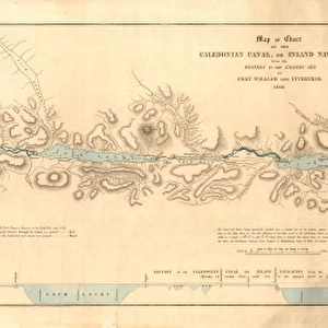
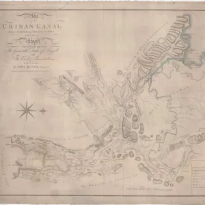
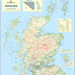
Metal Prints from Scottish Canals
SC0503reduced
Scottish Canals are in charge of the five canals in Scotland
Media ID 14786777
16"x24" (61x41cm) Metal Print
Made with durable metal and luxurious printing techniques, our metal photo prints go beyond traditional canvases, adding a cool, modern touch to your space. Wall mount on back. Eco-friendly 100% post-consumer recycled ChromaLuxe aluminum surface. The thickness of the print is 0.045". Featuring a Scratch-resistant surface and Rounded corners. Backing hangers are attached to the back of the print and float the print 1/2-inch off the wall when hung, the choice of hanger may vary depending on size and International orders will come with Float Mount hangers only. Finished with a brilliant white high gloss surface for unsurpassed detail and vibrance. Printed using Dye-Sublimation and for best care we recommend a non-ammonia glass cleaner, water, or isopropyl (rubbing) alcohol to prevent harming the print surface. We recommend using a clean, lint-free cloth to wipe off the print. The ultra-hard surface is scratch-resistant, waterproof and weatherproof. Avoid direct sunlight exposure.
Made with durable metal and luxurious printing techniques, metal prints bring images to life and add a modern touch to any space
Estimated Product Size is 61.5cm x 41.2cm (24.2" x 16.2")
These are individually made so all sizes are approximate
Artwork printed orientated as per the preview above, with landscape (horizontal) orientation to match the source image.
FEATURES IN THESE COLLECTIONS
> Europe
> France
> Canton
> Landes
> Europe
> United Kingdom
> Scotland
> Maps
> Europe
> United Kingdom
> Scotland
> Posters
> Europe
> United Kingdom
> Scotland
> Related Images
> Europe
> United Kingdom
> Scotland
> Rivers
> Maps and Charts
> Early Maps
> Maps and Charts
> Related Images
> Scottish Canals
> ScottishCanals
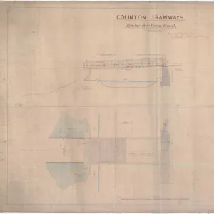
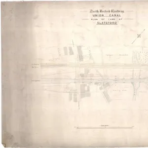
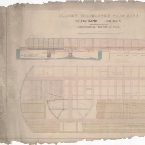
VISUAL DESCRIPTION
This image appears to be a historical map or plan. It shows a layout of streets, plots of land, and possibly a river or canal running through the area. The text is not clearly legible in this resolution, but it seems to include references to specific locations and perhaps names associated with the mapped region. This type of document could be used for urban planning, property records, or geographical documentation purposes from an earlier time period.
MADE IN THE USA
Safe Shipping with 30 Day Money Back Guarantee
FREE PERSONALISATION*
We are proud to offer a range of customisation features including Personalised Captions, Color Filters and Picture Zoom Tools
SECURE PAYMENTS
We happily accept a wide range of payment options so you can pay for the things you need in the way that is most convenient for you
* Options may vary by product and licensing agreement. Zoomed Pictures can be adjusted in the Cart.