Metal Print > Animals > Fishes > S > Salmon
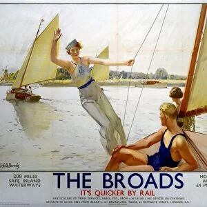
Metal Print : Map - The River Ant, Norfolk Broads

![]()
Metal Prints From Mary Evans Picture Library
Map - The River Ant, Norfolk Broads
Map by M. F. Peck - The River Ant, Norfolk Broads
Mary Evans Picture Library makes available wonderful images created for people to enjoy over the centuries
Media ID 29247898
© J Salmon Limited / Mary Evans P
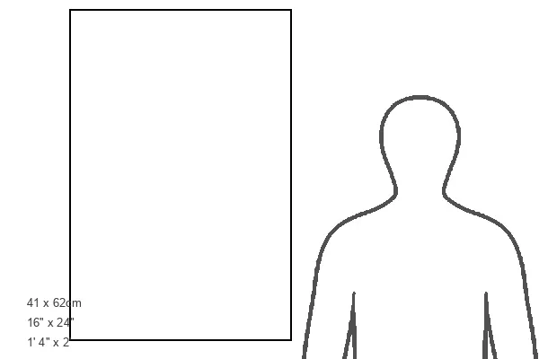
16"x24" (61x41cm) Metal Print
Discover the timeless beauty of the Norfolk Broads with our Media Storehouse Metal Print featuring the exquisite map of The River Ant by M.F. Peck from Mary Evans Prints Online. This high-quality metal print brings the intricate details of the map to life, making it a stunning addition to any room. The vibrant colors and sleek metal finish create a modern and sophisticated look that is sure to impress. Whether you're an avid collector of maps or simply appreciate the natural beauty of the Norfolk Broads, this metal print is the perfect way to bring a piece of the past into your home or office. Order yours today and let the adventure begin!
Made with durable metal and luxurious printing techniques, our metal photo prints go beyond traditional canvases, adding a cool, modern touch to your space. Wall mount on back. Eco-friendly 100% post-consumer recycled ChromaLuxe aluminum surface. The thickness of the print is 0.045". Featuring a Scratch-resistant surface and Rounded corners. Backing hangers are attached to the back of the print and float the print 1/2-inch off the wall when hung, the choice of hanger may vary depending on size and International orders will come with Float Mount hangers only. Finished with a brilliant white high gloss surface for unsurpassed detail and vibrance. Printed using Dye-Sublimation and for best care we recommend a non-ammonia glass cleaner, water, or isopropyl (rubbing) alcohol to prevent harming the print surface. We recommend using a clean, lint-free cloth to wipe off the print. The ultra-hard surface is scratch-resistant, waterproof and weatherproof. Avoid direct sunlight exposure.
Made with durable metal and luxurious printing techniques, metal prints bring images to life and add a modern touch to any space
Estimated Product Size is 41.2cm x 61.5cm (16.2" x 24.2")
These are individually made so all sizes are approximate
Artwork printed orientated as per the preview above, with portrait (vertical) orientation to match the source image.
FEATURES IN THESE COLLECTIONS
> Mary Evans Prints Online
> The J Salmon Archive Collection
> Animals
> Fishes
> S
> Salmon
> Arts
> Landscape paintings
> Waterfall and river artworks
> River artworks
> Arts
> Still life artwork
> Watercolor paintings
> Fine art
> Europe
> United Kingdom
> England
> Maps
> Europe
> United Kingdom
> England
> Norfolk
> Related Images
> Europe
> United Kingdom
> England
> Paintings
> Europe
> United Kingdom
> England
> Posters
> Europe
> United Kingdom
> England
> Rivers
> Maps and Charts
> Related Images
EDITORS COMMENTS
Nestled in the heart of Norfolk, England, lies the picturesque and serene River Ant, as depicted in this beautiful watercolour map by M.F. Peck. The River Ant is a significant waterway in the Norfolk Broads, a network of rivers and broads that covers approximately 125 square miles. This map invites us to explore the winding river, its tributaries, and the surrounding countryside. The River Ant originates from the village of Antingham and flows through the charming villages of Horning, Womack Water, and Coltishall before joining the Bure River at Wroxham. The map highlights various points of interest along the river, including St Benet's Abbey, a 12th-century monastery in ruins, and the picturesque village of Horning, famous for its thatched-roof cottages and vibrant community. M.F. Peck's meticulous attention to detail is evident in this stunning watercolour map. The artist has captured the essence of the Norfolk Broads, with its tranquil waters, lush greenery, and quaint villages. The map serves not only as a navigational tool but also as a work of art, transporting us to the idyllic landscapes of Norfolk. The River Ant is a popular destination for boating enthusiasts, offering a peaceful and scenic route through the Norfolk Broads. This map would make an excellent addition to any home or office, serving as a reminder of the natural beauty and serenity that can be found in the English countryside. Whether you are planning a trip to Norfolk or simply looking for a beautiful piece of art to brighten up your space, this map of the River Ant by M.F. Peck is an excellent choice.
MADE IN THE USA
Safe Shipping with 30 Day Money Back Guarantee
FREE PERSONALISATION*
We are proud to offer a range of customisation features including Personalised Captions, Color Filters and Picture Zoom Tools
SECURE PAYMENTS
We happily accept a wide range of payment options so you can pay for the things you need in the way that is most convenient for you
* Options may vary by product and licensing agreement. Zoomed Pictures can be adjusted in the Basket.