Metal Print : British roads damaged by military traffic, WW1


![]()
Metal Prints from Mary Evans Picture Library
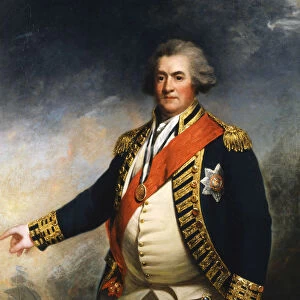
British roads damaged by military traffic, WW1
A map of the Southern counties of Britain prepared by the Automobile Association and the Motor Union to indicate the stretches of road extensively damaged by the passage of military traffic and which civilian motorists were advised to avoid. Roads in Wiltshire, Dorset, Hampshire, Sussex and Kent are all shown. Date: 1915
Mary Evans Picture Library makes available wonderful images created for people to enjoy over the centuries
Media ID 14140719
© Illustrated London News Ltd/Mary Evans
Association Automobile Counties Damage Damaged Dorset Hampshire Maps Motorists Roads Route Routes Traffic Wiltshire
16"x20" (51x41cm) Metal Print
Step back in time with our exclusive Media Storehouse Metal Print featuring a captivating image of British roads damaged by military traffic during World War I. This evocative photograph, sourced from Mary Evans Prints Online, showcases a map of the Southern counties of Britain prepared by the Automobile Association and the Motor Union. The intricate details of the damaged roads and terrain are brought to life in stunning clarity through our high-quality metal print process. Each print is individually crafted to order, ensuring a unique and durable piece of historical art for your home or office. Add this conversation-starting piece to your collection and relive the history of the past.
Made with durable metal and luxurious printing techniques, our metal photo prints go beyond traditional canvases, adding a cool, modern touch to your space. Wall mount on back. Eco-friendly 100% post-consumer recycled ChromaLuxe aluminum surface. The thickness of the print is 0.045". Featuring a Scratch-resistant surface and Rounded corners. Backing hangers are attached to the back of the print and float the print 1/2-inch off the wall when hung, the choice of hanger may vary depending on size and International orders will come with Float Mount hangers only. Finished with a brilliant white high gloss surface for unsurpassed detail and vibrance. Printed using Dye-Sublimation and for best care we recommend a non-ammonia glass cleaner, water, or isopropyl (rubbing) alcohol to prevent harming the print surface. We recommend using a clean, lint-free cloth to wipe off the print. The ultra-hard surface is scratch-resistant, waterproof and weatherproof. Avoid direct sunlight exposure.
Made with durable metal and luxurious printing techniques, metal prints bring images to life and add a modern touch to any space
Estimated Image Size (if not cropped) is 50.8cm x 40.6cm (20" x 16")
Estimated Product Size is 51.4cm x 41.2cm (20.2" x 16.2")
These are individually made so all sizes are approximate
Artwork printed orientated as per the preview above, with landscape (horizontal) orientation to match the source image.
EDITORS COMMENTS
This historic map, prepared by the Automobile Association and the Motor Union in 1915, highlights the extensive damage caused to roads in the southern counties of Britain due to the heavy military traffic during the First World War. The map covers the areas of Wiltshire, Dorset, Hampshire, Sussex, and Kent, all of which were significantly affected by the passage of troops and military vehicles. The map serves as a poignant reminder of the impact of the war on everyday life in Britain, particularly on the motorists of the time. The roads shown on the map, once smooth and well-maintained, were now riddled with potholes, cracks, and other damage that made travel difficult and dangerous. The military traffic was a necessary evil, as the war effort relied heavily on the movement of troops and supplies from one place to another. However, the damage caused to the roads was a significant inconvenience for civilians, who were advised to avoid these areas if possible. The map was a valuable resource for motorists during this time, as it allowed them to plan their journeys around the damaged roads and find alternative routes. It also served as a reminder of the sacrifices being made by the British people during the war, as they adjusted to the challenges of daily life in a country at war. Today, this map is a fascinating historical document that offers insights into the logistical challenges of the First World War and the resilience of the British people during a time of great upheaval. It is a reminder of the importance of transportation infrastructure and the role it plays in our daily lives, as well as the enduring impact of war on communities and individuals.
MADE IN THE USA
Safe Shipping with 30 Day Money Back Guarantee
FREE PERSONALISATION*
We are proud to offer a range of customisation features including Personalised Captions, Color Filters and Picture Zoom Tools
FREE COLORIZATION SERVICE
You can choose advanced AI Colorization for this picture at no extra charge!
SECURE PAYMENTS
We happily accept a wide range of payment options so you can pay for the things you need in the way that is most convenient for you
* Options may vary by product and licensing agreement. Zoomed Pictures can be adjusted in the Basket.