Metal Print > Asia > China > Maps
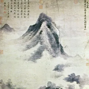
Metal Print : The Dunhuang Star map, ca 700. Artist: Anonymous master


Resolution may be reduced at this size (109 DPI)
![]()
Metal Prints From Heritage Images
The Dunhuang Star map, ca 700. Artist: Anonymous master
The Dunhuang Star map, ca 700. Found in the collection of the British Library
Heritage Images features heritage image collections
Media ID 15015614
© Fine Art Images
Anonymous Master British Library Cartography Ink On Paper Tang Dynasty
16"x24" (61x41cm) Metal Print
Discover the mysteries of the ancient world with our Media Storehouse Metal Print featuring the Dunhuang Star Map, an intriguing celestial chart from 700 AD. This captivating piece of history, sourced from the British Library and represented by the anonymous master from Heritage Images, is now available in a stunning metal print. Each print is meticulously crafted with a vibrant, high-definition image transferred onto a durable aluminum sheet, ensuring a long-lasting and eye-catching display. Bring the wonders of the universe into your home or office and ignite the imagination of all who see it.
Made with durable metal and luxurious printing techniques, our metal photo prints go beyond traditional canvases, adding a cool, modern touch to your space. Wall mount on back. Eco-friendly 100% post-consumer recycled ChromaLuxe aluminum surface. The thickness of the print is 0.045". Featuring a Scratch-resistant surface and Rounded corners. Backing hangers are attached to the back of the print and float the print 1/2-inch off the wall when hung, the choice of hanger may vary depending on size and International orders will come with Float Mount hangers only. Finished with a brilliant white high gloss surface for unsurpassed detail and vibrance. Printed using Dye-Sublimation and for best care we recommend a non-ammonia glass cleaner, water, or isopropyl (rubbing) alcohol to prevent harming the print surface. We recommend using a clean, lint-free cloth to wipe off the print. The ultra-hard surface is scratch-resistant, waterproof and weatherproof. Avoid direct sunlight exposure.
Made with durable metal and luxurious printing techniques, metal prints bring images to life and add a modern touch to any space
Estimated Product Size is 61.5cm x 41.2cm (24.2" x 16.2")
These are individually made so all sizes are approximate
Artwork printed orientated as per the preview above, with landscape (horizontal) orientation to match the source image.
FEATURES IN THESE COLLECTIONS
> Historic
> Ancient civilizations
> Chinese Dynasties
> Historic
> Chinese dynasties paintings
> Maps and Charts
> Related Images
> Maps and Charts
> Star Charts
EDITORS COMMENTS
This print showcases "The Dunhuang Star map" a remarkable piece of ancient Chinese artistry and scientific knowledge. Created around 700 AD during the Tang Dynasty, this anonymous masterpiece is now housed in the esteemed collection of the British Library. Intricately detailed and delicately rendered with ink on paper, this fine example of graphic arts offers a fascinating glimpse into China's rich history of astronomy and cartography. The Dunhuang Star map presents an intricate network of stars, constellations, and celestial bodies meticulously charted by an unknown master artist. As we explore this extraordinary artwork, we are transported back in time to an era when humans sought to understand the vastness of our universe. This star chart not only served as a navigational tool but also reflected the profound connection between heaven and earth within Chinese culture. The significance of The Dunhuang Star map lies not only in its historical value but also in its artistic brilliance. Its elegant lines and meticulous details demonstrate the skillful craftsmanship that flourished during the Tang Dynasty. Through this photo print, we can appreciate both the beauty and intellectual prowess embedded within ancient Chinese astronomical studies. It serves as a testament to human curiosity, ingenuity, and our ceaseless quest for knowledge about our place in the cosmos.
MADE IN THE USA
Safe Shipping with 30 Day Money Back Guarantee
FREE PERSONALISATION*
We are proud to offer a range of customisation features including Personalised Captions, Color Filters and Picture Zoom Tools
SECURE PAYMENTS
We happily accept a wide range of payment options so you can pay for the things you need in the way that is most convenient for you
* Options may vary by product and licensing agreement. Zoomed Pictures can be adjusted in the Basket.