Metal Print > Europe > United Kingdom > England > London > Museums > National Maritime Museum
Metal Print : Chart of part of the coasts of Cutch and Guzarat by J G Richardson... communicated by Capt Archibald Blair to whom this plate is inscribed by his most obliged A Dalrymple. Harmar Script, 1803 (engraving)
")

![]()
Metal Prints From Fine Art Finder
Chart of part of the coasts of Cutch and Guzarat by J G Richardson... communicated by Capt Archibald Blair to whom this plate is inscribed by his most obliged A Dalrymple. Harmar Script, 1803 (engraving)
7340637 Chart of part of the coasts of Cutch and Guzarat by J G Richardson... communicated by Capt Archibald Blair to whom this plate is inscribed by his most obliged A Dalrymple. Harmar Script, 1803 (engraving) by British School, (19th century); 19.7x27.6 cm; National Maritime Museum, London, UK; (add.info.: Creator: British Admiralty; J G Richardson; Captain Archibald Blair; A. Dalrymple
Scale: circa 1:800, 000.); © National Maritime Museum, Greenwich, London
Media ID 38515562
© © National Maritime Museum, Greenwich, London / Bridgeman Images
16"x20" (51x41cm) Metal Print
Uncover the beauty of India's coastline with our Metal Prints from Media Storehouse. This stunning piece, 'Chart of part of the coasts of Cutch and Guzarat' (1803), features a historic engraving by Bridgeman Images from Fine Art Finder. With its intricate details and rich tones, this metal print is sure to make a statement in any room.
Made with durable metal and luxurious printing techniques, our metal photo prints go beyond traditional canvases, adding a cool, modern touch to your space. Wall mount on back. Eco-friendly 100% post-consumer recycled ChromaLuxe aluminum surface. The thickness of the print is 0.045". Featuring a Scratch-resistant surface and Rounded corners. Backing hangers are attached to the back of the print and float the print 1/2-inch off the wall when hung, the choice of hanger may vary depending on size and International orders will come with Float Mount hangers only. Finished with a brilliant white high gloss surface for unsurpassed detail and vibrance. Printed using Dye-Sublimation and for best care we recommend a non-ammonia glass cleaner, water, or isopropyl (rubbing) alcohol to prevent harming the print surface. We recommend using a clean, lint-free cloth to wipe off the print. The ultra-hard surface is scratch-resistant, waterproof and weatherproof. Avoid direct sunlight exposure.
Made with durable metal and luxurious printing techniques, metal prints bring images to life and add a modern touch to any space
Estimated Image Size (if not cropped) is 40.6cm x 50.8cm (16" x 20")
Estimated Product Size is 41.2cm x 51.4cm (16.2" x 20.2")
These are individually made so all sizes are approximate
Artwork printed orientated as per the preview above, with portrait (vertical) orientation to match the source image.
FEATURES IN THESE COLLECTIONS
> Fine Art Finder
> Artists
> British School
> Fine Art Finder
> Artists
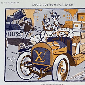
> French School
> Animals
> Insects
> Hemiptera
> Black Scale
> Arts
> Artists
> I
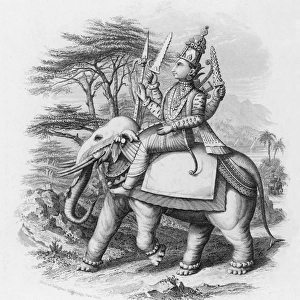
> Indian School Indian School
> Asia
> India
> Related Images
> Europe
> United Kingdom
> England
> London
> Boroughs
> Greenwich
> Europe
> United Kingdom
> England
> London
> Museums
> British Museum
> Europe
> United Kingdom
> England
> London
> Museums
> Greenwich Heritage Centre
> Europe
> United Kingdom
> England
> London
> Museums
> National Maritime Museum
> Europe
> United Kingdom
> England
> London
> Sights
> British Museum
> Europe
> United Kingdom
> England
> London
> Towns
> Greenwich
EDITORS COMMENTS
This engraving from 1803, titled 'Chart of part of the coasts of Cutch and Guzarat by J G Richardson', offers a glimpse into the intricate world of cartography during the 19th century. The detailed map, communicated by Capt Archibald Blair and inscribed by A Dalrymple, showcases the stunning coastlines of India with precision and artistry.
The scale of approximately 1:800,000 allows viewers to appreciate the vastness and complexity of these coastal regions. The British Admiralty's involvement in creating this chart highlights the importance placed on accurate navigation and exploration during this era.
As we gaze upon this historical piece, we are transported back in time to an age where maritime travel was essential for trade and communication. The black-and-white aesthetic adds a sense of nostalgia to the scene, emphasizing the craftsmanship involved in producing such maps.
Whether you have a passion for cartography or simply appreciate fine art, this engraving is sure to captivate your imagination. It serves as a reminder of our enduring fascination with exploring new horizons and understanding our place in the world.
MADE IN THE USA
Safe Shipping with 30 Day Money Back Guarantee
FREE PERSONALISATION*
We are proud to offer a range of customisation features including Personalised Captions, Color Filters and Picture Zoom Tools
SECURE PAYMENTS
We happily accept a wide range of payment options so you can pay for the things you need in the way that is most convenient for you
* Options may vary by product and licensing agreement. Zoomed Pictures can be adjusted in the Basket.