Metal Print > Aerial Photography > France
Metal Print : Maps of the Battle of Gross Beeren and Battle of Dennewitz


![]()
Metal Prints From Fine Art Finder
Maps of the Battle of Gross Beeren and Battle of Dennewitz
746886 Maps of the Battle of Gross Beeren and Battle of Dennewitz, published by William Blackwood and Sons, Edinburgh & London, 1848 (hand-coloured engraving) by Johnston, Alexander Keith (1804-71); Private Collection; (add.info.: Battle of Grosbeeren (23 August 1813). Battle of Dennewitz (6 September 1813).); The Stapleton Collection; Scottish, out of copyright
Media ID 22823162
© The Stapleton Collection / Bridgeman Images
Aerial View Armies Mapping Saxony War Of The Sixth Coalition Prussian
16"x20" (51x41cm) Metal Print
Add historical depth to your home or office with Media Storehouse's Metal Prints featuring intricately detailed maps of the Battle of Gross Beeren and Battle of Dennewitz. These stunning reproductions, taken from original hand-coloured engravings published by William Blackwood and Sons in 1848, showcase the strategic layouts of these pivotal battles during the Napoleonic Wars. The high-quality metal print material enhances the rich colors and fine details of these Bridgeman Images from Fine Art Finder, ensuring a beautiful and lasting addition to your space. Bring history to life with these captivating pieces of art.
Made with durable metal and luxurious printing techniques, our metal photo prints go beyond traditional canvases, adding a cool, modern touch to your space. Wall mount on back. Eco-friendly 100% post-consumer recycled ChromaLuxe aluminum surface. The thickness of the print is 0.045". Featuring a Scratch-resistant surface and Rounded corners. Backing hangers are attached to the back of the print and float the print 1/2-inch off the wall when hung, the choice of hanger may vary depending on size and International orders will come with Float Mount hangers only. Finished with a brilliant white high gloss surface for unsurpassed detail and vibrance. Printed using Dye-Sublimation and for best care we recommend a non-ammonia glass cleaner, water, or isopropyl (rubbing) alcohol to prevent harming the print surface. We recommend using a clean, lint-free cloth to wipe off the print. The ultra-hard surface is scratch-resistant, waterproof and weatherproof. Avoid direct sunlight exposure.
Made with durable metal and luxurious printing techniques, metal prints bring images to life and add a modern touch to any space
Estimated Image Size (if not cropped) is 50.8cm x 40.6cm (20" x 16")
Estimated Product Size is 51.4cm x 41.2cm (20.2" x 16.2")
These are individually made so all sizes are approximate
Artwork printed orientated as per the preview above, with landscape (horizontal) orientation to match the source image.
FEATURES IN THESE COLLECTIONS
> Fine Art Finder
> Artists
> Alexander Keith Johnston
> Fine Art Finder
> Maps (celestial & Terrestrial)
> Aerial Photography
> Related Images
> Aerial Photography
> Scotland
> Arts
> Artists
> A
> William Alexander
> Arts
> Artists
> K
> William Keith
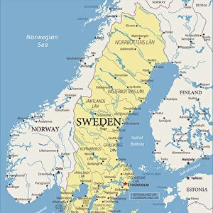
> Europe
> Sweden
> Aerial Views
EDITORS COMMENTS
This print showcases the historical significance of the Battle of Gross Beeren and Battle of Dennewitz, two pivotal events during the War of the Sixth Coalition. Published in 1848 by William Blackwood and Sons, this hand-coloured engraving by Alexander Keith Johnston offers a detailed aerial view of these battles. The Battle of Gross Beeren took place on August 23,1813, while the Battle of Dennewitz occurred on September 6th that same year. These clashes involved various armies including French, Swedish, Prussian, and Saxon forces. The intricately mapped out territories depicted in this print provide a visual narrative for understanding the strategic movements and positions held by each army during these conflicts. As we delve into history through this remarkable artwork from The Stapleton Collection, we are transported back to a time when nations fought fiercely for power and dominance. The precision and artistry displayed in this engraving highlight its importance as both a cartographic masterpiece and an invaluable historical document. With its rich colors and intricate details meticulously brought to life by hand-colouring techniques, this print is not only visually stunning but also serves as a testament to the skillful craftsmanship prevalent during the nineteenth century. As we explore every inch of this map-like artwork created by Alexander Keith Johnston over one hundred years ago, we gain insight into an era defined by warfare and territorial disputes. In conclusion, this extraordinary print allows us to immerse ourselves in history's past battles while appreciating both its
MADE IN THE USA
Safe Shipping with 30 Day Money Back Guarantee
FREE PERSONALISATION*
We are proud to offer a range of customisation features including Personalised Captions, Color Filters and Picture Zoom Tools
SECURE PAYMENTS
We happily accept a wide range of payment options so you can pay for the things you need in the way that is most convenient for you
* Options may vary by product and licensing agreement. Zoomed Pictures can be adjusted in the Basket.