Home > Maps and Charts > World
WORLD MAP / STRUTT 10C

![]()
Wall Art and Photo Gifts from Mary Evans Picture Library
WORLD MAP / STRUTT 10C
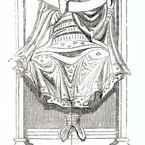
An ancient world map: note the buildings in some of the important cities Date: 10th century
Mary Evans Picture Library makes available wonderful images created for people to enjoy over the centuries
Media ID 20153825
© Bubblepunk
10th Cities Important Maps Note Strutt
FEATURES IN THESE COLLECTIONS
> Maps and Charts
> Early Maps
> Maps and Charts
> World
> Mary Evans Prints Online
> New Images July 2020
EDITORS COMMENTS
This 10th century map, sourced from Mary Evans Prints Online, offers a fascinating glimpse into the ancient world as it was perceived during the Middle Ages. Known as Strutt 10C, this intricately detailed map is believed to have originated from Europe, showcasing the known world at the time with a focus on the Mediterranean and the Holy Land. The map's creators meticulously marked various geographical features, including continents, seas, and major rivers. However, what sets this map apart from others of its era are the depictions of buildings in some of the most significant cities. These architectural representations provide valuable insights into the architectural styles and cultural influences of the time. Some of the cities depicted include Rome, Constantinople, Jerusalem, Alexandria, and Antioch. In Rome, the map shows the Colosseum, Pantheon, and the Basilica of San Pietro in Vaticano. In Constantinople, the Hagia Sophia and the Great Palace are clearly visible. The Dome of the Rock and the Al-Aqsa Mosque can be seen in Jerusalem, while Alexandria boasts the Pharos Lighthouse and the Serapeum. The inclusion of these architectural landmarks on the map not only underscores the cartographer's knowledge and skill but also serves as a testament to the interconnectedness of the medieval world. This ancient map invites us to explore the rich history and cultural exchanges that shaped our world centuries ago.
MADE IN THE USA
Safe Shipping with 30 Day Money Back Guarantee
FREE PERSONALISATION*
We are proud to offer a range of customisation features including Personalised Captions, Color Filters and Picture Zoom Tools
SECURE PAYMENTS
We happily accept a wide range of payment options so you can pay for the things you need in the way that is most convenient for you
* Options may vary by product and licensing agreement. Zoomed Pictures can be adjusted in the Cart.