Home > Animals > Mammals > Muridae > Fortior
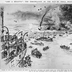
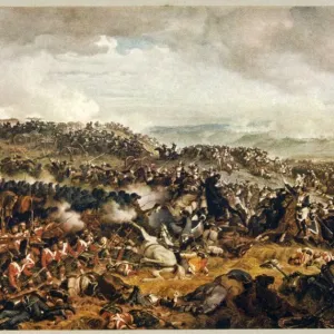
Map of France and Belgium, evacuation from Dunkirk, WW2

![]()
Wall Art and Photo Gifts from Mary Evans Picture Library
Map of France and Belgium, evacuation from Dunkirk, WW2
Map of northern France and Belgium, showing the formation of the gap in the Bapaume area, leading to a closing in of the Allied lines and the retreat towards the coast. Date: 1940
Mary Evans Picture Library makes available wonderful images created for people to enjoy over the centuries
Media ID 23275260
© Illustrated London News Ltd/Mary Evans
Bergues Dunkirk Evacuated Evacuation Expeditionary Maps Nov19 Poperinghe Rescue Rescued Return Saved
FEATURES IN THESE COLLECTIONS
> Animals
> Mammals
> Muridae
> Fortior
> Europe
> Belgium
> Related Images
> Historic
> World War I and II
> World War II
> Maps and Charts
> Related Images
> Mary Evans Prints Online
> New Images August 2021
MADE IN THE USA
Safe Shipping with 30 Day Money Back Guarantee
FREE PERSONALISATION*
We are proud to offer a range of customisation features including Personalised Captions, Color Filters and Picture Zoom Tools
SECURE PAYMENTS
We happily accept a wide range of payment options so you can pay for the things you need in the way that is most convenient for you
* Options may vary by product and licensing agreement. Zoomed Pictures can be adjusted in the Cart.