Fraud Blocker Skip to main content

Home > Maps and Charts > World

World Collection (#6)

World maps and charts are visual representations of the Earth's surface, showing geographical features such as continents, oceans, countries, cities

4,621 Items

Background imageWorld Collection: Australia Map Gotha, Justus Perthes, 1872, Atlas

Australia Map Gotha, Justus Perthes, 1872, Atlas. Perthes, Johan Georg Justus 1749 aa 1816, German publisher, was born in Rudolstadt in 1749

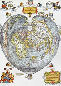
Background imageWorld Collection: First World Map in Whole 1508

First World Map in Whole 1508

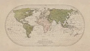
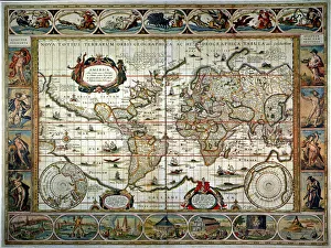
Background imageWorld Collection: Old map of the World Map

Old map of the World Map
Antique Illustration. Copyright has expired on this artwork. From my own archives, digitally restored

Background imageWorld Collection: Map of Palestine, circa 1800

Map of Palestine, circa 1800. From Gaza and Ashkelon in the south to Tyre and Sidon (Lebanon) in the north. La Palestina. Handcoloured copperplate engraving after Giulio Ferrario in his Costumes

Background imageWorld Collection: Map of Italy in 1836 by Ab. Bartolomeo Borghi

Map of Italy in 1836 by Ab. Bartolomeo Borghi
Map of Italy in 1836. Showing the kingdoms of Sardinia, Lombardy, Venice, Rome, Tuscany, Parma, Naples and Corsica. Map by Ab. Bartolomeo Borghi, Florence. l Italia dell Ab. B. Borghi, Firenze 1836

Background imageWorld Collection: Map of Dunkirk area during the evacuation, WW2

Map of Dunkirk area during the evacuation, WW2
Map of the Dunkirk area in northern France during the evacuation, showing two flooded areas of low-lying meadow land which assisted in the Allied retreat. Date: 1940

Background imageWorld Collection: Hawker Typhoon fighters are now being built in impressive numbers at one of the Gloster

Hawker Typhoon fighters are now being built in impressive numbers at one of the Gloster Aircraft Company factories in the West of England

Background imageWorld Collection: The punk band the Sex Pistols, who signed up last week with A & M Records have been fired

The punk band the Sex Pistols, who signed up last week with A & M Records have been fired again, but with a £ 75, 000 pay off

Background imageWorld Collection: World map

World map
the dissemination of human races by Muller and Peschel

Background imageWorld Collection: United Nations Map of The World 1948

United Nations Map of The World 1948
PH006

Background imageWorld Collection: France 1851

France 1851
A fine facimile artworked from an antique original map of France, issued as part of the 1851 edition of John Tallis and Companys " The Illustrated Atlas and Modern History of the World"

Background imageWorld Collection: Malay Archipelago, or East India Islands 1851

Malay Archipelago, or East India Islands 1851
A fine facimile artworked from an antique original map of the Malay Archipelago, or East India Islands, issued as part of the 1851 edition of John Tallis and Companys " The Illustrated Atlas

Background imageWorld Collection: Old Map of Egypt and Arabia Petraea 1851 by John Tallis

Old Map of Egypt and Arabia Petraea 1851 by John Tallis
A fine facimile artworked from an antique original map of Egypt and Arabia Petraea, issued as part of the 1851 edition of John Tallis and Companys " The Illustrated Atlas

Background imageWorld Collection: Old Map of the World 1939

Old Map of the World 1939
WMY1939

Background imageWorld Collection: Old Map of the World 1970

Old Map of the World 1970
WMY1970

Background imageWorld Collection: Old Map of the World 1965

Old Map of the World 1965
WMY1965

Background imageWorld Collection: Old Map of the World 1950

Old Map of the World 1950
WMY1950

Background imageWorld Collection: Old Map of the World 1908

Old Map of the World 1908
WMY1908

Background imageWorld Collection: Old Map of the World 1871

Old Map of the World 1871
THE WORLD THAT WAS 1871 - End of Franco-Prussian War; Germany unified, and Empire formed; Third Republic in France; suppression of the Paris Commune. British Columbia joins Canada. Chicago fires

Background imageWorld Collection: New Zealand 1851

New Zealand 1851
A fine facimile artworked from an antique original map of New Zealand, issued as part of the 1851 edition of John Tallis and Companys " The Illustrated Atlas and Modern History of the World"

Background imageWorld Collection: Ancient Palestine 1851

Ancient Palestine 1851
A fine facimile artworked from an antique original map of Ancient Palestine, issued as part of the 1851 edition of John Tallis and Companys " The Illustrated Atlas

Background imageWorld Collection: Western Australia and the Swan River 1851

Western Australia and the Swan River 1851
A fine facimile artworked from an antique original map of Western Australia and the Swan River, issued as part of the 1851 edition of John Tallis and Companys " The Illustrated Atlas

Background imageWorld Collection: Old Map of Turkey in Asia 1852 by Henry George Collins

Old Map of Turkey in Asia 1852 by Henry George Collins
This is a finely detailed map of Turkey in Asia remastered from a rare Atlas of the World published in 1852 by Henry George Collins

Background imageWorld Collection: Old Map of Prussia 1852 by Henry George Collins

Old Map of Prussia 1852 by Henry George Collins
This is a finely detailed map of Prussia remastered from a rare Atlas of the World published in 1852 by Henry George Collins

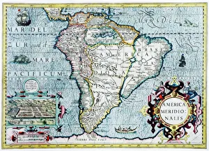
Background imageWorld Collection: Old Map of South America 1852 by Henry George Collins

Old Map of South America 1852 by Henry George Collins
This is a finely detailed map of South America remastered from a rare Atlas of the World published in 1852 by Henry George Collins

Background imageWorld Collection: Cabool, The Punjab and Beloochistan 1851

Cabool, The Punjab and Beloochistan 1851
A fine facimile artworked from an antique original map of Cabool, The Punjab and Beloochistan, issued as part of the 1851 edition of John Tallis and Companys " The Illustrated Atlas

Background imageWorld Collection: Old Map of North America 1851 by John Tallis

Old Map of North America 1851 by John Tallis
A fine reproduction artworked from an antique original map of North America, issued as part of the 1851 edition of John Tallis and Companys " The Illustrated Atlas

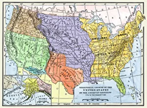
Background imageWorld Collection: Old Map of the United States of America 1851 by John Tallis

Old Map of the United States of America 1851 by John Tallis
A fine facimile artworked from an antique original map of the United States of America, issued as part of the 1851 edition of John Tallis and Companys " The Illustrated Atlas

Background imageWorld Collection: Old Map of Africa 1851 by John Tallis

Old Map of Africa 1851 by John Tallis
A fine facimile artworked from an antique original map of the Continent of Africa, issued as part of the 1851 edition of John Tallis and Companys " The Illustrated Atlas

Background imageWorld Collection: Old Map of The World 1879

Old Map of The World 1879
THE WORLD THAT WAS 1878 - Irish Land War (1879-1882). Second Afghan War gives Britain control over Afghanistan. Dual Alliance between Germany and Austria-Hungary. Anglo-Zulu War

Background imageWorld Collection: Old Map of the World 1893

Old Map of the World 1893
WMY1893

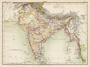
Background imageWorld Collection: British India 1851

British India 1851
A fine facimile artworked from an antique original map of British India, issued as part of the 1851 edition of John Tallis and Companys " The Illustrated Atlas

Background imageWorld Collection: Old Map of the World 1896

Old Map of the World 1896
WMY1896

Background imageWorld Collection: Old Map of Isthmus of Panama 1851 by John Tallis

Old Map of Isthmus of Panama 1851 by John Tallis
A fine facimile artworked from an antique original map of the Isthmus of Panama, issued as part of the 1851 edition of John Tallis and Companys " The Illustrated Atlas

Background imageWorld Collection: Tibet, Mongolia and Manchuria 1851

Tibet, Mongolia and Manchuria 1851
A fine facimile artworked from an antique original map of Tibet, Mongolia and Manchuria, issued as part of the 1851 edition of John Tallis and Companys " The Illustrated Atlas

Background imageWorld Collection: Old Map of South America 1851 by John Tallis

Old Map of South America 1851 by John Tallis
A fine facimile artworked from an antique original map of South America, issued as part of the 1851 edition of John Tallis and Companys " The Illustrated Atlas

Background imageWorld Collection: Old Map of Southern India 1852 by Henry George Collins

Old Map of Southern India 1852 by Henry George Collins
This is a finely detailed map of Southern India remastered from a rare Atlas of the World published in 1852 by Henry George Collins

Background imageWorld Collection: Old Map of the World 1981

Old Map of the World 1981
WMY1981

Background imageWorld Collection: Old Map of The World 1864

Old Map of The World 1864
THE WORLD THAT WAS 1864 - American Civil War (1861-1865). Prussia defeats Denmark. Russia suppresses Polish revolt. Taiping Rebellion in China (1851-1864), the second most destructive war in history

Background imageWorld Collection: Old Map of the World 1959

Old Map of the World 1959
WMY1959

Background imageWorld Collection: Old Map of the World 1906

Old Map of the World 1906
WMY1906

Background imageWorld Collection: Old Map of Austria 1852 by Henry George Collins

Old Map of Austria 1852 by Henry George Collins
This is a finely detailed map of Austria remastered from a rare Atlas of the World published in 1852 by Henry George Collins

Background imageWorld Collection: Old Map of the World 1900

Old Map of the World 1900
WMY1900

Background imageWorld Collection: Scotland 1851

Scotland 1851
A fine facimile artworked from an antique original map of Scotland, issued as part of the 1851 edition of John Tallis and Companys " The Illustrated Atlas and Modern History of the World"

Background imageWorld Collection: Old Map of the World 1875

Old Map of the World 1875
THE WORLD THAT WAS 1875 - Britain under Disraeli buys the Suez Canal to protect the sea route to India. USA expands settlement into Oregon. Egyptian invasion of Ethiopia

Background imageWorld Collection: Old Map of Birmingham 1834 by John Dower and William Orr

Old Map of Birmingham 1834 by John Dower and William Orr
A highly detailed reproduction city map of Birmingham originally published in London, 1834. Interestingly it shows the planned route of the Grand Junction Railway coming into the North of Birmingham

Background imageWorld Collection: Old Map of Denmark 1852 by Henry George Collins

Old Map of Denmark 1852 by Henry George Collins
This is a finely detailed map of Denmark remastered from a rare Atlas of the World published in 1852 by Henry George Collins

Background imageWorld Collection: Old Map of The North Pole 'Septentrionalium Terrarum descriptio'originally Published by Johannes

Old Map of The North Pole "Septentrionalium Terrarum descriptio"originally Published by Johannes Cloppenburg
A striking reproduction from Cloppenburgs reduced size edition of Mercators map of the North Polar regions, the first separate map of the North Polar Regions

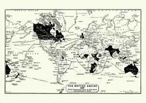
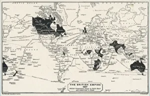
Background imageWorld Collection: Map of The British Empire by Fullarton & Co 1850

Map of The British Empire by Fullarton & Co 1850
Fine reproduction of the attractive World Map showing the British Empire. Mapmaker John Bartholomew and publishers Fullarton were then the first to use red or pink to indicate British possessions

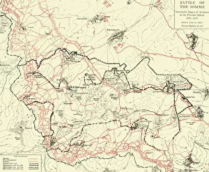
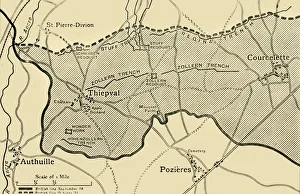
Background imageWorld Collection: The Battle of The Somme 1916, The Attack of the III Corps on 1st July

The Battle of The Somme 1916, The Attack of the III Corps on 1st July
BAT02001

Background imageWorld Collection: Old map of Liverpool 1650 by Thomas Kaye

Old map of Liverpool 1650 by Thomas Kaye
An interesting map originally published in 1829 by Thomas Kaye, this reproduction map represents the town of Liverpool in 1650

Background imageWorld Collection: Historical World Events map 1970 US version

Historical World Events map 1970 US version
A world map originally published in 1970, reproduced from the internationally famousCollins Bartholomew World Through Timehistoric cartographic archive

Background imageWorld Collection: Historical World Events map 1965 US version

Historical World Events map 1965 US version
A world map originally published in 1965, reproduced from the internationally famousCollins Bartholomew World Through Timehistoric cartographic archive

Background imageWorld Collection: Historical World Events map 1963 US version

Historical World Events map 1963 US version
A world map originally published in 1963, reproduced from the internationally famousCollins Bartholomew World Through Timehistoric cartographic archive

Background imageWorld Collection: Historical World Events map 1957 US version

Historical World Events map 1957 US version
A world map originally published in 1957, reproduced from the internationally famousCollins Bartholomew World Through Timehistoric cartographic archive

Background imageWorld Collection: Historical World Events map 1952 US version

Historical World Events map 1952 US version
A world map originally published in 1952, reproduced from the internationally famousCollins Bartholomew World Through Timehistoric cartographic archive

Background imageWorld Collection: Historical World Events map 1997 US version

Historical World Events map 1997 US version
A world map originally published in 1997, reproduced from the internationally famousCollins Bartholomew World Through Timehistoric cartographic archive

Background imageWorld Collection: Historical World Events map 1944 US version

Historical World Events map 1944 US version
A world map originally published in 1944, reproduced from the internationally famousCollins Bartholomew World Through Timehistoric cartographic archive

Background imageWorld Collection: Historical World Events map 2000 US version

Historical World Events map 2000 US version
A world map originally published in 2000, reproduced from the internationally famousCollins Bartholomew World Through Timehistoric cartographic archive

Background imageWorld Collection: Historical World Events map 1991 US version

Historical World Events map 1991 US version
A world map originally published in 1991, reproduced from the internationally famousCollins Bartholomew World Through Timehistoric cartographic archive

Background imageWorld Collection: Historical World Events map 1995 US version

Historical World Events map 1995 US version
A world map originally published in 1995, reproduced from the internationally famousCollins Bartholomew World Through Timehistoric cartographic archive

Background imageWorld Collection: Historical World Events map 1996 US version

Historical World Events map 1996 US version
A world map originally published in 1996, reproduced from the internationally famousCollins Bartholomew World Through Timehistoric cartographic archive

Background imageWorld Collection: Historical World Events map 1988 US version

Historical World Events map 1988 US version
A world map originally published in 1988, reproduced from the internationally famousCollins Bartholomew World Through Timehistoric cartographic archive

Background imageWorld Collection: Historical World Events map 1984 US version

Historical World Events map 1984 US version
A world map originally published in 1984, reproduced from the internationally famousCollins Bartholomew World Through Timehistoric cartographic archive

Background imageWorld Collection: Historical World Events map 1986 US version

Historical World Events map 1986 US version
A world map originally published in 1986, reproduced from the internationally famousCollins Bartholomew World Through Timehistoric cartographic archive

Background imageWorld Collection: Historical World Events map 1979 US version

Historical World Events map 1979 US version
A world map originally published in 1979, reproduced from the internationally famousCollins Bartholomew World Through Timehistoric cartographic archive

Background imageWorld Collection: Historical World Events map 1968 US version

Historical World Events map 1968 US version
A world map originally published in 1968, reproduced from the internationally famousCollins Bartholomew World Through Timehistoric cartographic archive

Background imageWorld Collection: Historical World Events map 1978 US version

Historical World Events map 1978 US version
A world map originally published in 1978, reproduced from the internationally famousCollins Bartholomew World Through Timehistoric cartographic archive

Background imageWorld Collection: Historical World Events map 1971 US version

Historical World Events map 1971 US version
A world map originally published in 1971, reproduced from the internationally famousCollins Bartholomew World Through Timehistoric cartographic archive

Background imageWorld Collection: Historical World Events map 1937 US version

Historical World Events map 1937 US version
A world map originally published in 1937, reproduced from the internationally famousCollins Bartholomew World Through Timehistoric cartographic archive

Background imageWorld Collection: Historical World Events map 1934 US version

Historical World Events map 1934 US version
A world map originally published in 1934, reproduced from the internationally famousCollins Bartholomew World Through Timehistoric cartographic archive

Background imageWorld Collection: Historical World Events map 1926 US version

Historical World Events map 1926 US version
A world map originally published in 1926, reproduced from the internationally famousCollins Bartholomew World Through Timehistoric cartographic archive

Background imageWorld Collection: Historical World Events map 1925 US version

Historical World Events map 1925 US version
A world map originally published in 1925, reproduced from the internationally famousCollins Bartholomew World Through Timehistoric cartographic archive

Background imageWorld Collection: Historical World Events map 1924 US version

Historical World Events map 1924 US version
A world map originally published in 1924, reproduced from the internationally famousCollins Bartholomew World Through Timehistoric cartographic archive

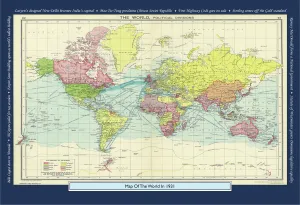
Background imageWorld Collection: Historical World Events map 1921 US version

Historical World Events map 1921 US version
A world map originally published in 1921, reproduced from the internationally famousCollins Bartholomew World Through Timehistoric cartographic archive

Background imageWorld Collection: Historical World Events map 1920 US version

Historical World Events map 1920 US version
A world map originally published in 1920, reproduced from the internationally famousCollins Bartholomew World Through Timehistoric cartographic archive

Background imageWorld Collection: Historical World Events map 1917 US version

Historical World Events map 1917 US version
A world map originally published in 1917, reproduced from the internationally famousCollins Bartholomew World Through Timehistoric cartographic archive

Background imageWorld Collection: Historical World Events map 1958 US version

Historical World Events map 1958 US version
A world map originally published in 1958, reproduced from the internationally famousCollins Bartholomew World Through Timehistoric cartographic archive

Background imageWorld Collection: Historical World Events map 1914 US version

Historical World Events map 1914 US version
A world map originally published in 1914, reproduced from the internationally famousCollins Bartholomew World Through Timehistoric cartographic archive

Background imageWorld Collection: Historical World Events map 1948 US version

Historical World Events map 1948 US version
A world map originally published in 1948, reproduced from the internationally famousCollins Bartholomew World Through Timehistoric cartographic archive

Background imageWorld Collection: Historical World Events map 1961 US version

Historical World Events map 1961 US version
A world map originally published in 1961, reproduced from the internationally famousCollins Bartholomew World Through Timehistoric cartographic archive

Background imageWorld Collection: Historical World Events map 1947 US version

Historical World Events map 1947 US version
A world map originally published in 1947, reproduced from the internationally famousCollins Bartholomew World Through Timehistoric cartographic archive

Background imageWorld Collection: Historical World Events map 1935 US version

Historical World Events map 1935 US version
A world map originally published in 1935, reproduced from the internationally famousCollins Bartholomew World Through Timehistoric cartographic archive

Background imageWorld Collection: Historical World Events map 1910 US version

Historical World Events map 1910 US version
A world map originally published in 1910, reproduced from the internationally famousCollins Bartholomew World Through Timehistoric cartographic archive


All Professionally Made to Order for Quick Shipping


-

World Collection

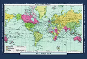
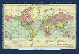
World maps and charts are visual representations of the Earth's surface, showing geographical features such as continents, oceans, countries, cities, rivers and mountains. They have been used for centuries to aid navigation, exploration and education. Maps can be created using various techniques including satellite imagery or hand-drawn illustrations. Charts are graphical representations of data that help people understand complex information in a simplified manner. Examples include population growth rates or economic indicators by country. Both maps and charts are important tools for understanding our world and making informed decisions about global issues such as climate change or international trade policies.
+

Our beautiful Wall Art and Photo Gifts include Framed Prints, Photo Prints, Poster Prints, Canvas Prints, Jigsaw Puzzles, Metal Prints and so much more

The World collection from Media Storehouse is a stunning array of wall art and framed prints that showcase the beauty and diversity of our planet. Featuring an extensive range of maps, charts, and diagrams, our collection offers something for everyone – from vintage world maps to modern satellite imagery. Each print is carefully crafted using high-quality materials to ensure that it looks great in any setting. Whether you're looking for a piece to decorate your home or office, or simply want to add some visual interest to your space, the World collection has something for you. With its wide variety of styles and subjects, our collection is perfect for anyone who loves travel, geography, history or science. So why not explore the world from the comfort of your own home with one of these beautiful prints?
+

What are World (Maps and Charts) art prints?

World maps and charts art prints are high-quality reproductions of historical or contemporary maps and charts that depict the geography, topography, political boundaries, and other features of different regions of the world. These prints can be used for decorative purposes in homes, offices, schools, museums, libraries or any other setting where a visual representation of global locations is needed. World maps and charts art prints come in various sizes to suit different spaces and preferences. They may feature antique designs from centuries ago or modern interpretations with updated information on countries' borders and names. Some popular styles include vintage world maps with sepia tones or muted colors; colorful political maps highlighting specific regions such as Europe or Africa; nautical charts showing ocean depths and currents; or satellite images displaying terrain details. Whether you're a history buff looking to decorate your study room with an old-world map print or a traveler seeking inspiration for your next adventure destination, World Maps & Charts Art Prints offer something for everyone's taste.
+

What World (Maps and Charts) art prints can I buy from Media Storehouse?

We offer a wide range of World Maps and Charts art prints that are perfect for decorating your home or office. You can choose from vintage maps, antique charts, modern world maps, satellite images of the earth, and many more options. These art prints come in various sizes to suit your needs and preferences. The collection includes detailed maps of different countries and continents such as Europe, Africa, Asia, North America, South America among others. The prints also feature famous landmarks like the Eiffel Tower in Paris or the Statue of Liberty in New York City. Moreover, you can find educational charts on topics like geography or astronomy that are ideal for classrooms. Our World Maps and Charts art prints are printed using high-quality materials to ensure they last a long time without fading or losing their vibrancy. They make great gifts for anyone who loves travel or wants to learn more about our planet's geography.
+

How do I buy World (Maps and Charts) art prints?

To purchase World art prints from Media Storehouse, you can browse our extensive collection of high-quality images online. Once you have found the print that you would like to buy, simply add it to your cart and proceed to checkout. At this point, you will be prompted to enter your shipping and payment information. We offer a variety of sizes for their art prints, so be sure to select the size that best fits your needs. You may also have the option to choose between different paper types or finishes. Once your order has been processed, Media Storehouse will carefully package your print and ship it directly to your doorstep. Whether you are looking for a unique piece of wall decor or a thoughtful gift for someone special, World art prints from Media Storehouse are an excellent choice for anyone who loves geography or history.
+

How much do World (Maps and Charts) art prints cost?

We offer a wide range of World Maps and Charts art prints that are available at varying prices. The cost of our World Maps and Charts art prints depends on the size, quality, and type of print you choose. We have different options such as canvas prints, framed prints, photographic prints, and poster prints. Our World Maps and Charts art prints come in various sizes ranging from small to large formats. The price also varies depending on whether you want a black-and-white or colored print. Our collection features vintage maps as well as contemporary designs that cater to different tastes. We take pride in providing high-quality products at affordable prices without compromising on the quality of our artwork. You can be sure that every piece is carefully crafted with attention to detail using premium materials. The cost of our World Maps and Charts art prints is reasonable considering their quality and uniqueness. Whether you're looking for a statement piece for your home or office space or an educational tool for your classroom, we have something for everyone's budget.
+

How will my World (Maps and Charts) art prints be delivered to me?

We take great care in delivering your World art prints to you. We use a trusted courier service to ensure that your order arrives safely and on time. Your print will be carefully packaged in protective materials to prevent any damage during transit. We offer a range of delivery options for our customers, including standard shipping and express delivery for those who need their order sooner. Once your order has been dispatched, you will receive an email with tracking information so that you can keep track of its progress. Our team is committed to providing excellent customer service, so if you have any questions or concerns about the delivery of your World art prints, please do not hesitate to get in touch with us. We are always happy to help.
© Copyright Media Storehouse, All Rights Reserved 2003 - 2024
Facebook     Pinterest     100% Payment Secure     Reviews IO