Home > Oceania > Australia > Maps
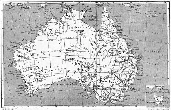
Maps / Australia 1908
![]()

Wall Art and Photo Gifts from Mary Evans Picture Library
Maps / Australia 1908
A map of the commonwealth of Australia and Tasmania Date: 1908
Mary Evans Picture Library makes available wonderful images created for people to enjoy over the centuries
Media ID 7152487
© Mary Evans Picture Library 2015 - https://copyrighthub.org/s0/hub1/creation/maryevans/MaryEvansPictureID/10149917
Australasia Common Wealth Maps Queens Land Tasmania Territory
FEATURES IN THESE COLLECTIONS
EDITORS COMMENTS
This map print, dated 1908, showcases the Commonwealth of Australia and Tasmania during a pivotal period in the country's history. The map, titled 'Australia and New Zealand. Sheet I. - Australia,' was published by the London-based geographical and statistical publishing firm, George Philip & Son. At the time, Australia was a federation of six colonies that had united to form the Commonwealth of Australia on January 1, 1901. This map reflects the new political landscape, with the commonwealth boundaries clearly marked. The map also includes the island of Tasmania, which was not part of the mainland Commonwealth but was still under British rule as a separate entity known as the State of Tasmania. The map delineates the various territories and colonies that made up the Australian continent, including Queensland, New South Wales, Victoria, South Australia, Western Australia, and Tasmania. The map also highlights the vast expanses of unexplored territory in the northern regions of Australia, which were still largely unknown to Europeans at the time. The map's intricate detailing and accurate cartography make it an invaluable historical document, providing insights into the geography and political landscape of Australia during the early 20th century. The map's antique charm and nostalgic appeal make it a beautiful addition to any home or office, transporting us back in time to an era of exploration and discovery. Whether you are an avid collector of historical maps, a student of Australian history, or simply someone who appreciates the beauty of antique cartography, this map print is sure to captivate and inspire you. With its rich history and intriguing details, it is a must-have for anyone interested in the story of Australia and its fascinating past.
MADE IN THE USA
Safe Shipping with 30 Day Money Back Guarantee
FREE PERSONALISATION*
We are proud to offer a range of customisation features including Personalised Captions, Color Filters and Picture Zoom Tools
FREE COLORIZATION SERVICE
You can choose advanced AI Colorization for this picture at no extra charge!
SECURE PAYMENTS
We happily accept a wide range of payment options so you can pay for the things you need in the way that is most convenient for you
* Options may vary by product and licensing agreement. Zoomed Pictures can be adjusted in the Cart.

